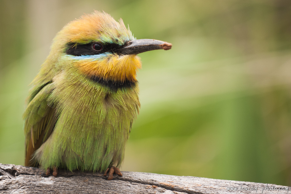
 Rainbow bee-eater
Tasman Glacier, the largest of New Zealand, offers to its visitors a beautiful sight. Ice blocks collaps from its southern face, and remain afloat in a dark gray lake. While walking around the lake, these icebergs give us an image of a polar excursion.
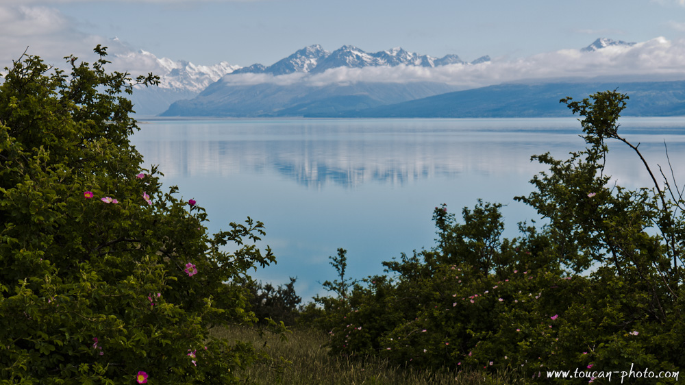
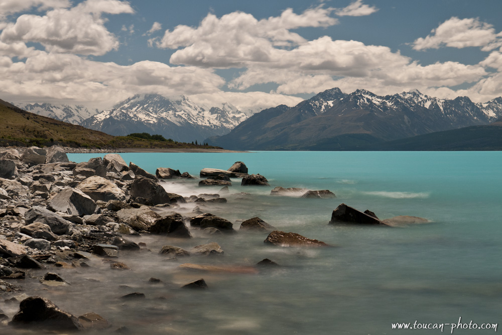
The visit will continue up to the Pukaki lake, an attractive place of this glacier valley due to the turquoise color of the water.
The Tasman glacier Location
Tasman glacier lies at the Aoraki/Mount cook base. It’s a 20 kilometers long glacier, and the thickness is up to 600 metres. This scope make it the biggest glacier in New Zealand. 20,000 years ago, Tasman glacier encompassed other glaciers, like Hooker, Murchison, Muelle, and formed an ice tongue of over 115 kilometers long. It is this ice tongue that dug the contours of the valley, allowing Pukaki lake and Tasman lake to appear gradually as the glacier surface decreased.
The Tasman glacier topology (Interactive Map)
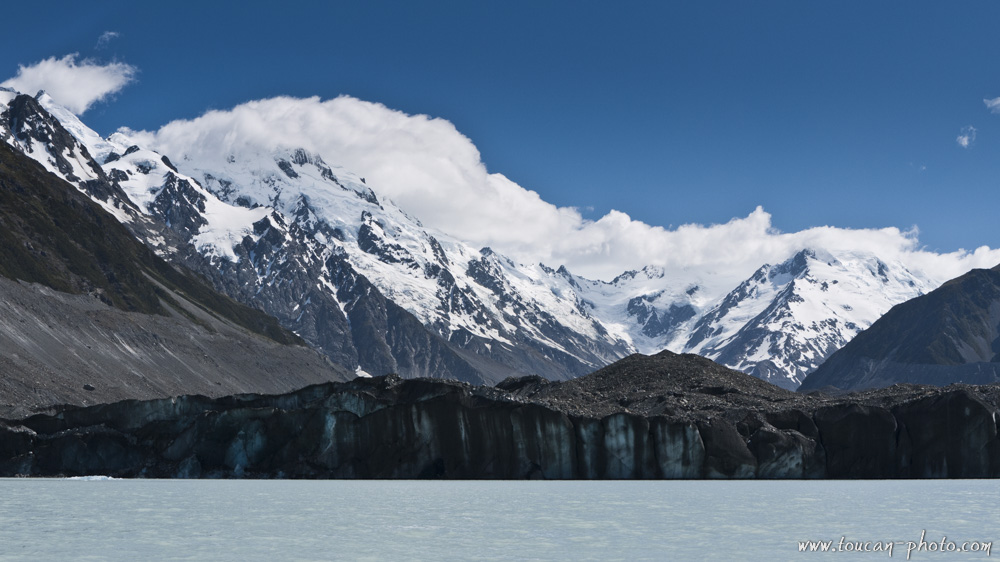
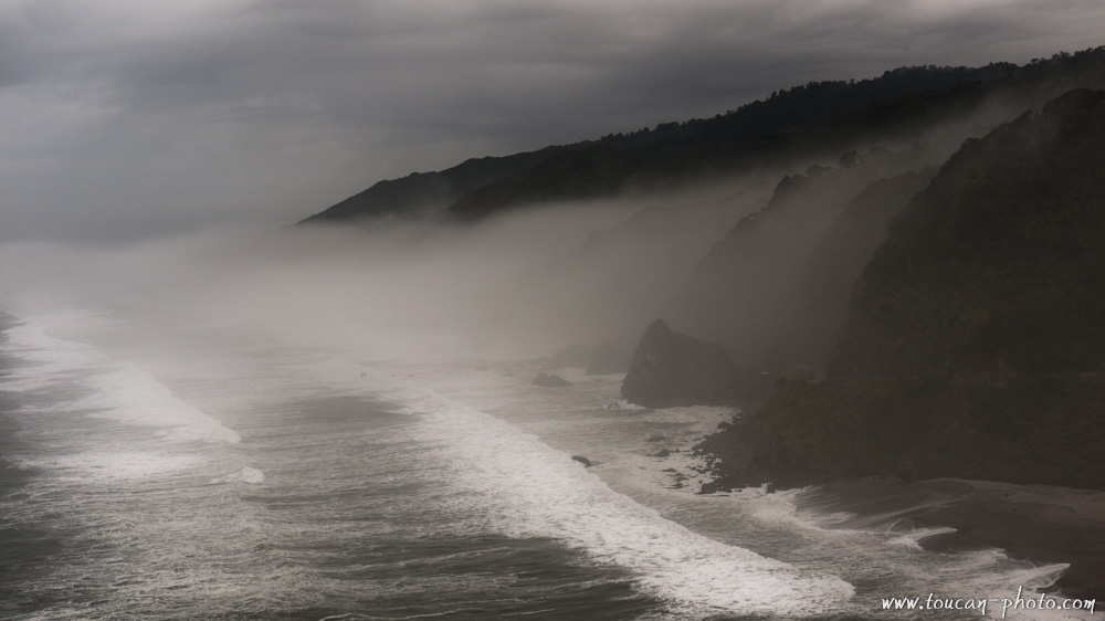
The front of the Tasman glacier, and the Tasman lake at the base
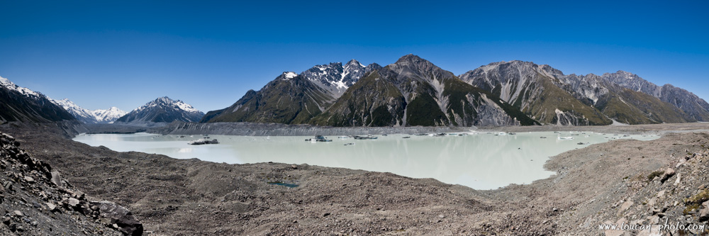
A sight of Tasman lake. The glacier is on the left
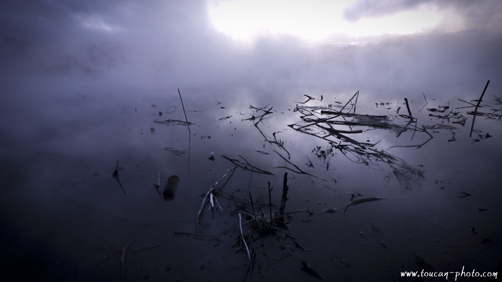
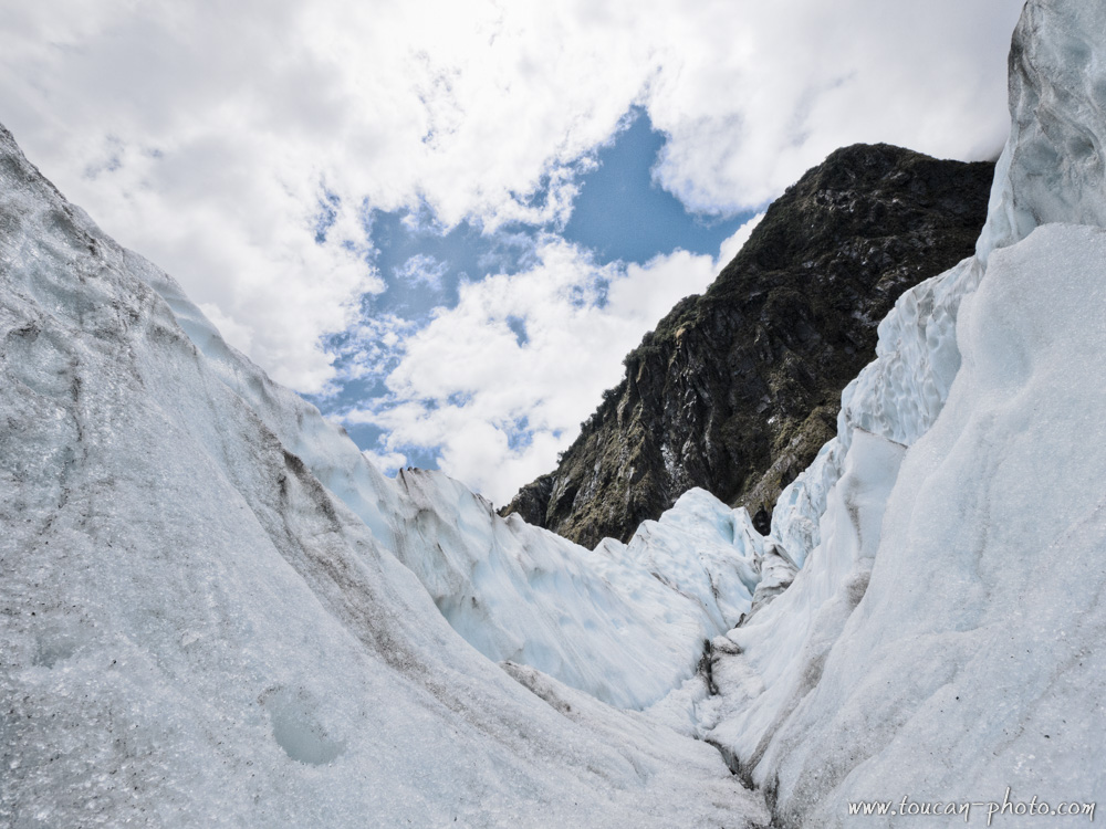
Tasman Lake is located at the glacier base. The glacier fragments fall into the lake, and take the appearance of large icebergs. Because the temperature of the lake water does not exceed two degrees Celsius, the icebergs melt slowly. Only 10% of the iceberg is visible, the rest is under water surface.
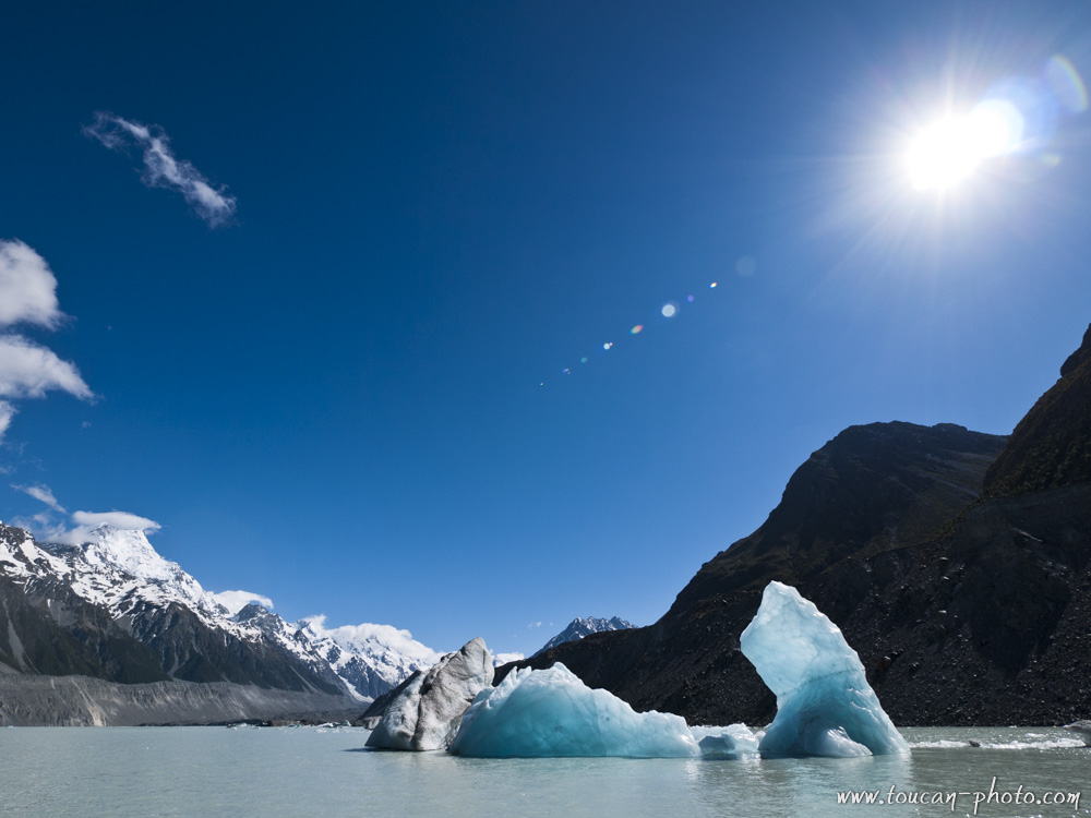
Drifting icebergs
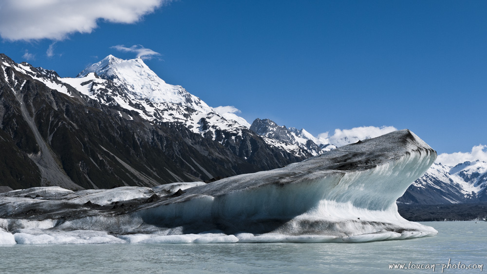
An iceberg, on the background the Aoraki/Mont Cook
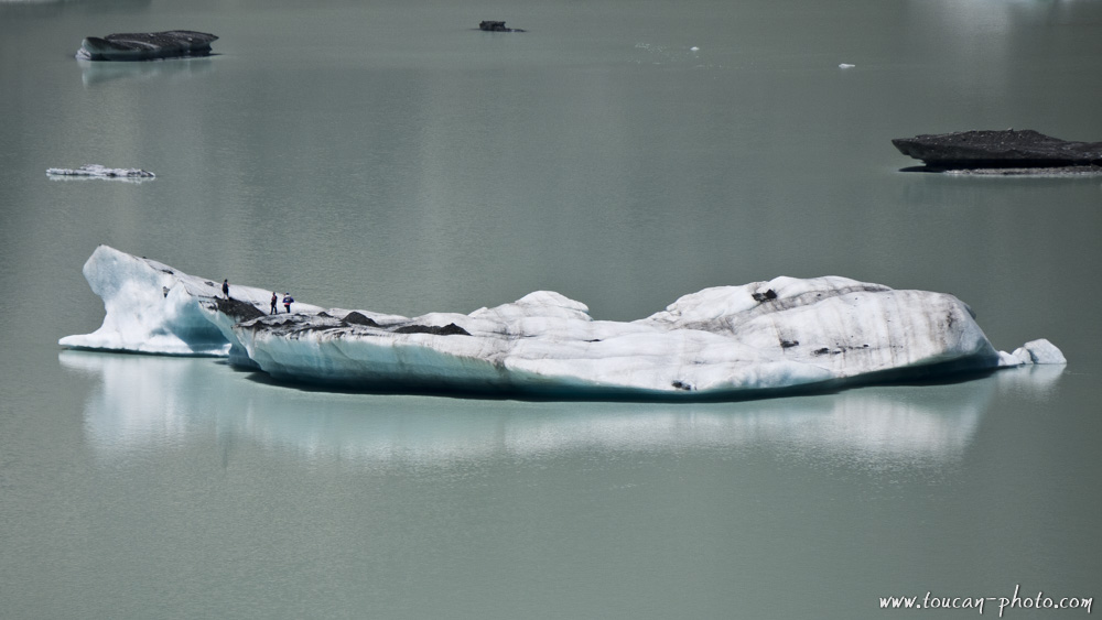
A walk that looks like a polar expedition
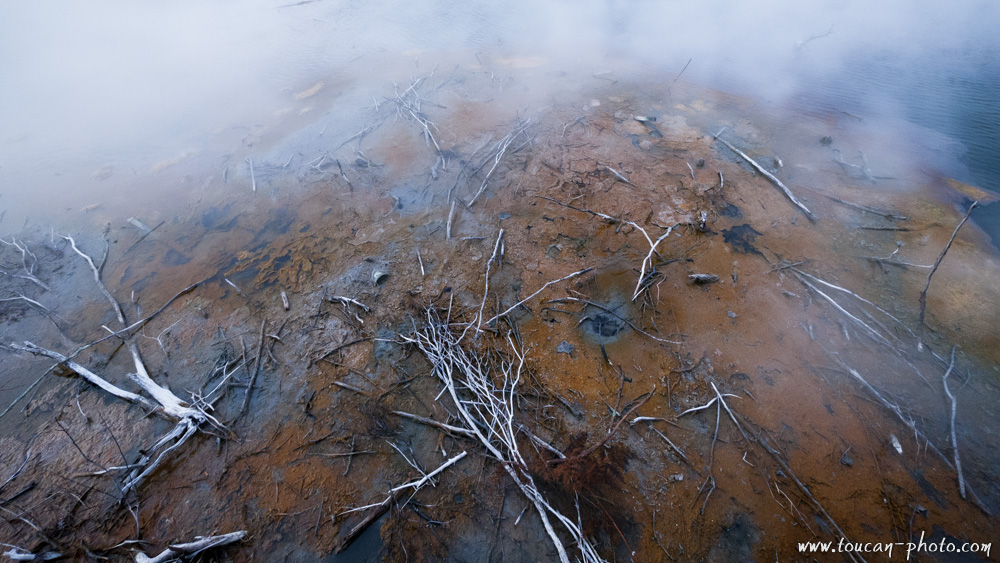
Tasman Glacier, when sliding the mountain, is loading the black rock chunks snatched in the mountains. These black particles accumulate in the ice and will stay on board of the glaciers when they are floating in the lake. During the melting of the iceberg, the particles concentration increases, and changes the ice coloration. Thus, a newborn iceberg will appear white, while an older iceberg would have a dull gray color. At the end of melting, the particles of rock are giving a milky gray to the Tasman lake.
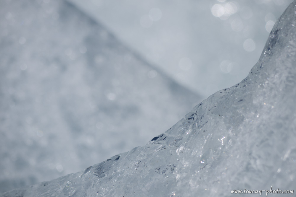
An apparently pure ice when melting…
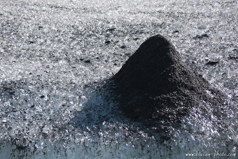
… can form strange particle clusters.
A river rises in Lake Tasman. This river carries particles of rock from the lake, which also give to the river the gray color. As the rock particles have a higher density than water, they sink to the bottom of the Tasman River before the water flows into Lake Pukaki. The water ice, when it arrives in the Pukaki Lake, is free from all impurity, and colors the lake water in an incredible turquoise blue.
The Pukaki lake early morning
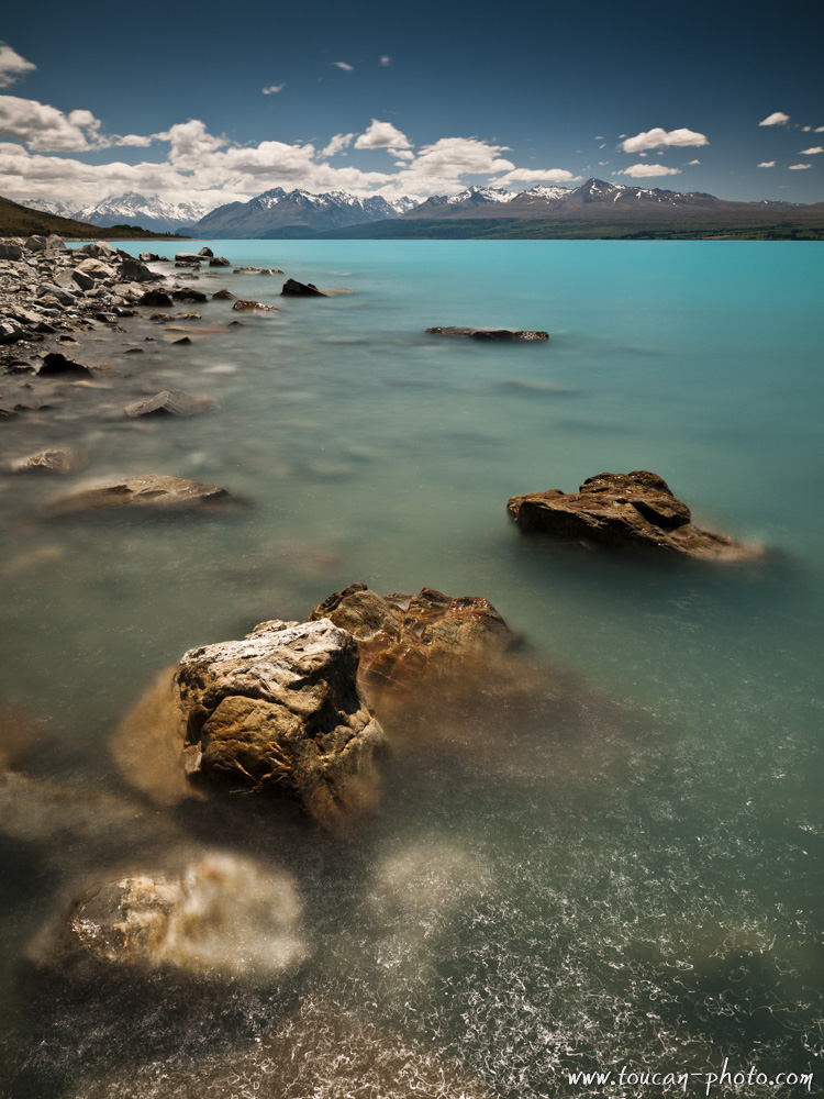
Pukaki lake and turquoise water
— Continue the journey —
See more pictures from New Zealand
Kauris: the legendary trees of New-Zealand
— Complementary Resources —
Under your feet, a warm and golden sand…
The surrounding dunes are pierced with thousands limestone arrows . Some measuring almost four meters high, which give the whole place a strange atmosphere, almost surreal.
You are in the Australian Pinnacles Desert …
Continue reading“Australia: The Pinnacles Desert”
Rafflesia is a kind of parasitic flower which lives under tropical climate of the Southeast Asia. This genus has 28 species and can measure up to 1 meter in diameter (Rafflesia Arnoldii) and weights up to 10 kg. Even the smaller species, Rafflesia Baletei, has 12 cm diameter flowers. So, Rafflesias, is the world’s largest flower. The species introduced in this article, the Rafflesia Kerri, has a diameter of 50-90 cm.
Continue reading“Malaysia: Rafflesia, the world’s biggest flower”
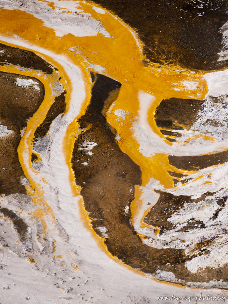
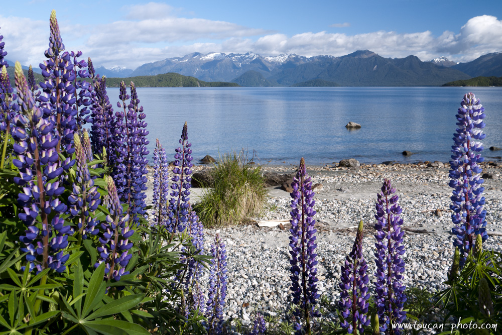
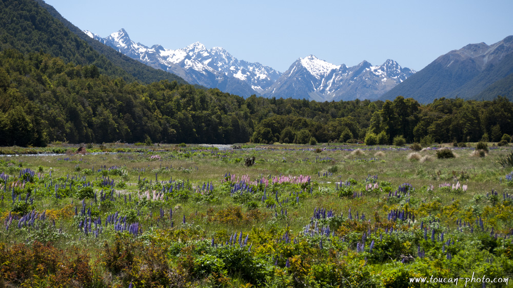
New Zealand offers to its visitors varied and colorful landscapes. The pure white glaciers rubs turquoise blue or emerald green mountain lakes. An intense geothermal activity that reveals from soil gray mud pools, or sulfured water springs they brings small particles that colors the ground to yellow…
The pictures in this series, issued from a grandiose landscape or a small detail of a curious source, are, therefore, also rich in color.
Hauru falls
Riwaka valley night view
Oxidized vegetation in Rotorua
Desolation around Rotorua

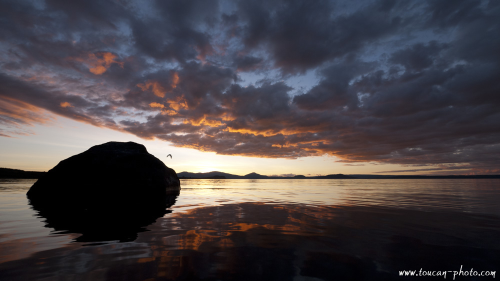
Sunset on Lake Taupo
The Kepler Track in the Fiordland National Park
Vegetal rainbow
Fern spared by the sulfur vapors
Colored flow in the Orakei Korako
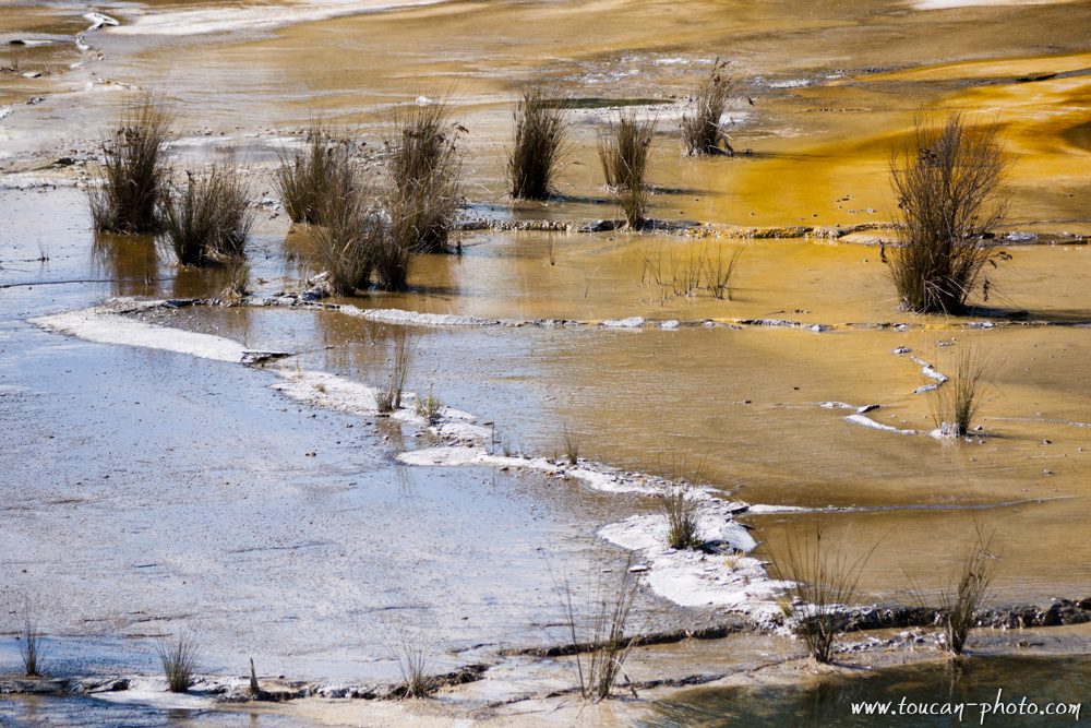
Plants and colored ground
Detail of colored deposits
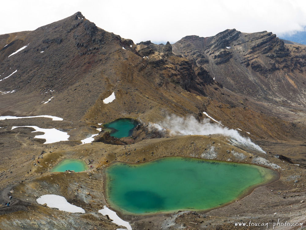
Emerald lakes on the Tongariro volcano
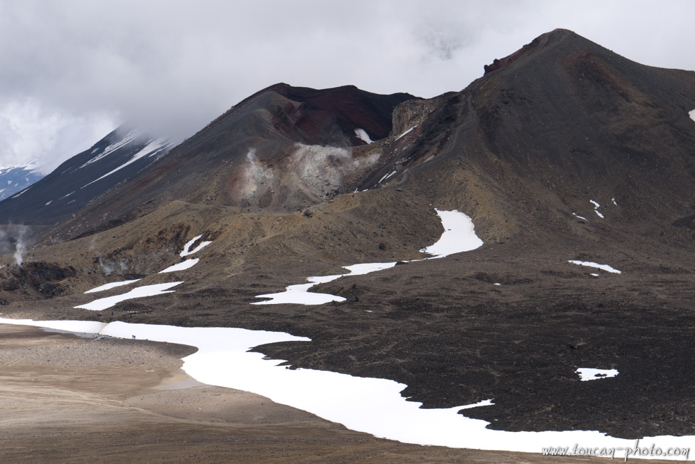
Red crater of the Tongariro
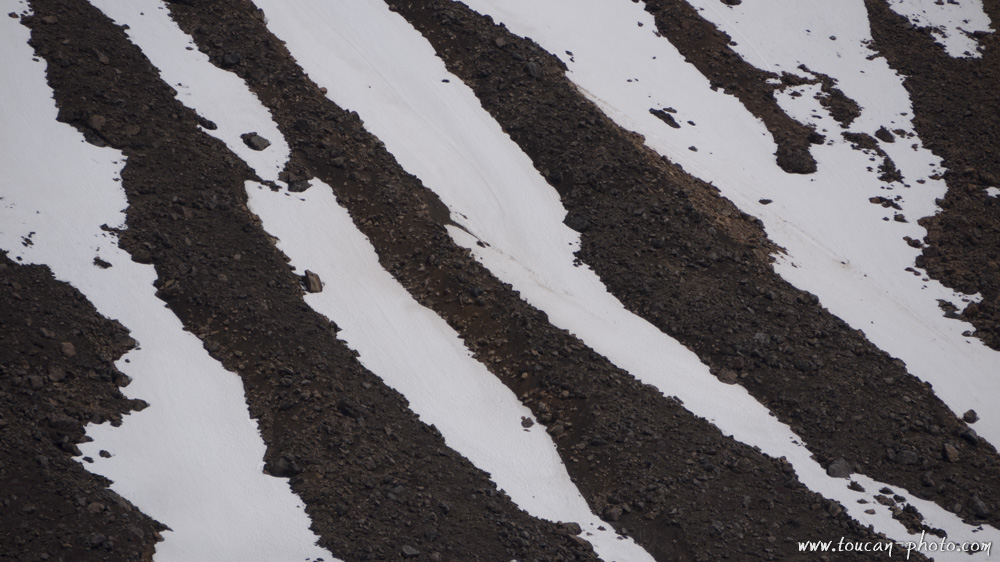
Snow zebra on Mount Tongariro
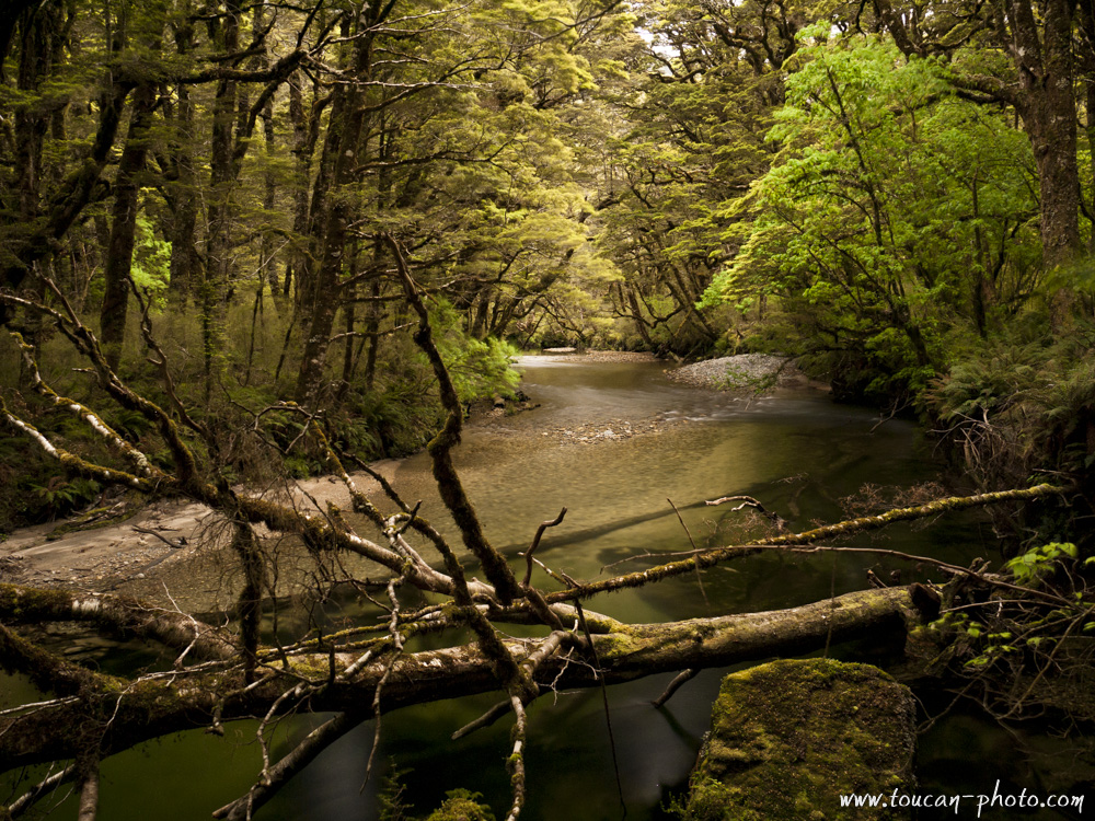
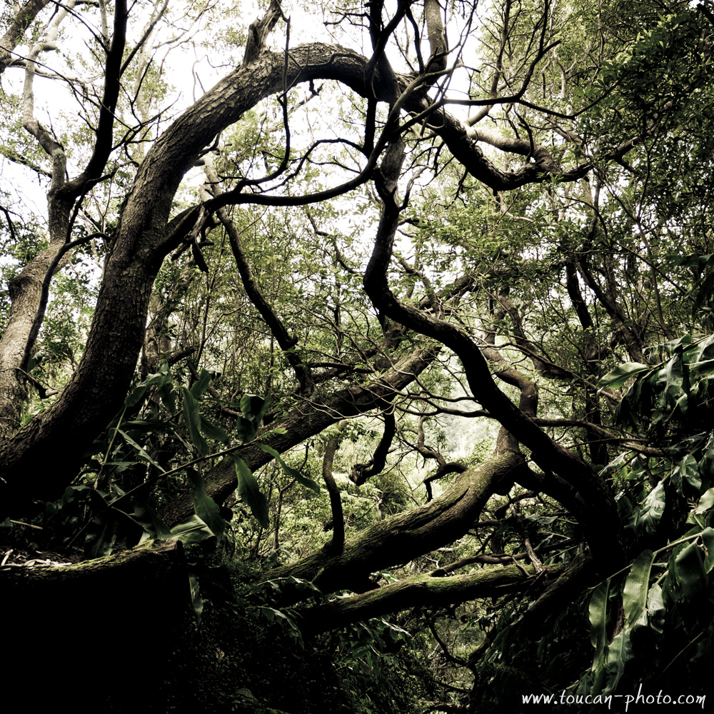
Forest atmosphere in the Fiordlands
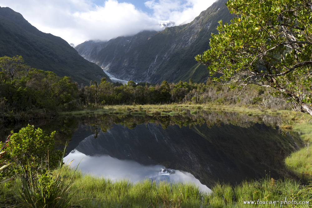
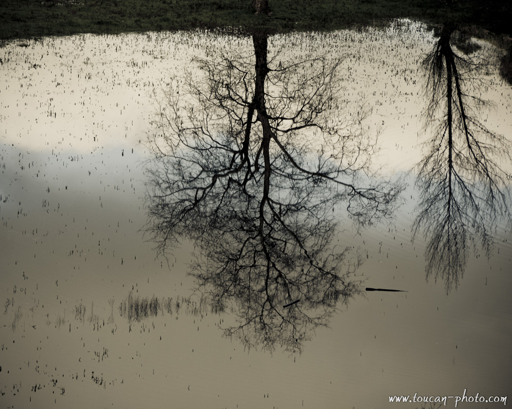
Franz Josef Glacier reflection in Peter’s pool
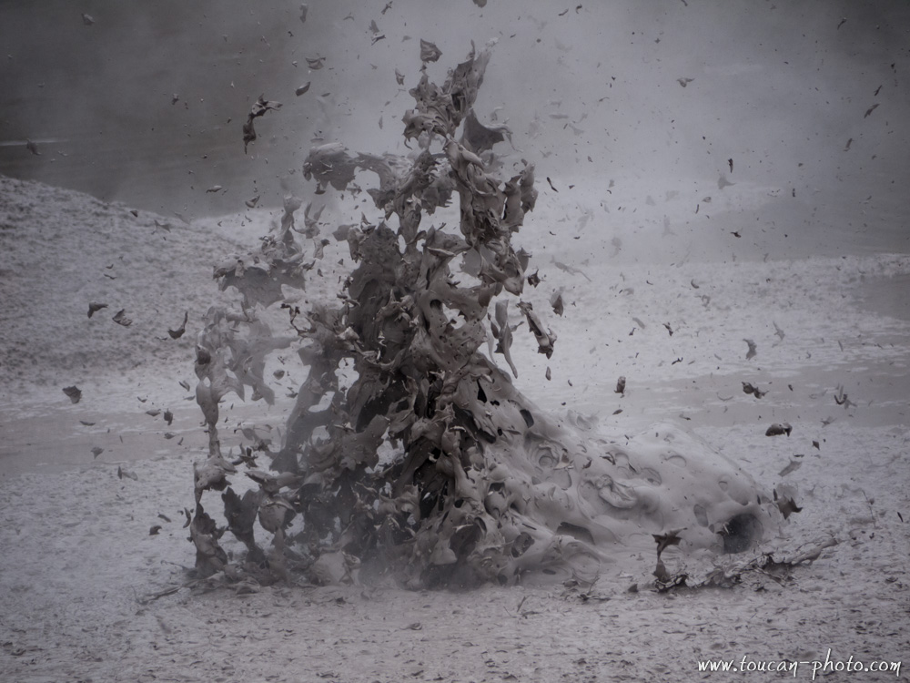
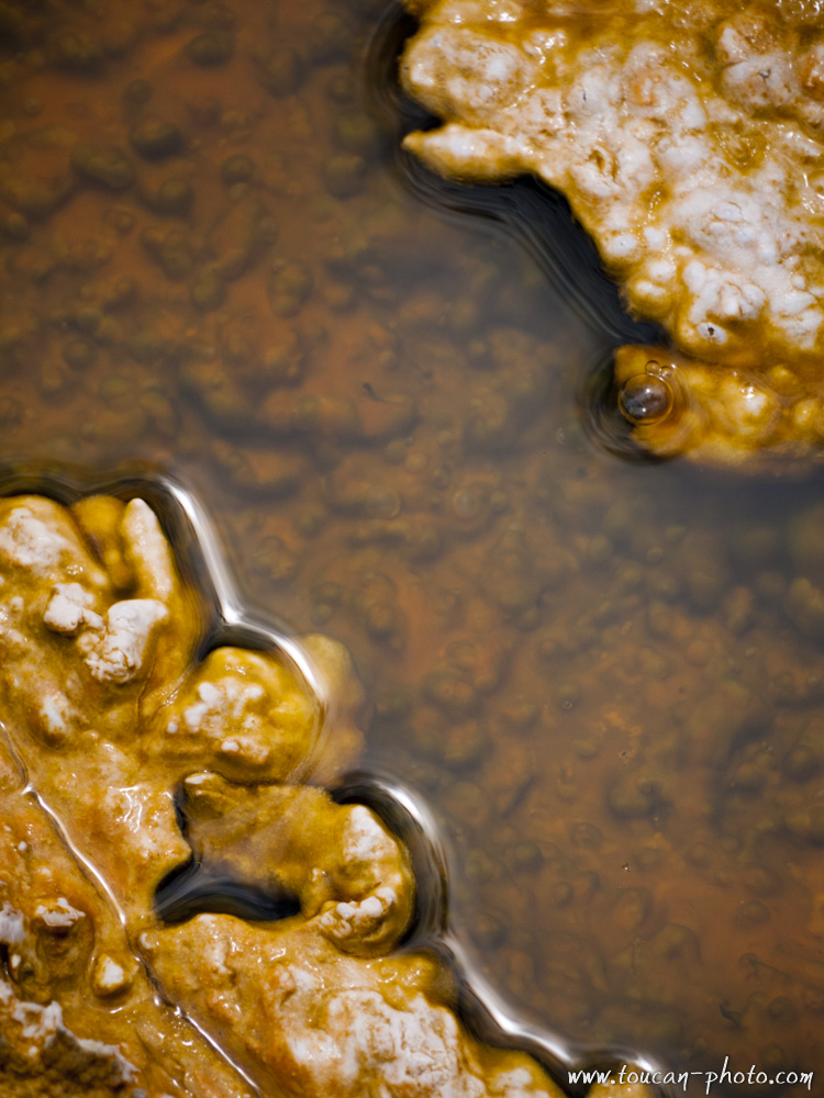
Mud explosion
Colored detail
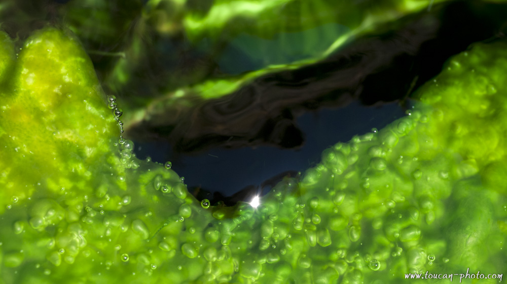
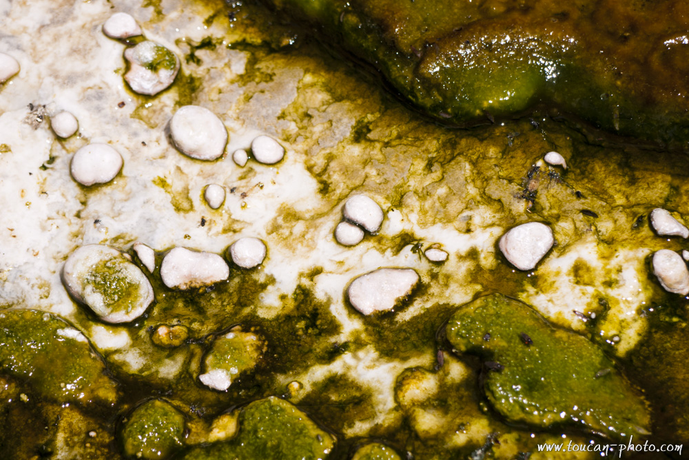
Green algae
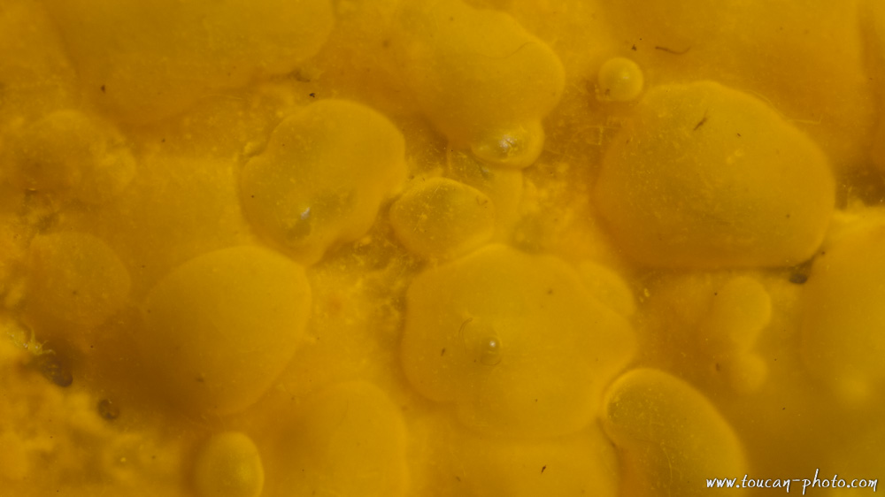
Yellow detail
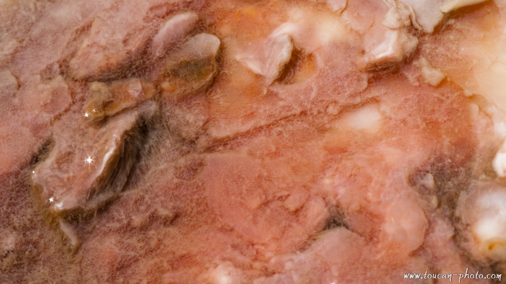
Pink detail
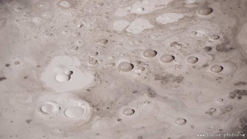
Boiling gray mud
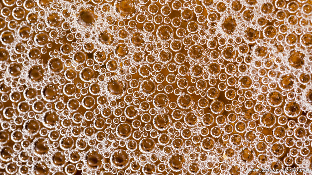
Small bubbles in a stream
Abel Tasman Park
Tongariro National Park
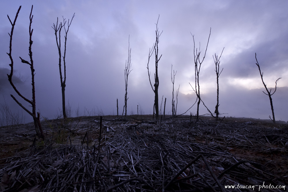
Dying branches
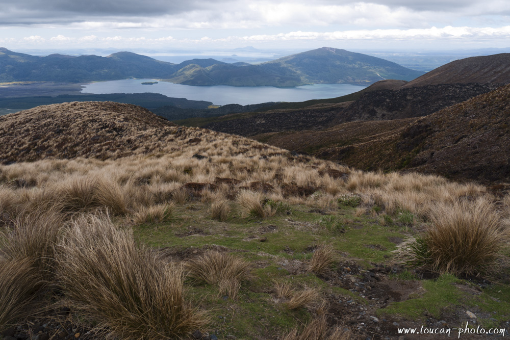
Lake Taupo
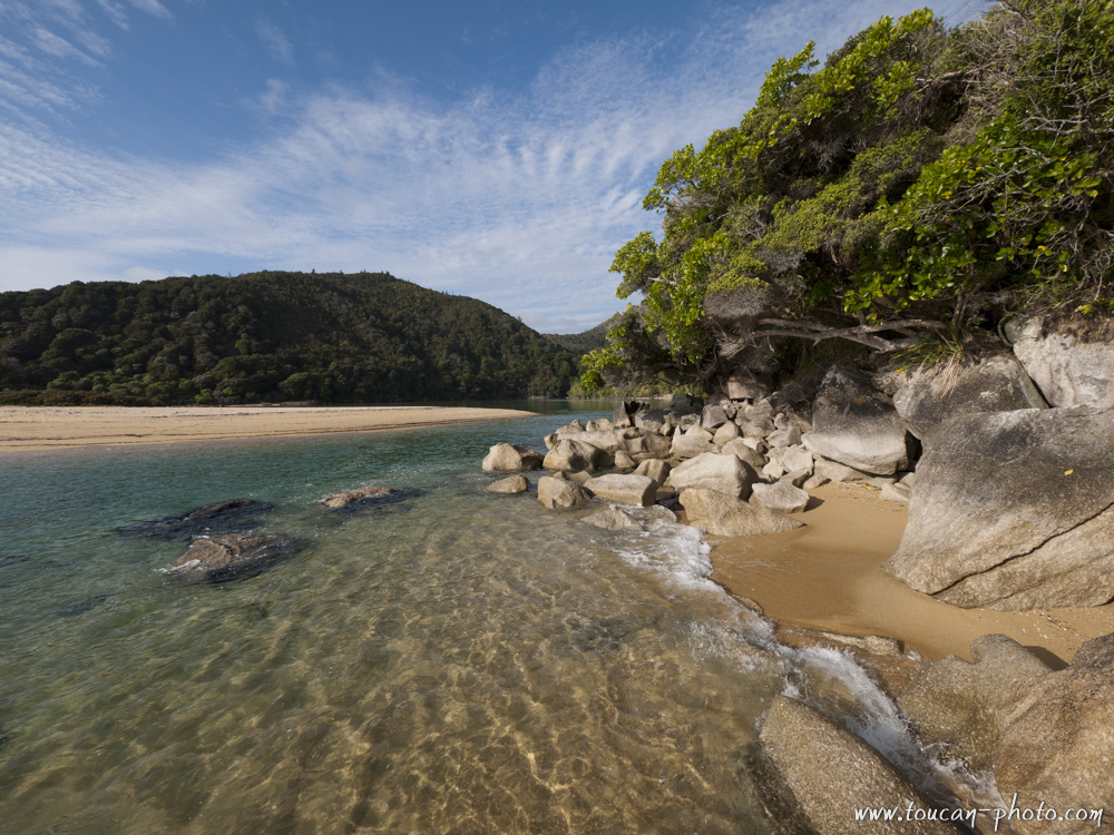
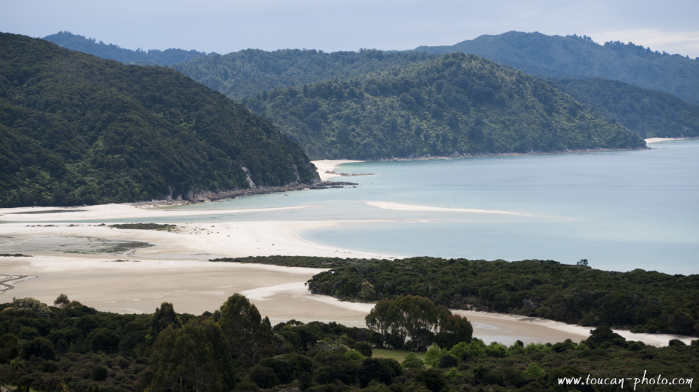
Beach of Abel Tasman Park
Mountains in the Kahurangi National Park
Meybille Bay
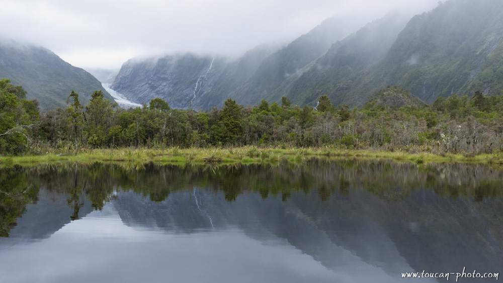
Franz Josef Glacier and its reflection
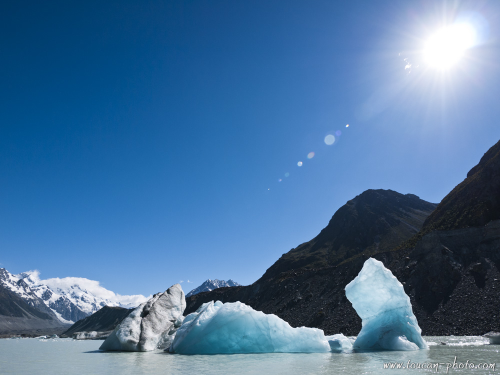
Icebergs in Tasman Lake
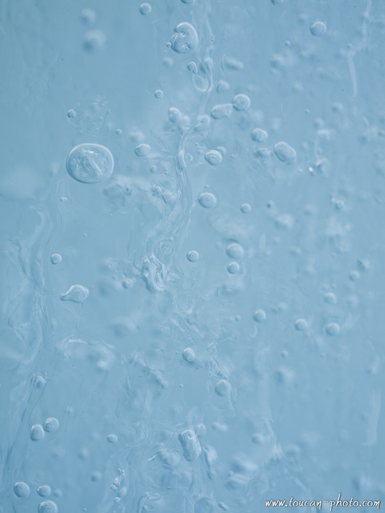
Bubbles in the ice
Inside Franz Josef Glacier
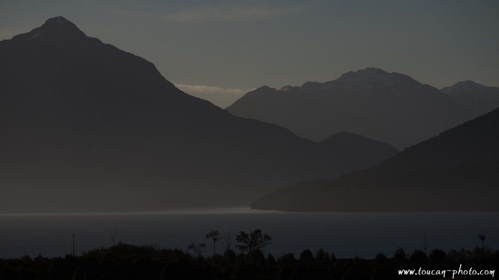
Lake Manapouri
Fiordland National Park
Rainbow between the rocks
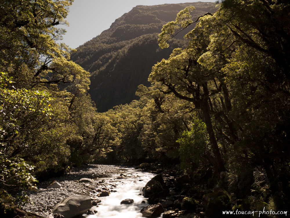
Atmosphere in a forest of Fiordland National Park
Lake Te Anau
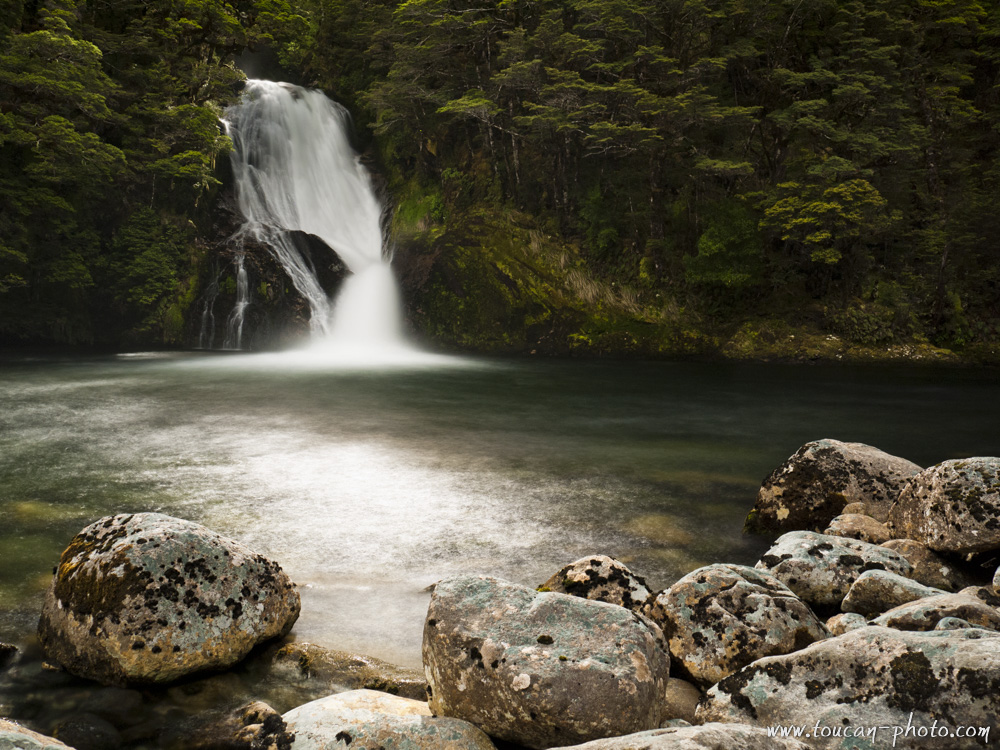
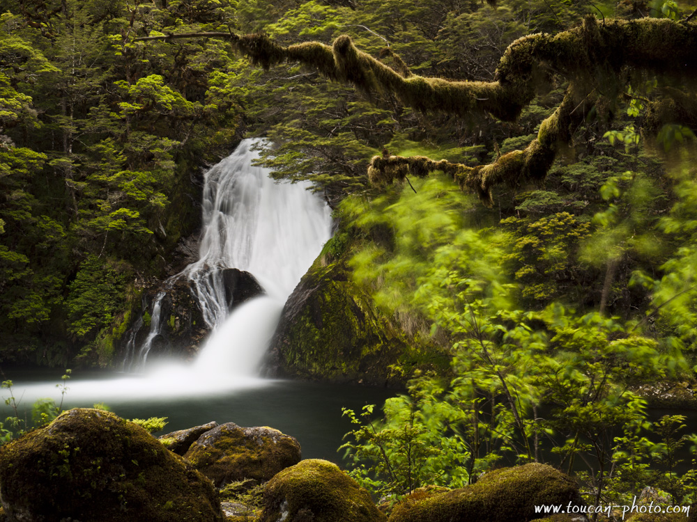
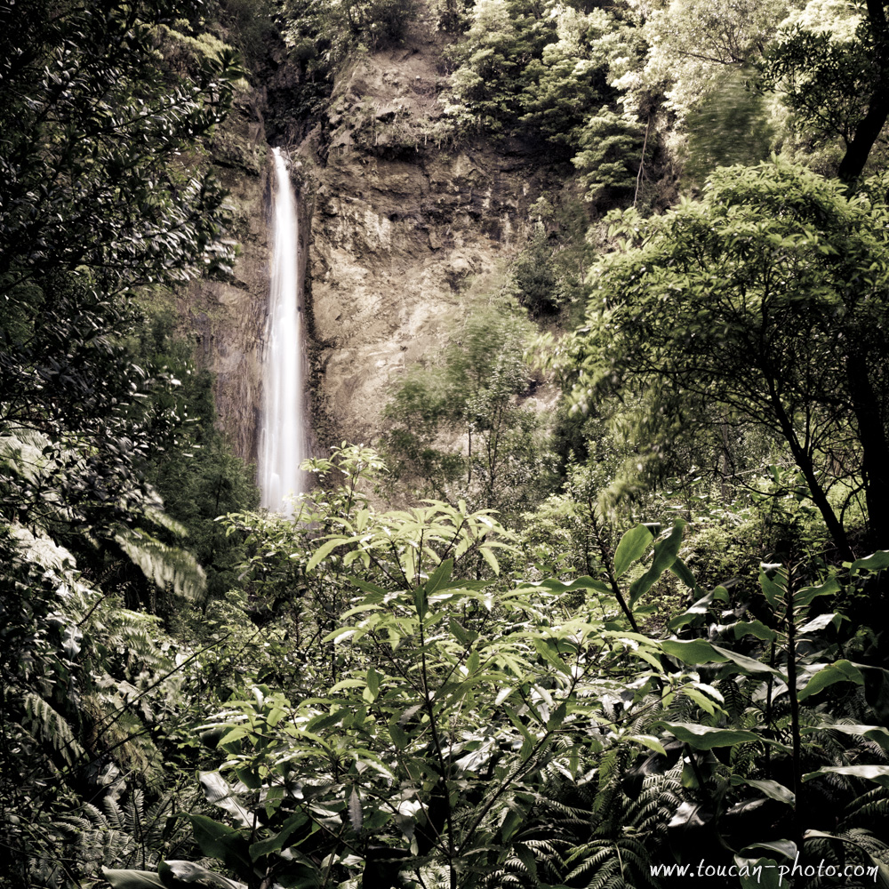
Waterfall in the Fiordland National Park
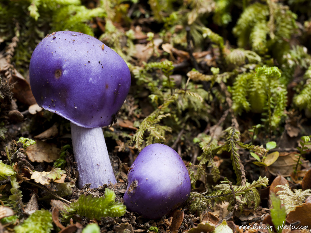
Violet mushroom
Lake Manapouri
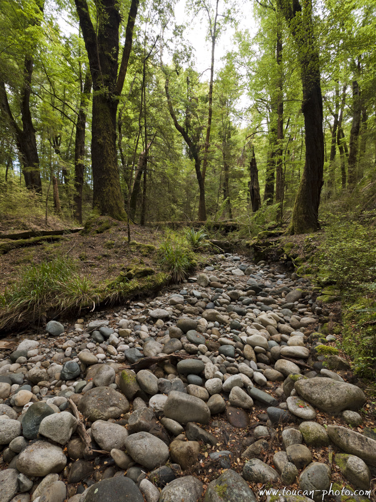
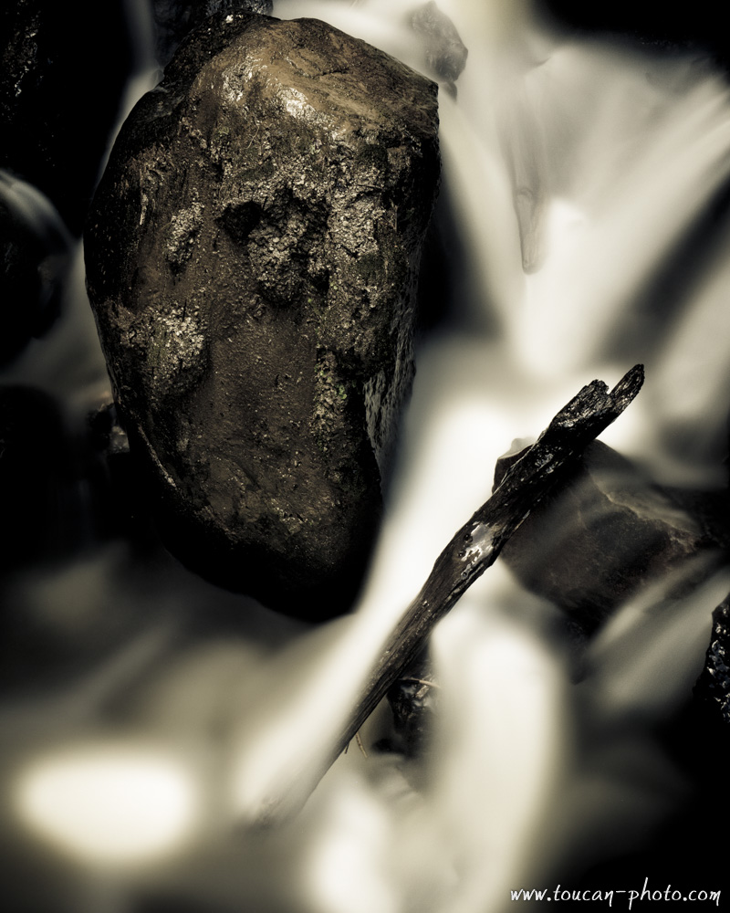
Pebble river
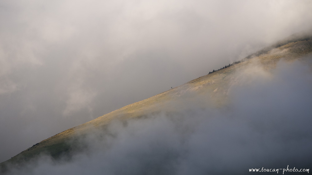
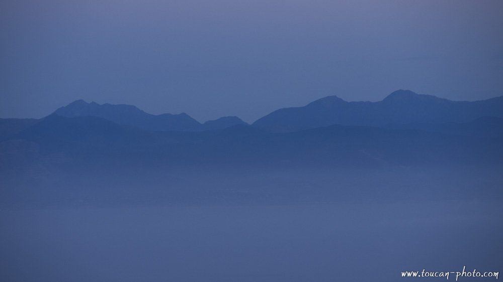
Hill piercing the clouds
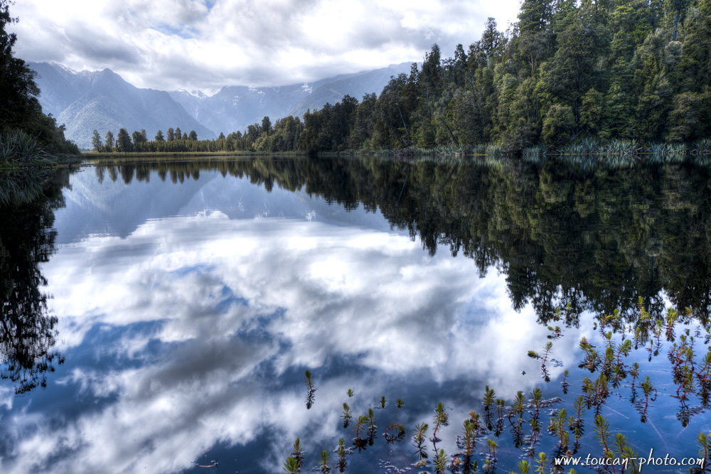
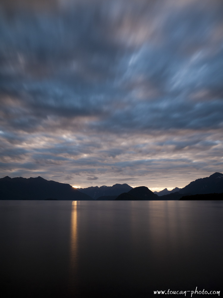
Lake Pukaki
— Continue the journey —
Tasman Glacier and Pukaki lake
See more pictures from New Zealand
Kauris: the legendary trees of New-Zealand
— Complementary Resources —
The bamboo train, called “Norry” in Khmer, is an original form of rail transport that can be seen on the railway that crosses through Cambodia. A norry consists of a bamboo tray about 2.5 x 4 meters assembled with two axles similar to heavy weights and powered by a small engine. He runs on the Cambodian railway.
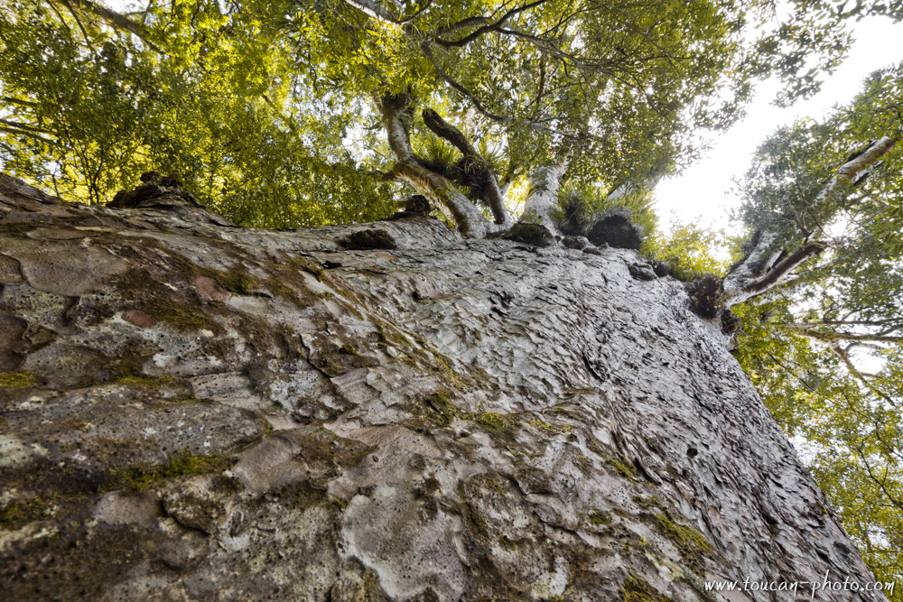
The Kauri (Agathis australis), also called Kaori, is an endemic tree from the family of the conifer that can be found in the northern part of New-Zealand. Kauris exist in New-Zealand for ages. Some fossils had been discovered and have been estimated to 220 millions of years old.
The Waipoua forest location, New Zealand
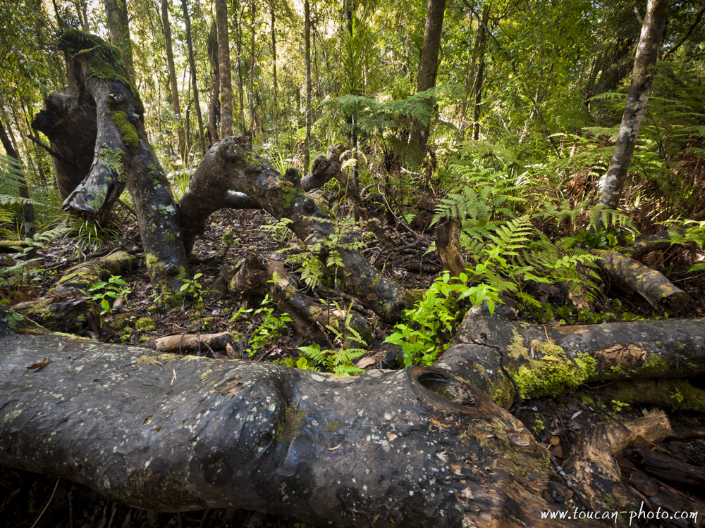
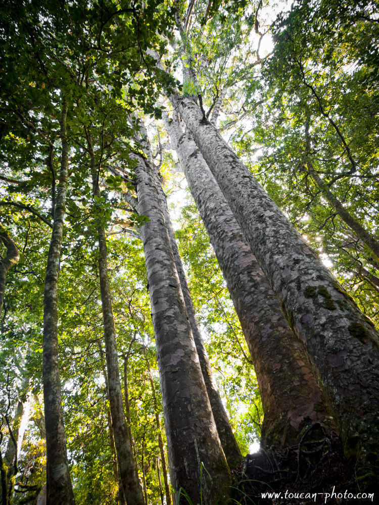
In the past, very thick forests of Kauris covered the northland. We estimate that before 1800, the Kauris forests used to occupy more than 12,000 square kilometers. However, after the overexploitation of the forest by the western population after their landing on this archipelago, only 4% of the initial number of these legendary trees has been spared. The survivors are now mostly located in the Waipoua forest.
The size of this tree and its straightness make it the ideal wood to build boats. Especially for the boat masts. Its sap, called « gum », was also taken and used to make varnish for the wood pieces, glue and also fire starter. Once the sap taken, the tree was dead. Despite its huge size, the Kauri is very fragile because of its very thin roots. The use of synthetic products instead of the sap helps to save the Kauri.
The few remaining Kauris can be more than 50 meters high and the trunk more than 3 meters large. These characteristics make it one of the most majestic trees on Earth. Even if it’s difficult to estimate the age of these trees, some recent studies conclude that the oldest trees are 2000 years old. Nowadays, preservation and protection plans are controlled by the DOC (Department of Conservation). The Kauris are referenced; some footpaths are marked to prevent hikers to step on weak tree roots.

Huge kauri in the Waipoua forest
Remains from dead kauris
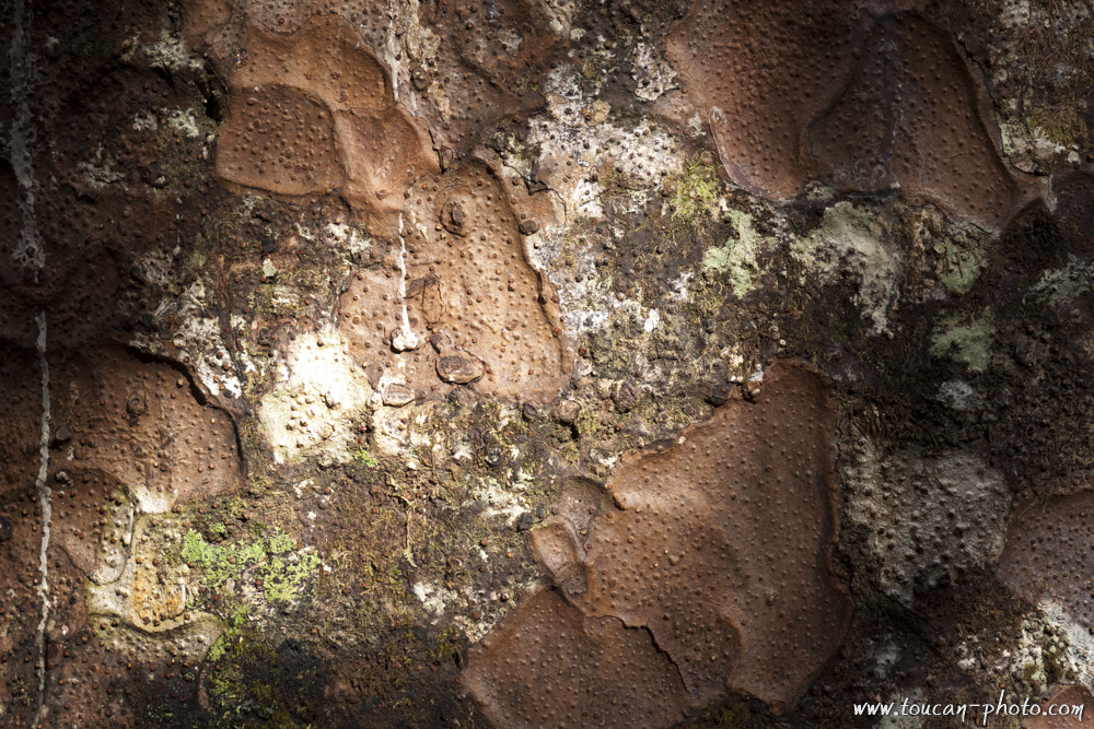
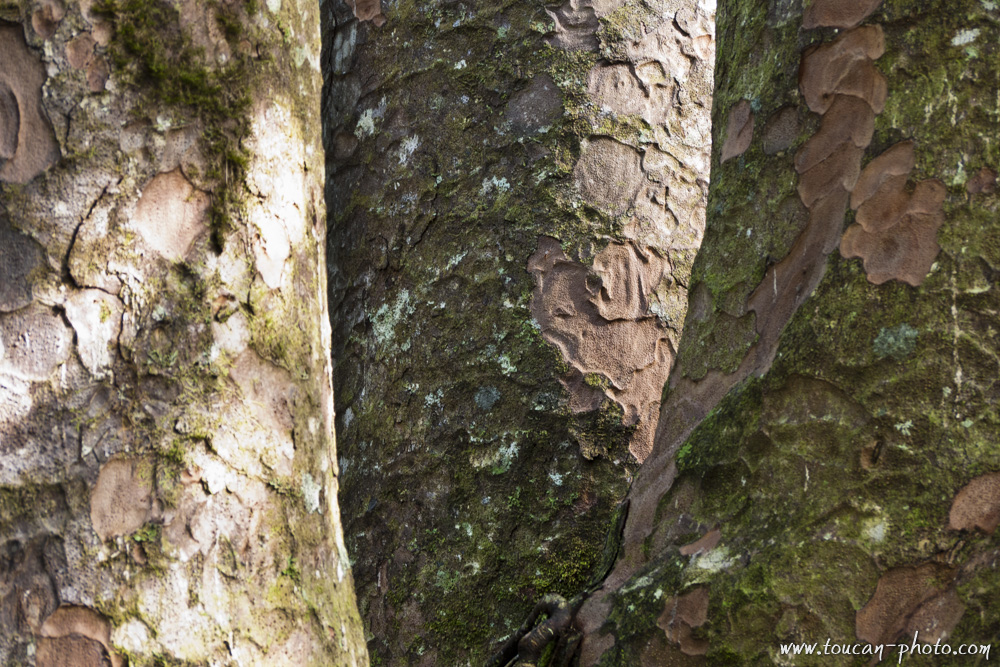
Kauri bark
One tree, the Tane Mahuta (“lord of the forest”), has an important place in the Maori cosmology because it is the son of Papatuanuku (the earth Mother) and of Ranginui (the Sky Father). Papatuanuku and Ranginui were living entwined, deeply in love. They were physically so close of each other that the universe was smothering.
Tane Mahuta, the fruit of their love, grew up with strength and separates his parents, the earth and the sky and allowed the surroundings to live within the light. The atmosphere has also been created by this event as well as the life as we know it today. Tane Mahuta, with its 51.2 meters height and with a circumference of 13.77 meters is really the lord of the forest. Its age is estimates to 2000 years old.
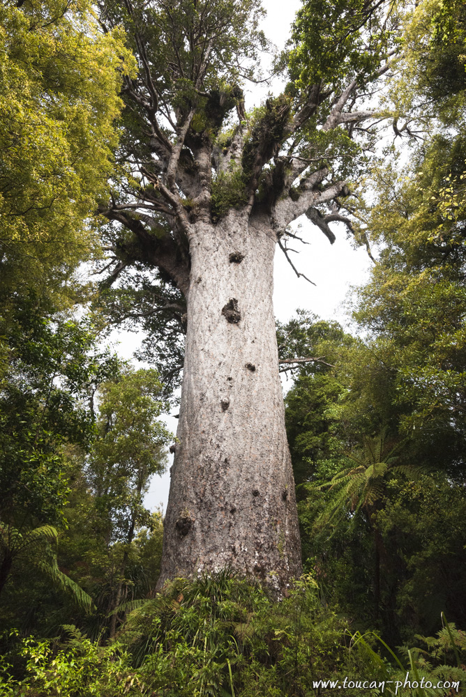
Tane Mahuta, « Lord of the forest »
Among the other interesting trees, Te Matua Ngahere, is considered by some scientists as the oldest tree on earth within the humid forest category. It would be about 4000 years old. Te Matua Ngahere has a colossal trunk with a circumference of 16.41 meters and 5.2 meters large. Sometimes it happens that the Kauris trunks are splitted in several pieces. That’s the case of the “Four sisters”, a tree composed of 4 trunks growing in the Waipoua Forest.
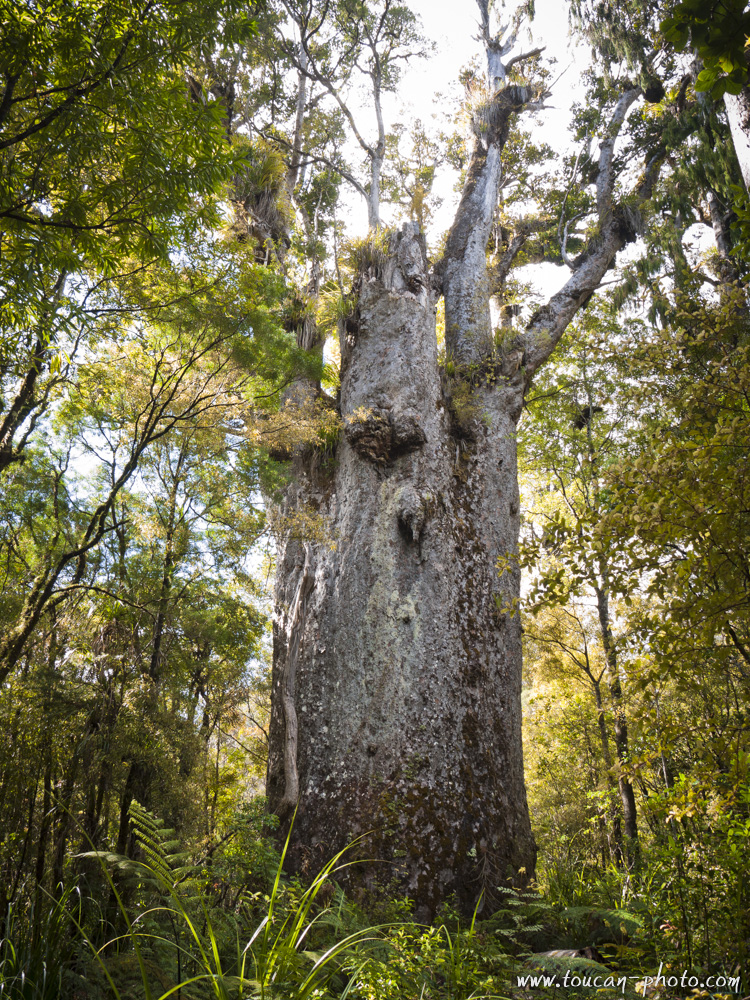
Te Matua Ngahere, the widest trunk Kauris
Te Matua Ngahere
Four sisters, composed of 4 trunks
Four sisters
Uluṟu is a rock formation located in the heart of Australia, Northern Territory, near Alice Springs. Uluru, and other geological curiosities around (like Mount Olga) is part of the Uluru-Kata Tjuta. The park, covering an area of 1325km² created in 1987, was classified in the same year as a UNESCO Natural Heritage Site world.
Location of the Uluṟu-Kata-Tjuta national park
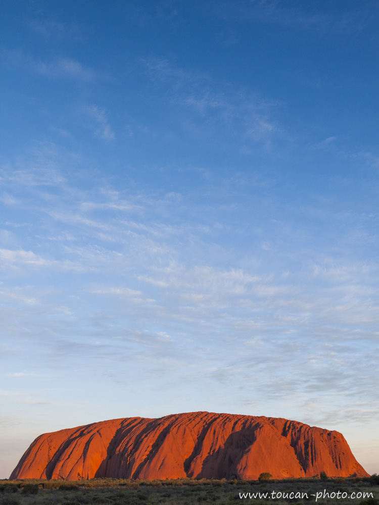
Uluṟu / Ayers Rock
Uluṟu is the name given by natives (Anangu) at this sacred rock their eyes. Although this word does not have precise meaning in the Anangu culture, but It is sometimes used to define or translate the words “protection”, “long sleep”, “journey” or “freedom”… Renamed «Ayers Rock» in 1873 by William Gosse, the first explorer European to have visited the site, the building now bears the double name Uluṟu/Ayers Rock.
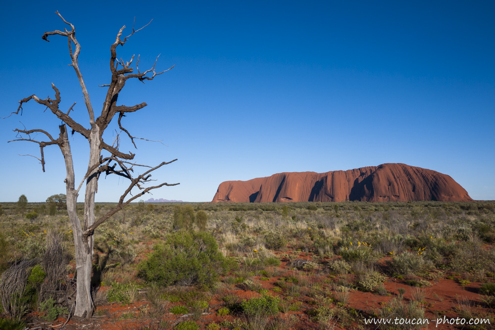
Uluṟu/Ayers Rock, in the heart of Uluru-Kata-Tjuta National Parc, and at the horizon line, the Mount Olga
Contrary to popular belief, Uluṟu is a monolith, but only emerged part (348 meters above ground) the rock formation that continues deep underground and it is called “mountain-island” (like an iceberg is rock) second largest “mountain-island” in the world after Mount Augustus, located also in Australia. Uluṟu is a sandstone rock formation very homogeneous, since it does nor diaclase or cleavage, it is very resistant to erosion and wear of time, since, only the outer portion subject to bad weather. It is therefore very likely that its shape is not changed for 10,000 years, when the first Anangu people settled in the region. It is also because of ferrous elements that make the Uluṟu’s sandstone that characteristic red / brown colour. The oxidative effect of these ferrous rock, change the grey colour from the inside to rusty.
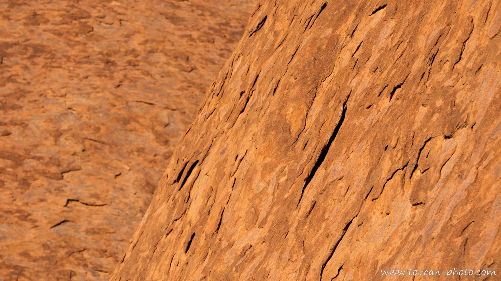
Uluṟu’s stone detail, under the oxidized crust, tiny grey rock appears
According to the tradition of the Australian Aborigines, the “Dreamtime” (Tjukurpa Anangu language) is the period during which the world not yet existed, but was being created by the “Great Minds”, whom appeared in the form of plants, humans or animals. That’s for example, when were created the great rivers, which are borrowed from a spirit snake footprint. Uluṟu and was erected by two children playing in the mud after rain. They would have done this hill of mud so they could slide on the side. Traces of these different slides are also still visible throughout Uluṟu. Today, the “Great Minds” would be held in Uluṟu, making this site one of the most sacred to Anangu culture*.
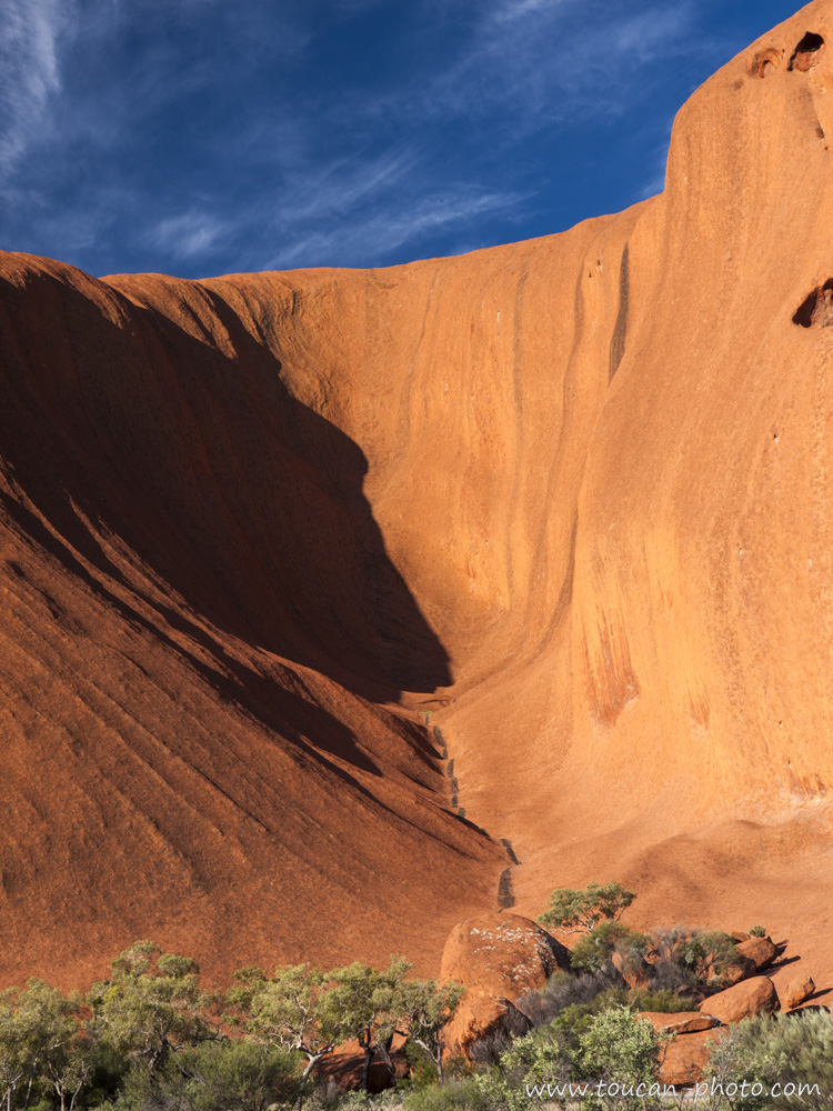
A «Slide trace» on the Uluṟu’s side
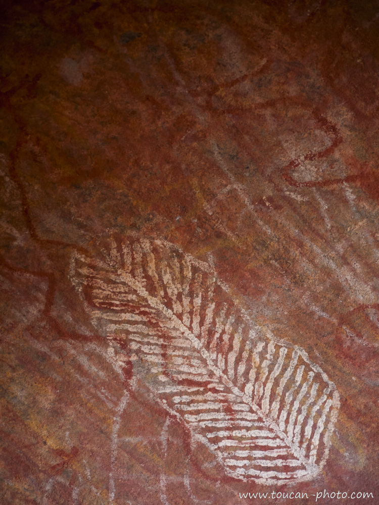
Rock Painting
Uluṟu which “belonged” to the Australian government before that, was surrendered to Anangu people in 1985, in exchange of granting a lease and operating for 99 years to the National Parks and Wildlife agency. This organization is still seeking the best way forward in site management. For example, perceived as a sacrilege in Anangu culture, the National Parks and Wildlife agency, fearing a desertion of tourists, still doesn’t prohibit to climb Uluṟu. On the other hand, the photography of some areas of Uluṟu that may affect the Aborigines was prohibited (these areas are normally reserved for an elite, but it is very difficult for the National Parks and Wildlife agency to monitor them).
*Climbing Uluṟu and photograph these prohibited areas has obviously not been done for the realization of this article
— Continue the journey —
— Complementary Resources —
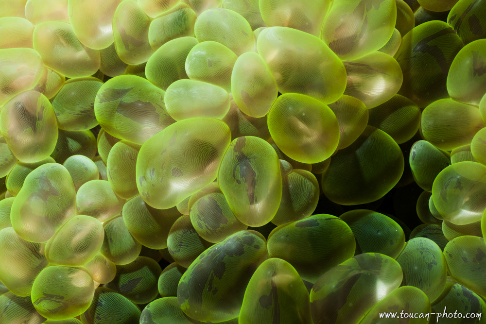
The experts may certainly recognize Moray, Manta Ray, Clown fish, Parrotfish, Squid and Cuttlefish, different species of hard and soft corals, and some Shellfishes. Have a good dive!
Andaman Sea location
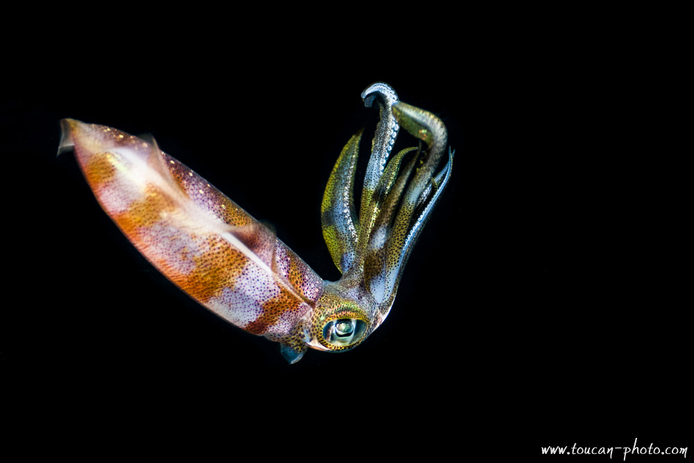
Night shot of a squid
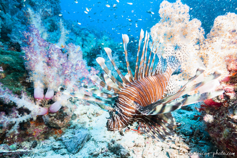
Lion Fish
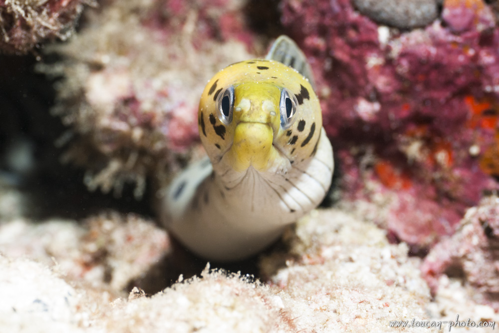
Yellow head moray
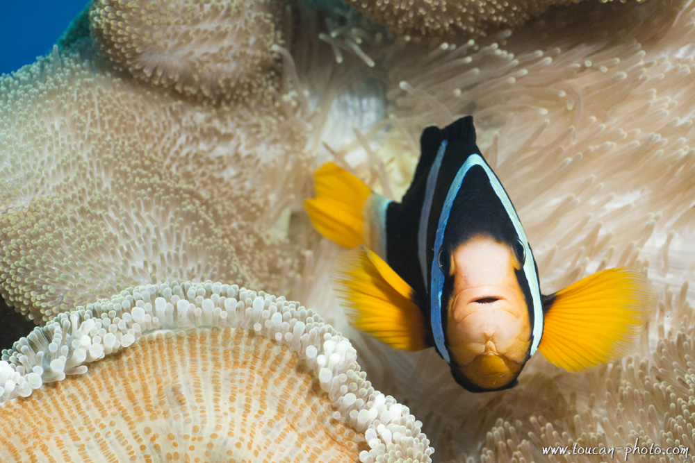
Clark’s anemone fish
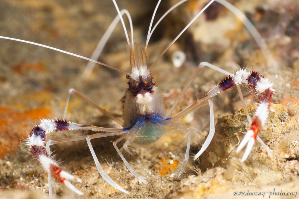
Banded cleaner shrimp (Stenopus hispidus)
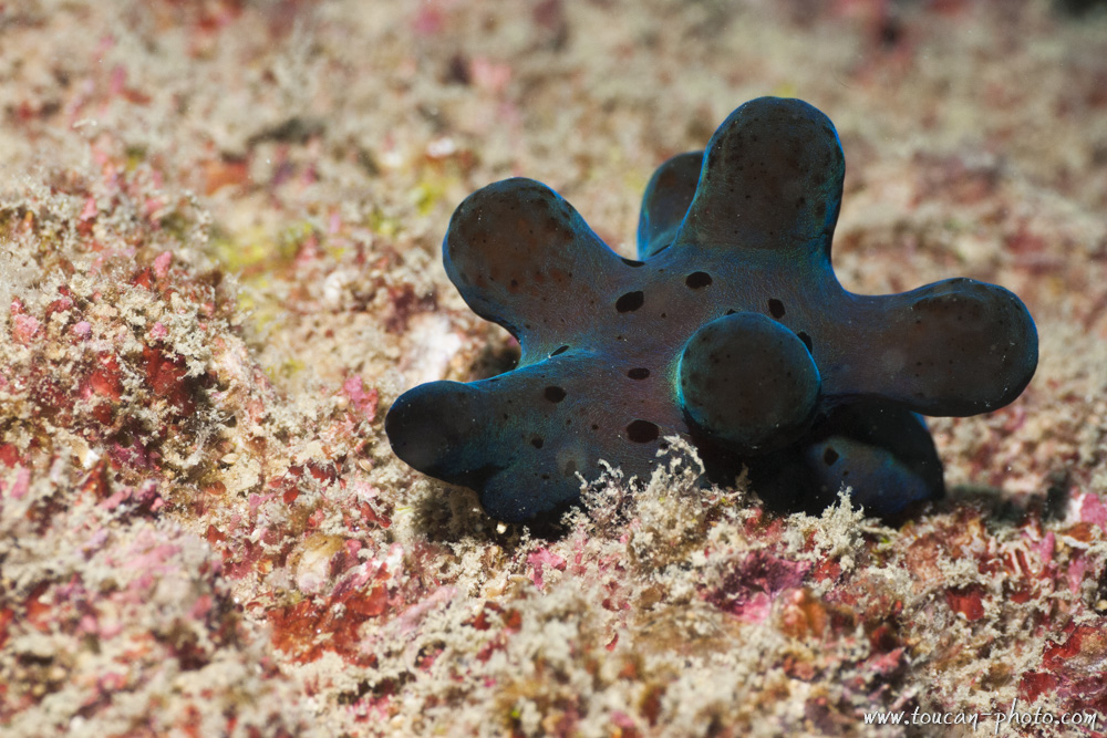
Hiby’s coriocella (Coriocella hibyae)
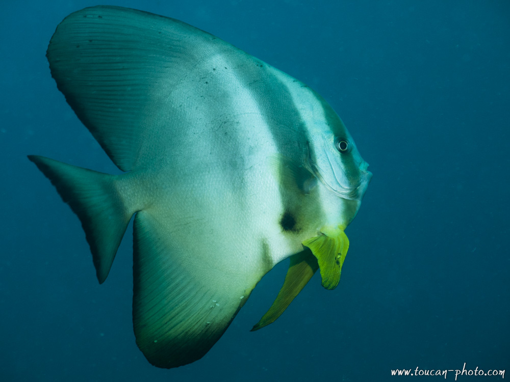
Batfish
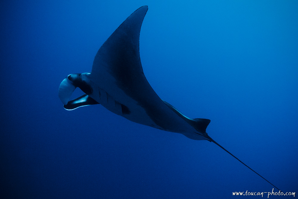
Manta ray
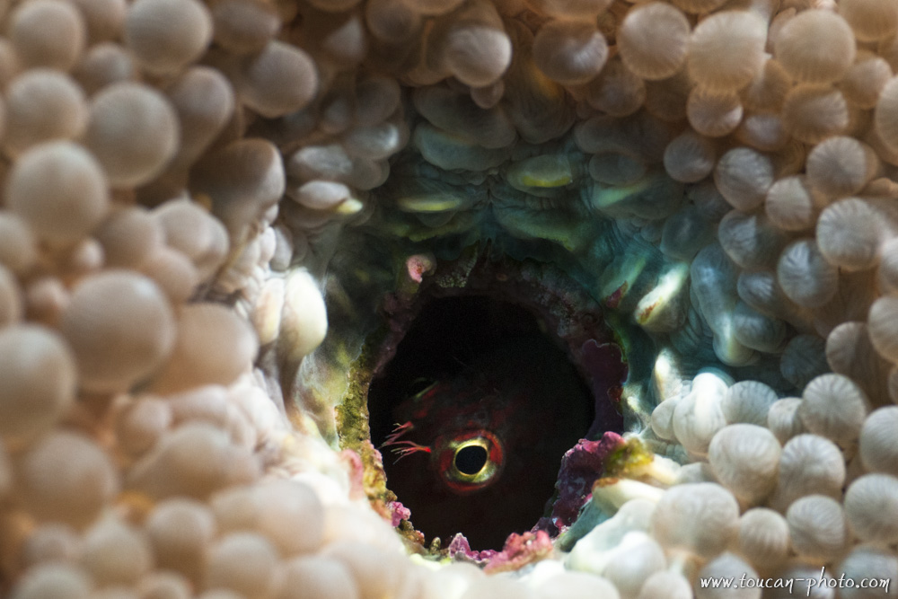
A blenny try to get hide inside a coral hole
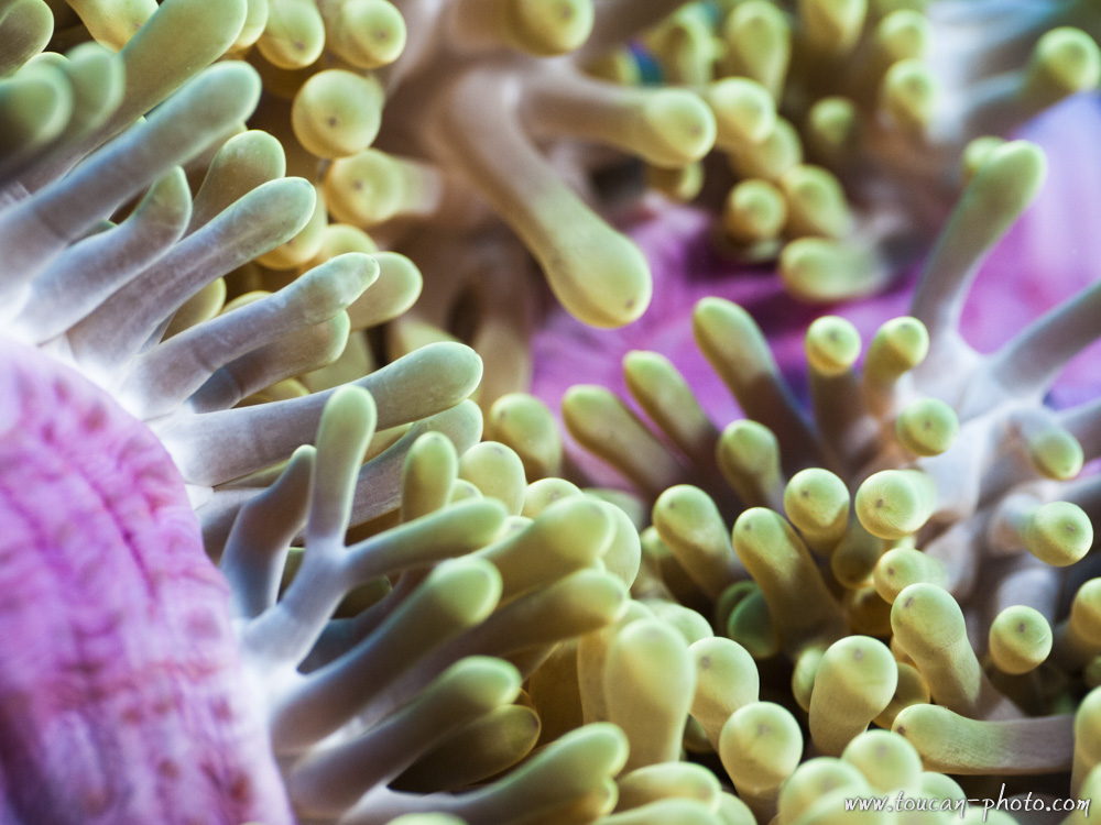
Inside the anemone
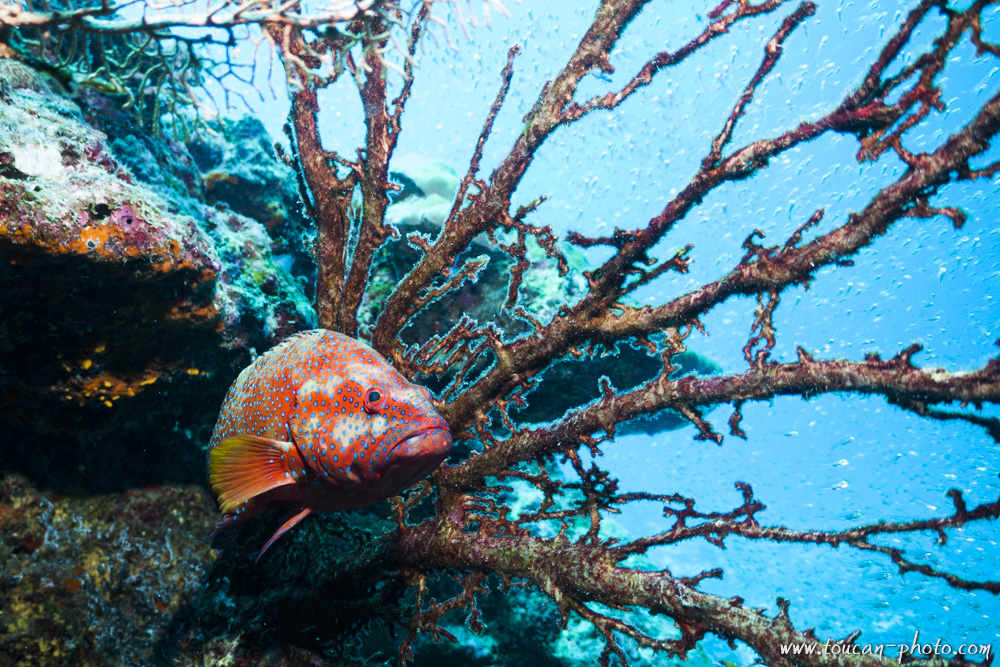
Coral hind (Cephalopholis miniata)
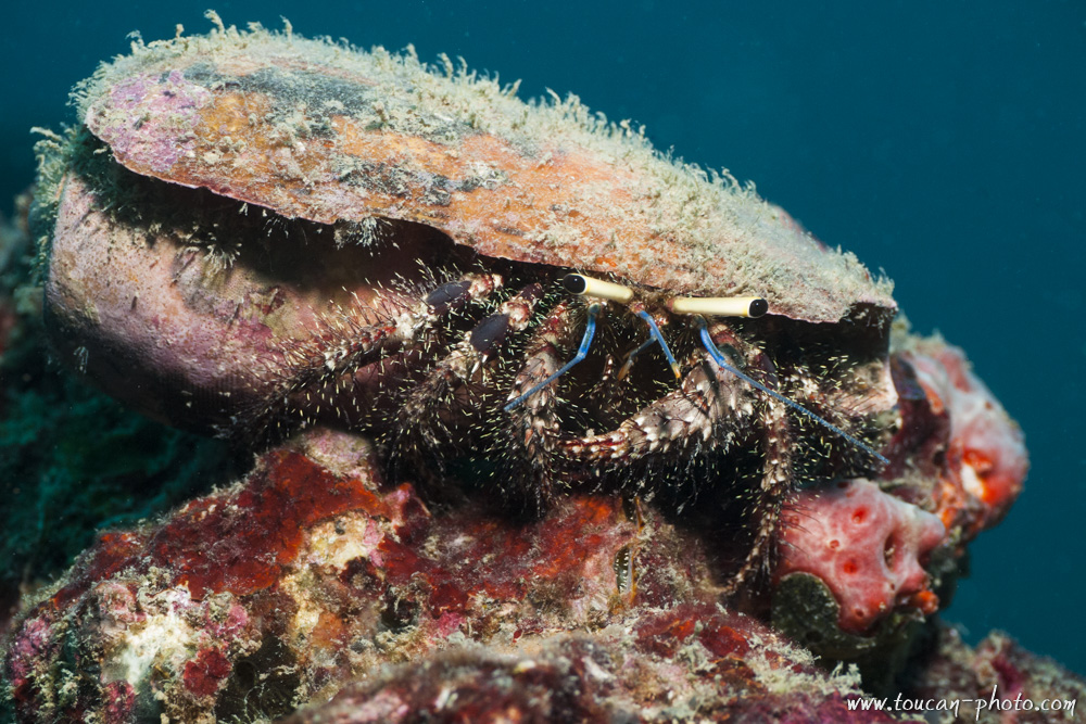
Hermit crab
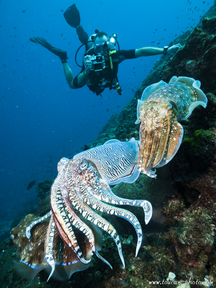
Cuttlefishes and diver
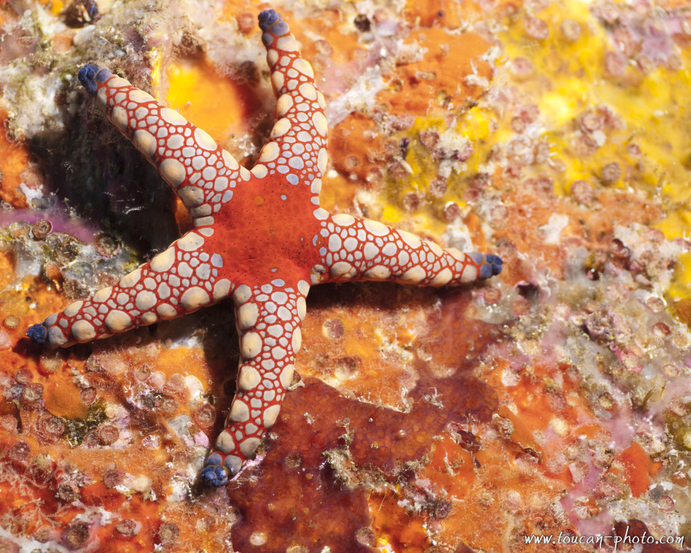
Sea star
Bubble coral
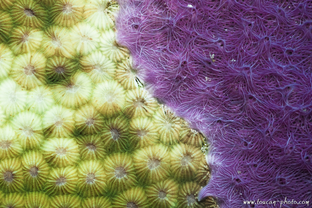
Coral
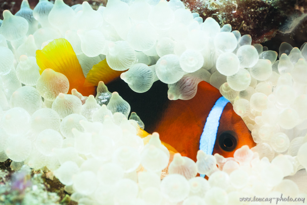
Anemone-Fish in its anemone nest
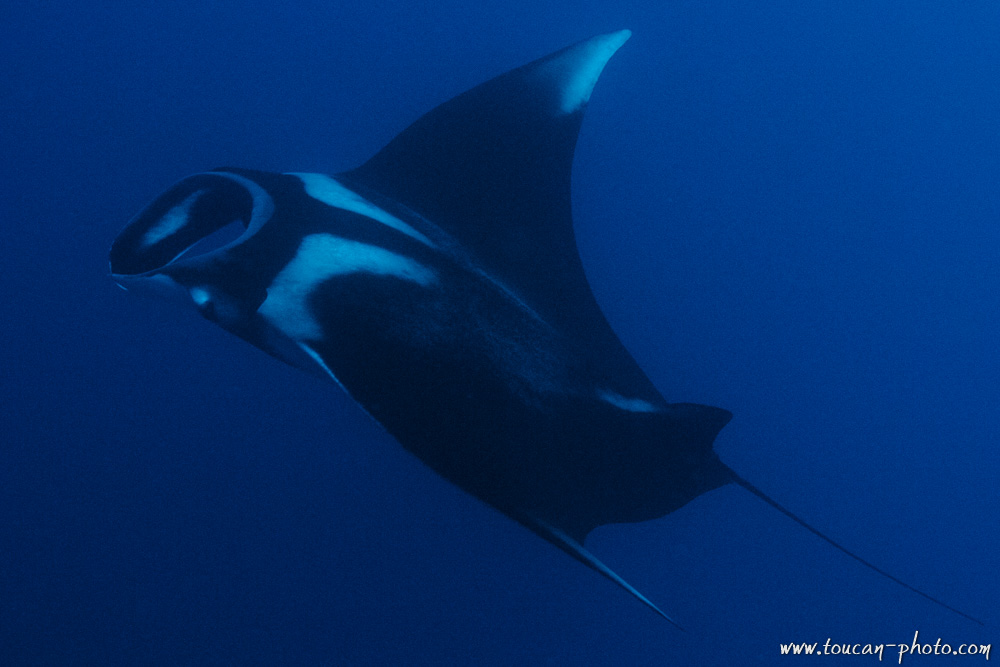
Manta Ray
Reef
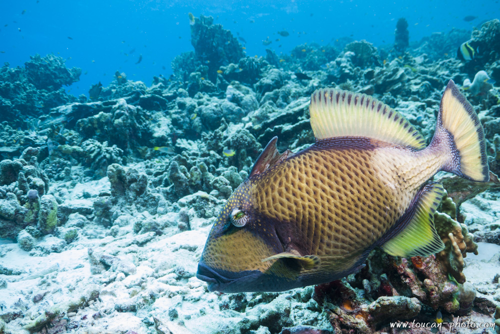
Trigger-Fish
— Continue the journey —
— Complementary Resources —
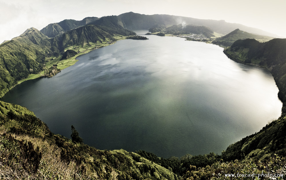
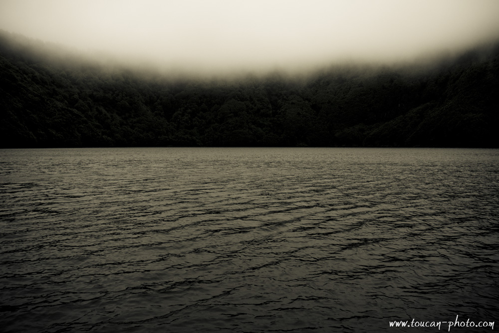
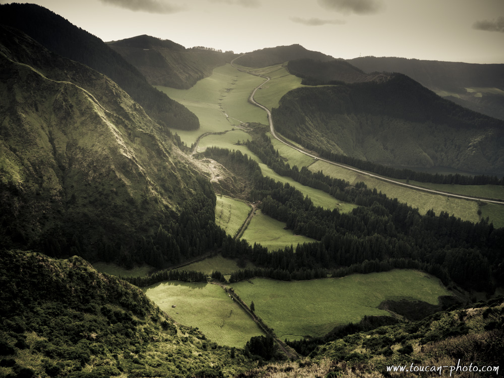
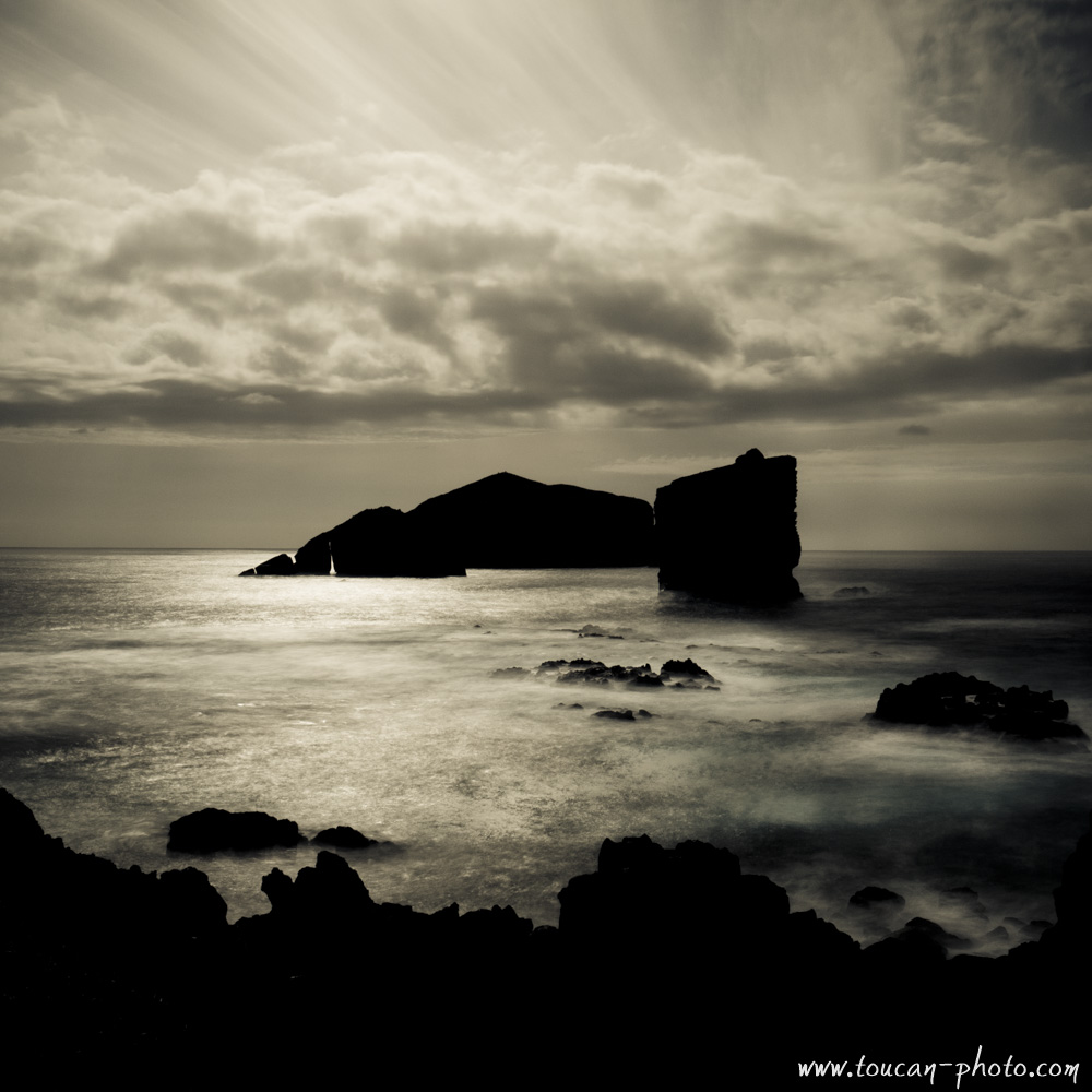
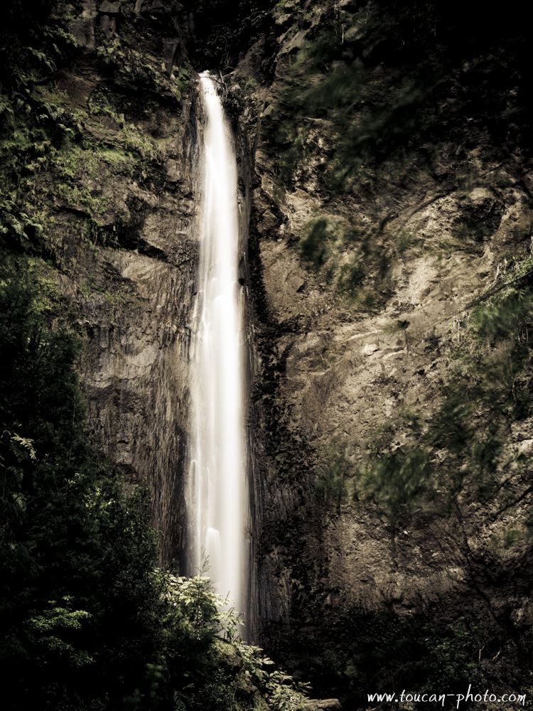
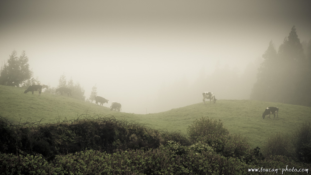
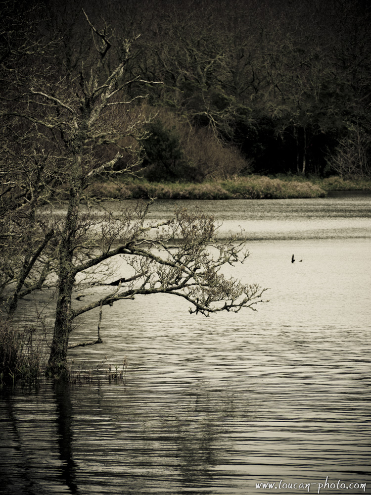
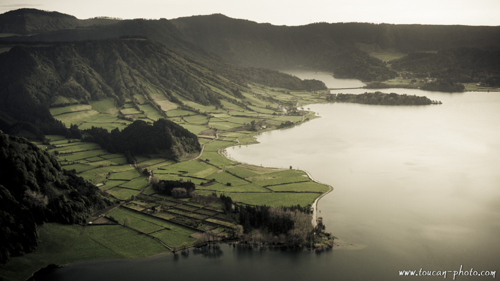
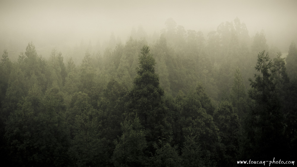
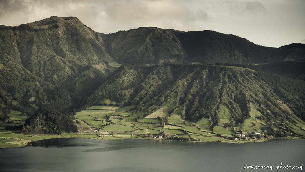
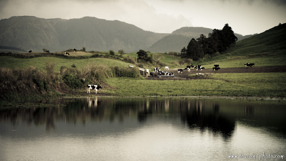
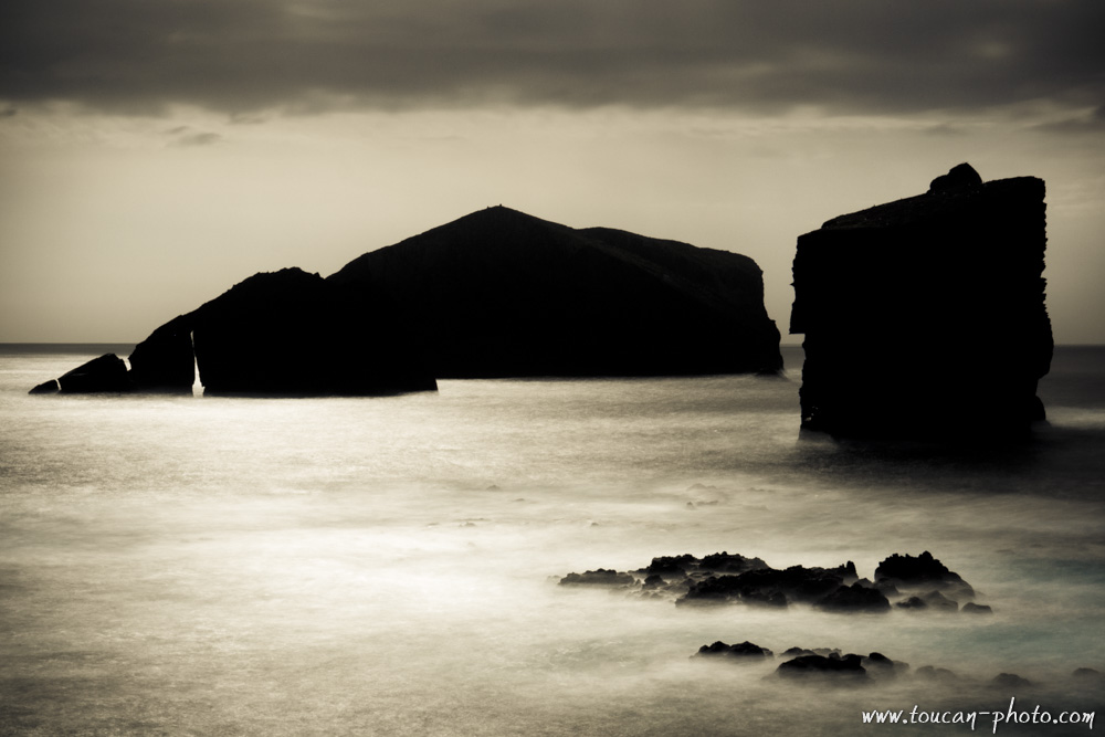
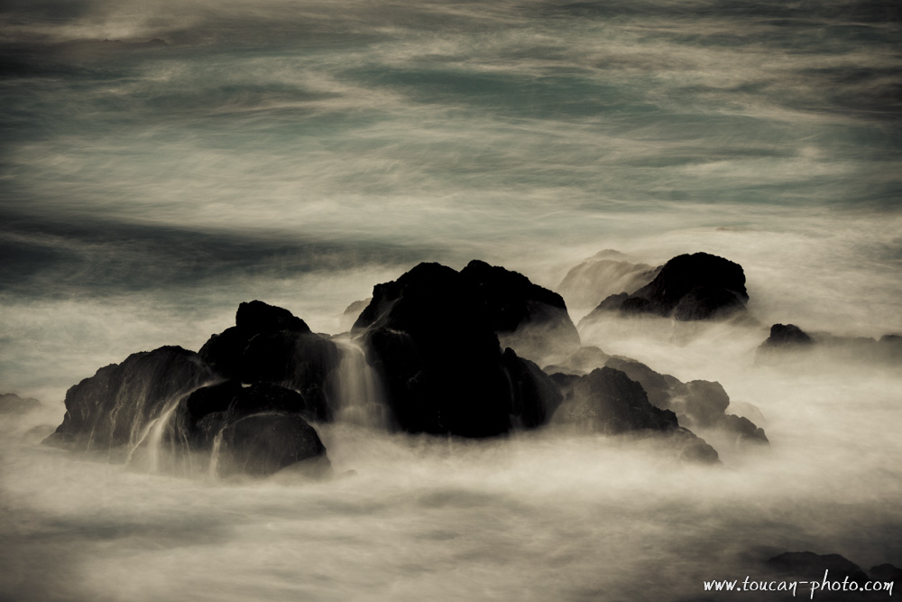
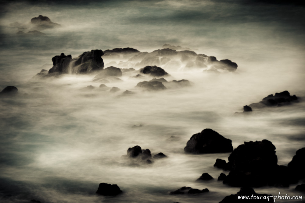
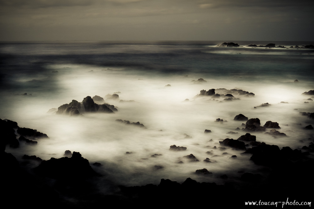
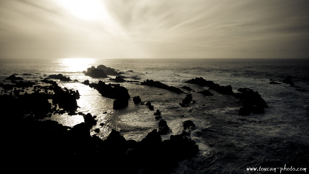
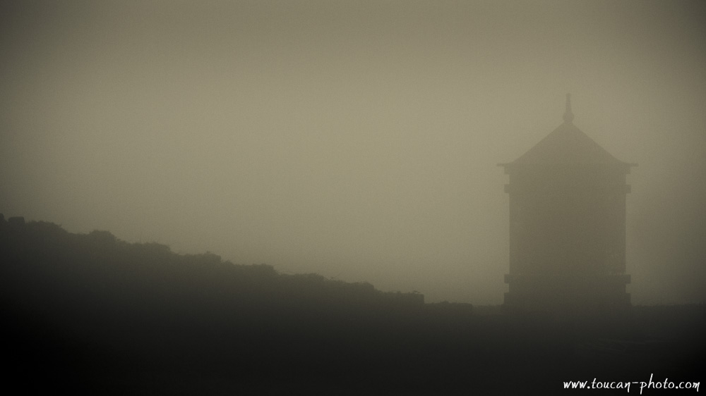
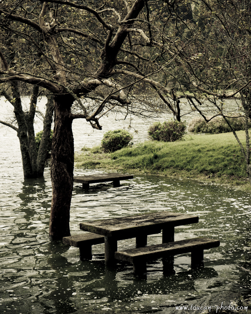
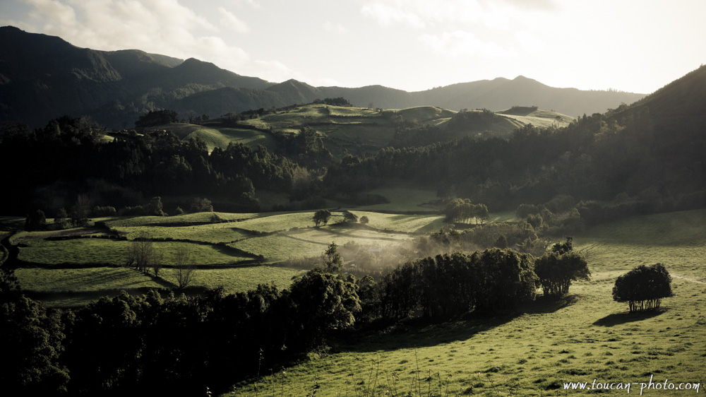
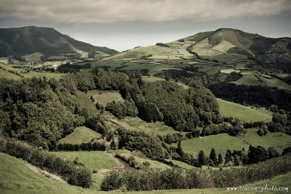
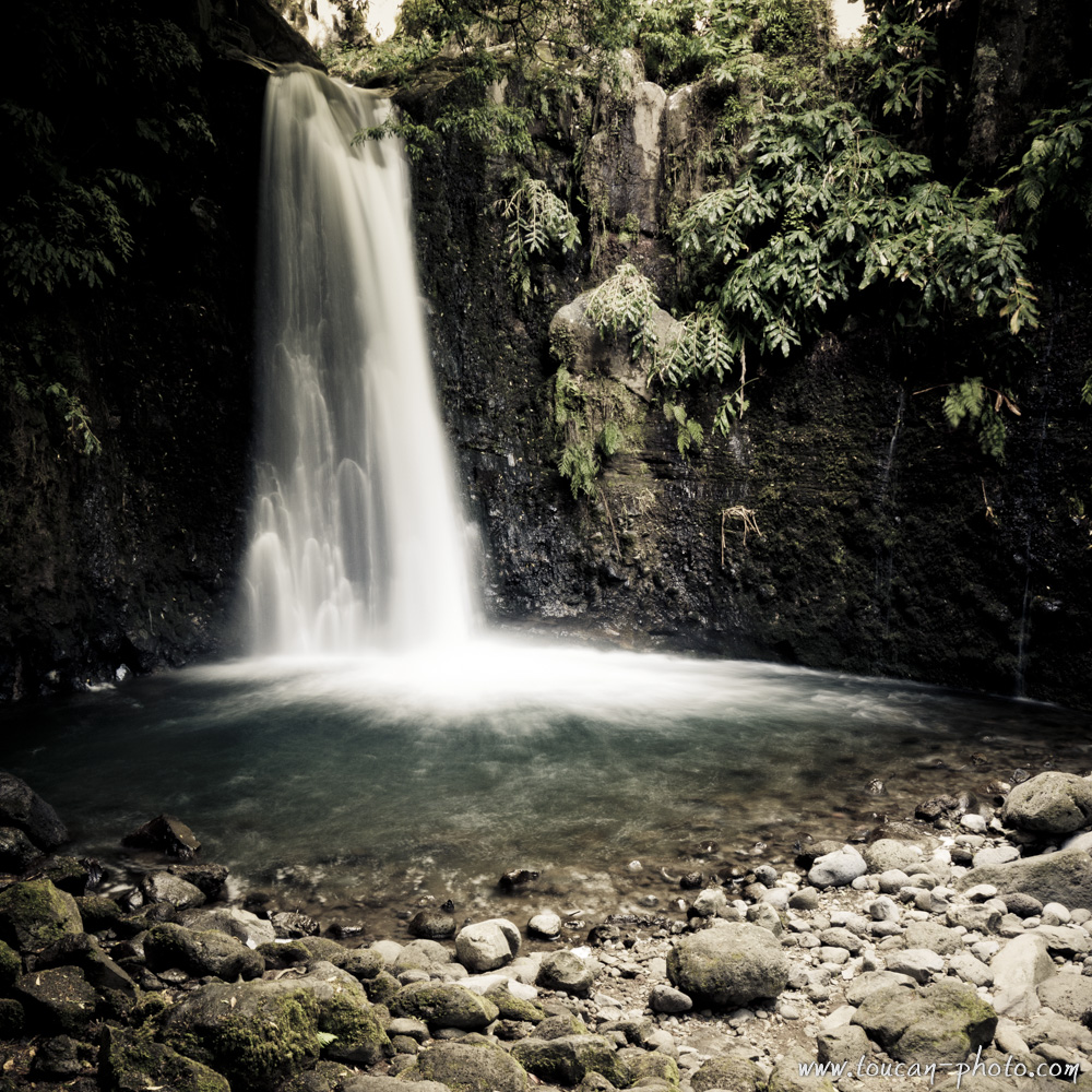
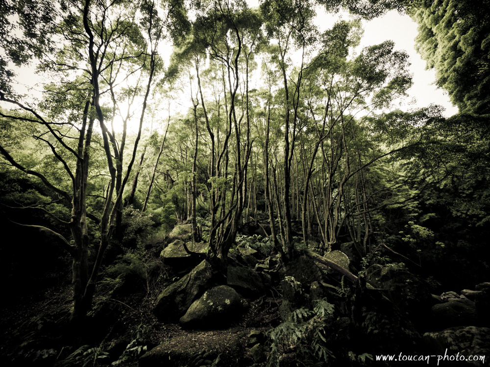
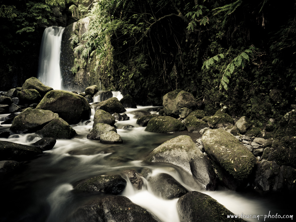
Everyone has heard of the Azores … At least during a weather report. 😉 Indeed, an anticyclone is covering the Azores. It acts like a barrier and prevents precipitation to come to West Europe. However, this is synonymous of heavy rains and strong winds to the Azorean population.
It took me a few minutes after getting out of the plane to realize that water is omnipresent in the Azores. Rain, coulees, Hot springs getting out from nowhere, torrents, waterfalls … all in a small island in the middle of the Atlantic Ocean! You see for yourself on the pictures that I have created, that water is everywhere ! Take a poncho!
— Continue the journey —
— Complementary Resources —
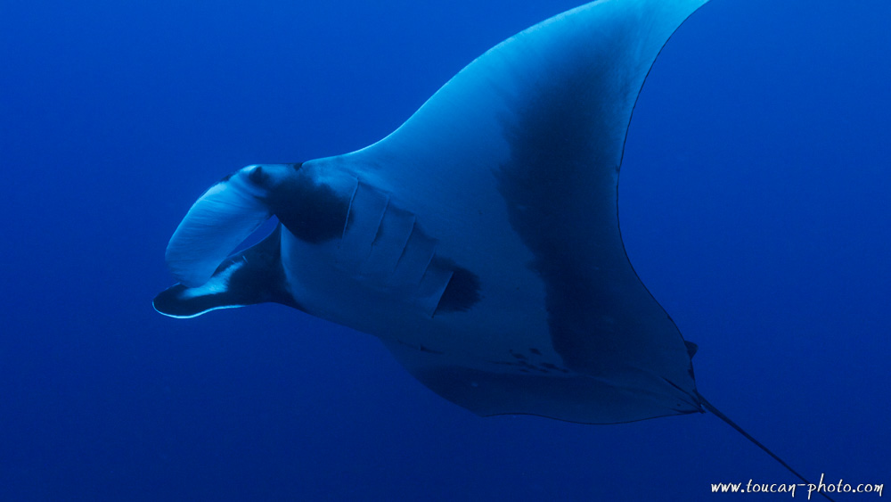 Manta Ray
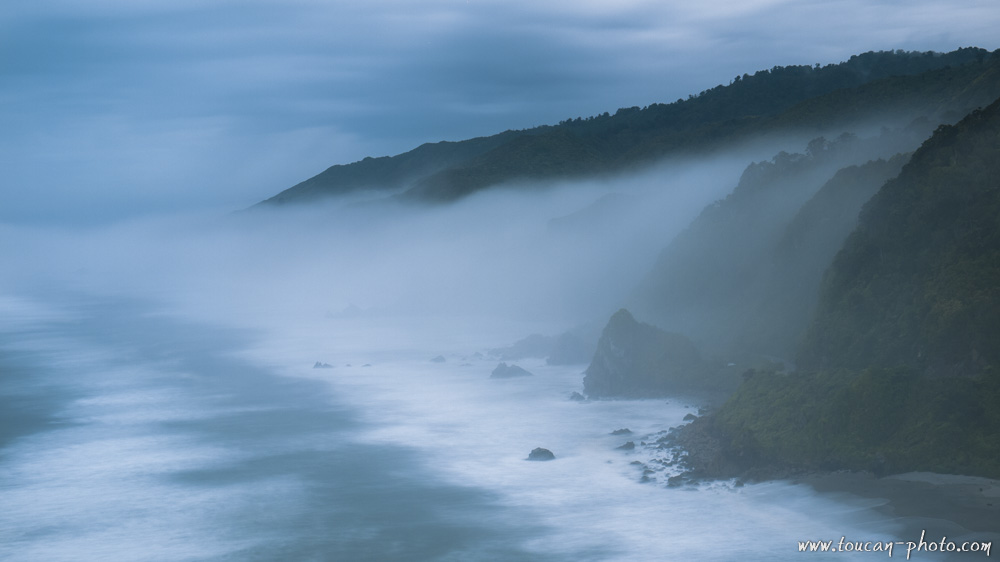 New Zealand
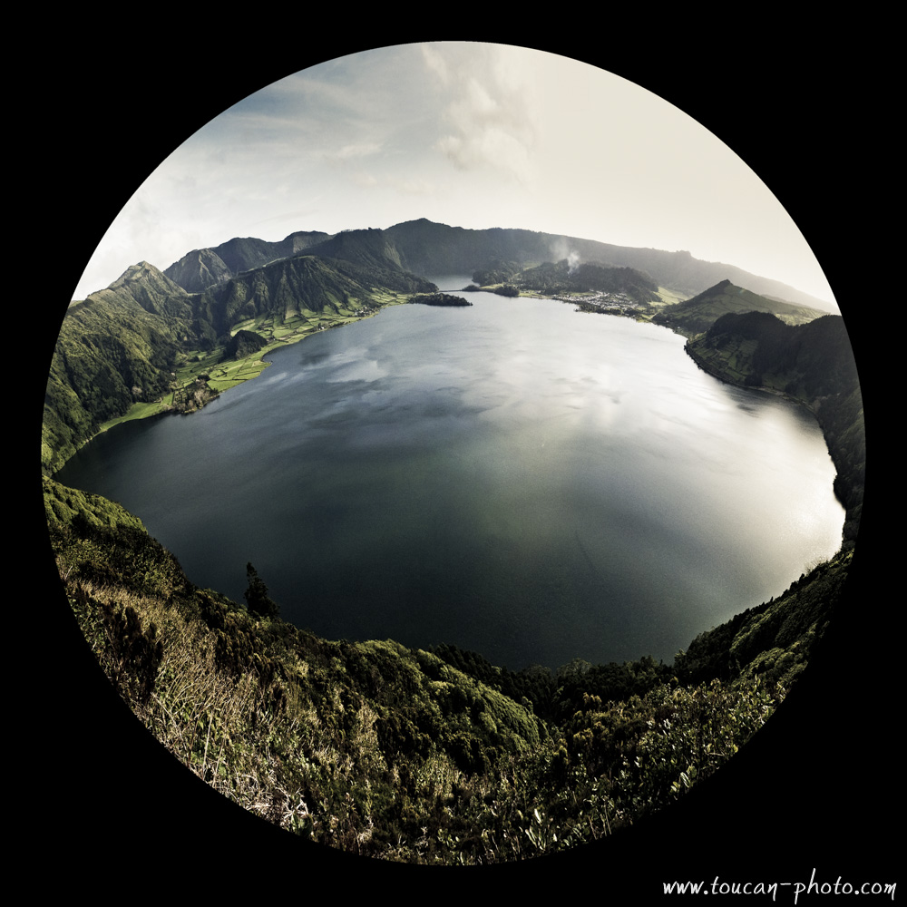
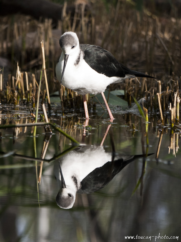 White Stilt