Snow monkeys (in Japanese, nihonzaru 日本猿), also known as Japanese macaques (Macaca fuscata), are the only species of primate living in the wild in Japan. This species is also endemic to the Japanese archipelago. These monkeys are mainly found in mountainous regions, at altitudes ranging from 500 to 2,500 meters. In winter, when temperatures become harsh, these monkeys have developed a surprising habit: soaking in natural hot springs to keep warm!
Paper
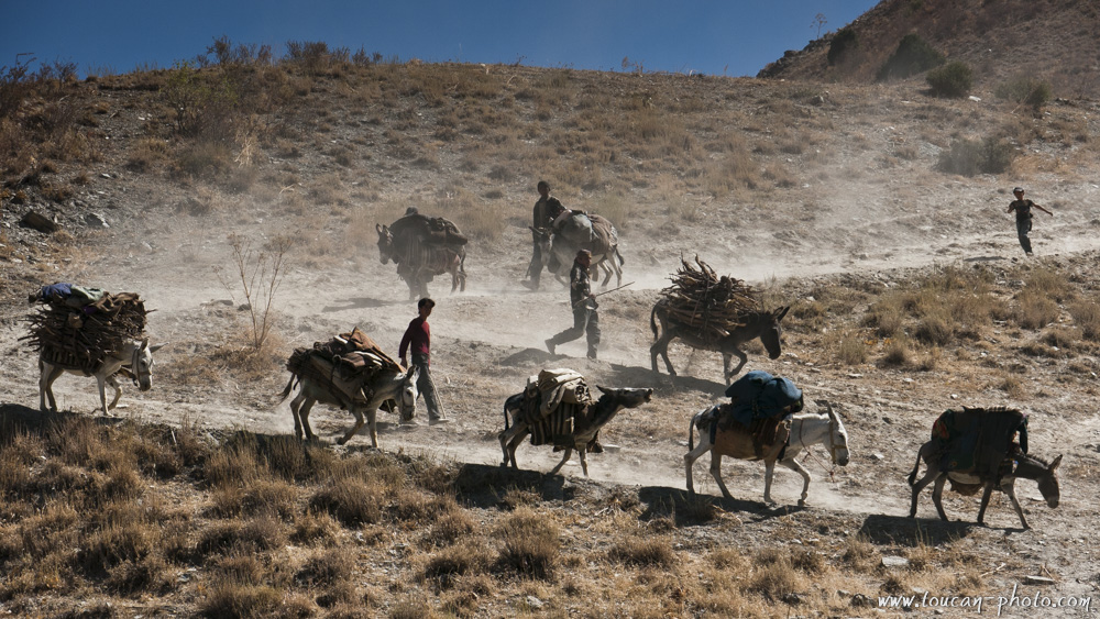
Ethiopia: The salt from lake Karum
Lake Karum is a salt lake located in Ethiopia, at the northern end of the Great Rift Valley. This lake, as well as the volcanoes of Dallol and Erta Ale, are among the most improbable landscapes of the Danakil Depression. This place also offers a timeless spectacle. Indeed, perpetuating a centuries-old tradition, Tigrayans travel to Lake Karum from the Ethiopian highlands, followed by long caravans of dromedaries and donkeys in order to recover salt slabs from the dry areas of the lake, a vestige of a time when the sea still flooded the Danakil Depression.
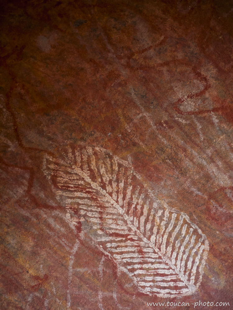
Algeria: The Tadrart Rouge, a window to the Sahara and its history
Larger than Australia with its 8 million square kilometres, the Sahara has not always been the biggest hot desert on the planet. About 15,000 years ago, it was a green period brought about by a warming phase that had intensified evaporation from the top of the ocean and pushed the monsoons into the heart of the North African continent. The arid landscapes that we know today were then covered by large lakes and rich vegetation. Elephants were living there, as well as hippos, crocodiles and humans too. Those ones, as to immortalize this full of life period, have drawn paintings and engravings cut out of rock. These testimonies of the past are omnipresent in Tadrart Rouge. Indeed, this Sahara’s fragment is located in south-eastern Algeria and offers the vision of over 15,000 engravings to the brave who dare adventuring themselves into there. Over the sand dunes and rocky peaks, the traveller will discover, at the same time as breathtaking landscapes, a touching testimony of the past.
Continue reading“Algeria: The Tadrart Rouge, a window to the Sahara and its history”
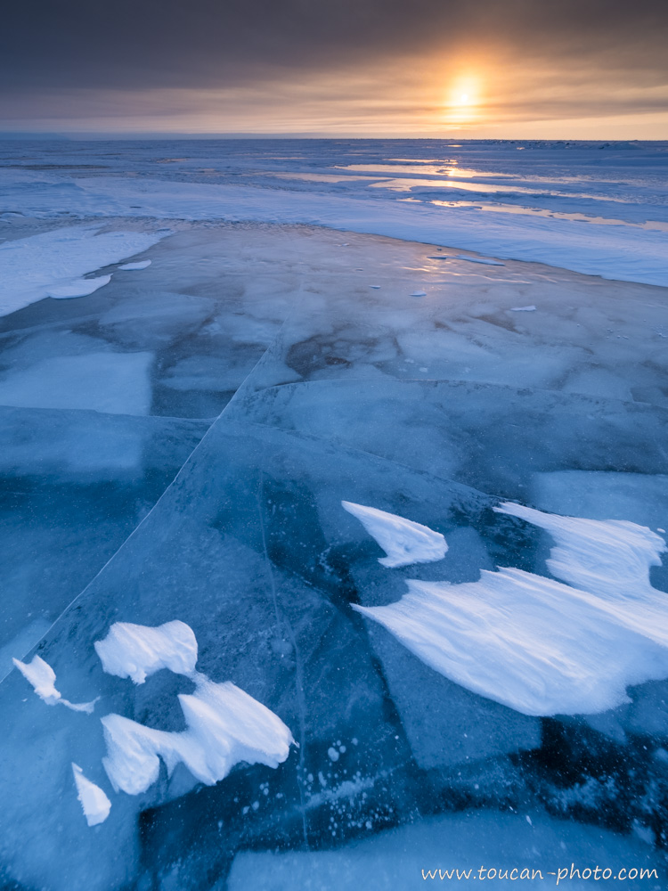
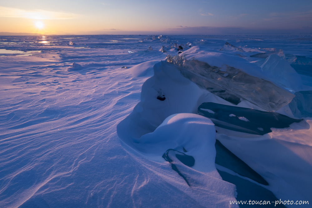
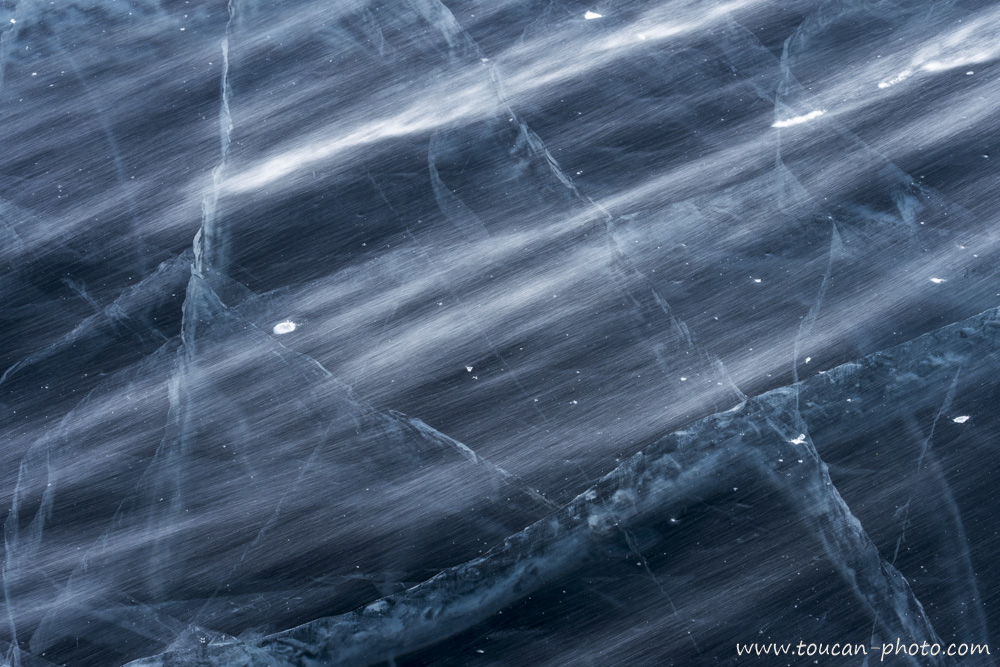
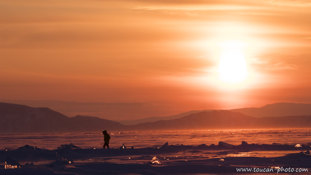
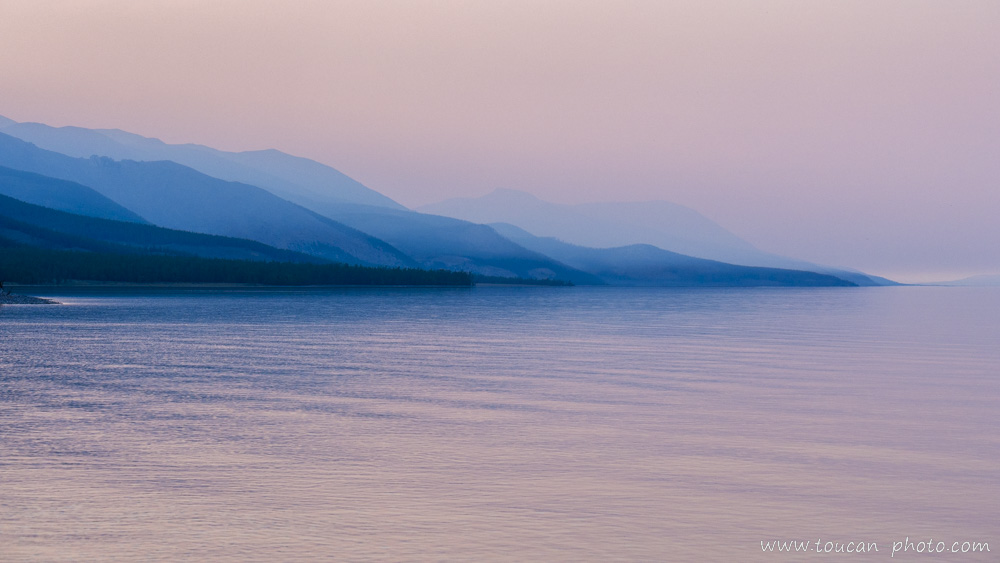
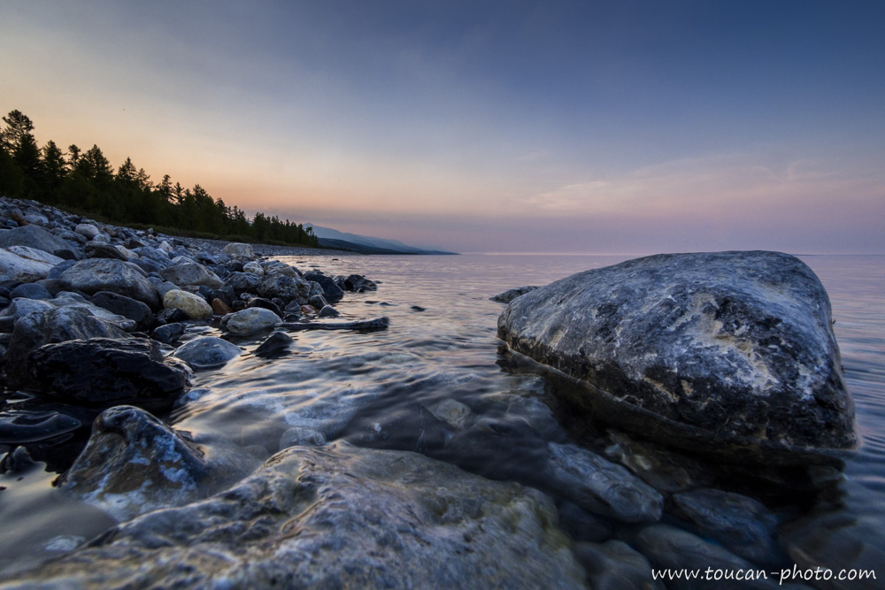
Russia: The Baïkal lake during winter, frozen pearl of Siberia
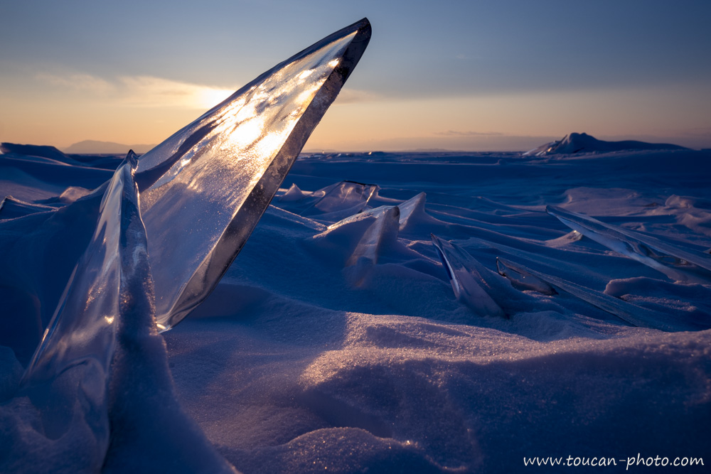
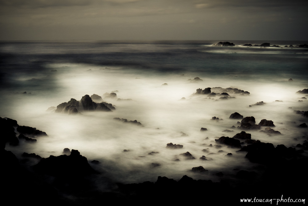
Under the Siberian’s winter freezing temperatures, Baïkal lake’s surface is changing into ice several months a year, usually from beginning of January to May. The 1 to 2 meters thick ice, allows people and even cars circulation on it. The following photos have been taken during a frozen lake’s foot crossing. Several aspects of the ice, sun ray’s reverberation on it, the lights playing through the “Toros” are as many photogenic subjects that would make this crossing unforgettable.
The Baïkal lake (in Russian : “Озеро Байкал, Ozero Baïkal”) is located in Russia, in south part of Siberia.
You can’t possibly not use superlatives to describe Baïkal Lake. This lake, which is twenty-five million years old, is the oldest existing lake. Baikal, which is 636 km long and up to 79 km wide, is also the largest lake in the world. And with a depth of up to 1642 meters, it is the deepest on the planet. Baikal’s huge dimensions make it the largest reserve of liquid fresh water in the world. This means 23,600 km3 of water, or 23,600,000,000,000 cubic meters. This volume of water would be enough to cover with liquid 1.6 cm all the Earth’s land surface. Imagine that the water of Baïkal Lake is completely frozen and cut into ice blocks. If these blocks were used for the construction of a wall measuring 1,000 height meters and 100 thick meters, there would be enough material for the building to be 240,000 kilometers long, long enough to go around the world six times.
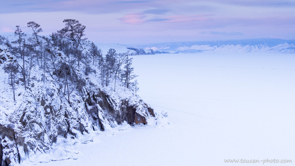
View of the frozen lake that has just covered with a snowpack. This photograph was taken from Olkhone Island, located about 15 km from the lake’s West shore, which can be seen in the background. The lake has 27 islands, and Olkhone, which is 70km long, is the largest one of them.
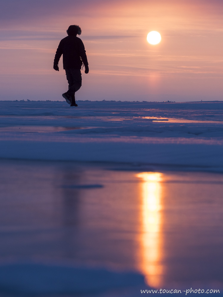
At sunrise, lonely walker goes to discover the frozen lake.
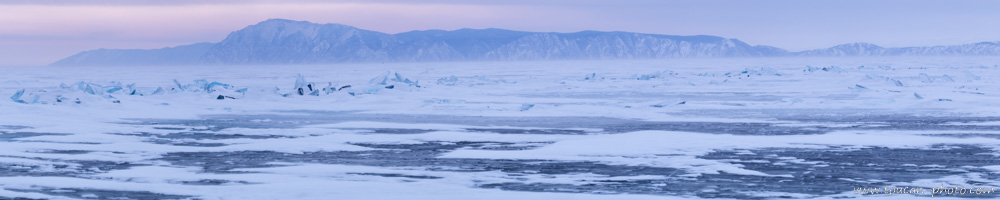
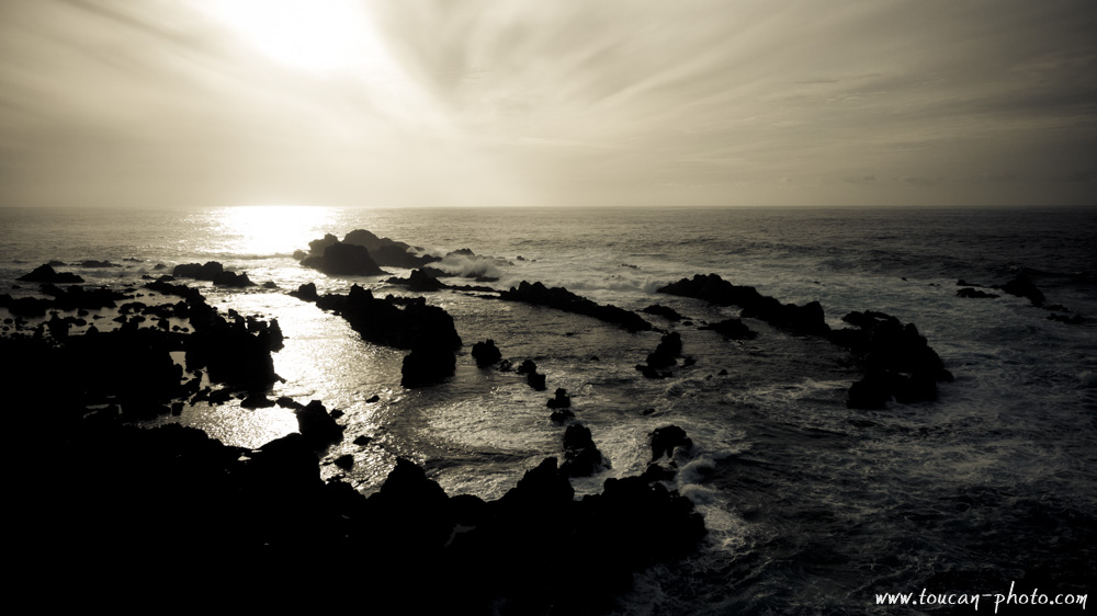
Paranomic view from the lake to the coast. Breaking zones are numerous on the lake. They are the result of the frozen cover almost “tectonic” activity.
A first ice layer, still thin at the beginning of winter, cracked before the cold froze again the surface of the lake.
Ice thorne.
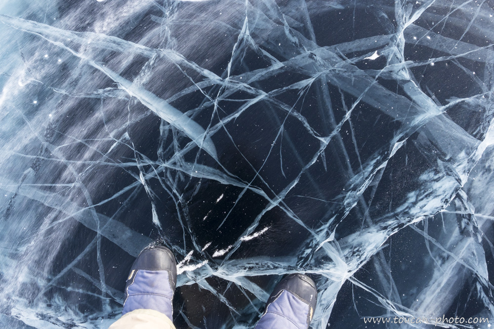
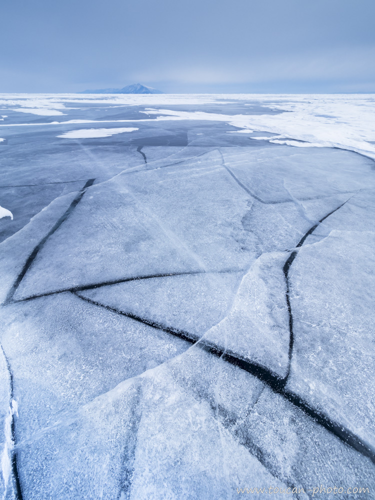
Under my feet, about 120cm of ice. After digging the ice, it would take about 1540 meters diving to reach the bottom of the lake.
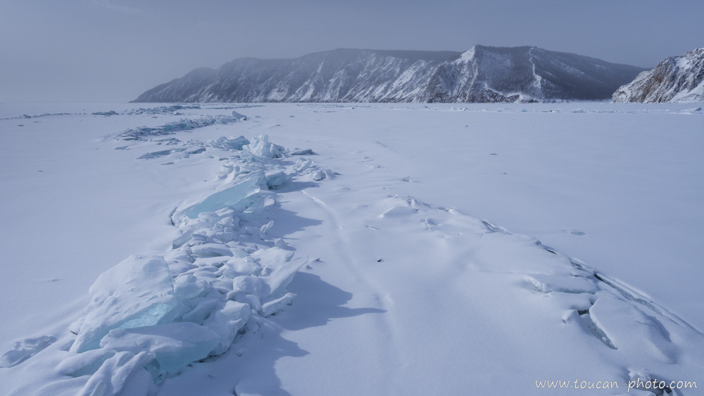
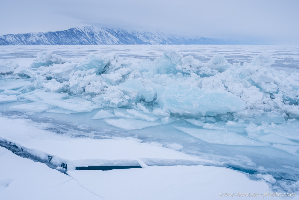
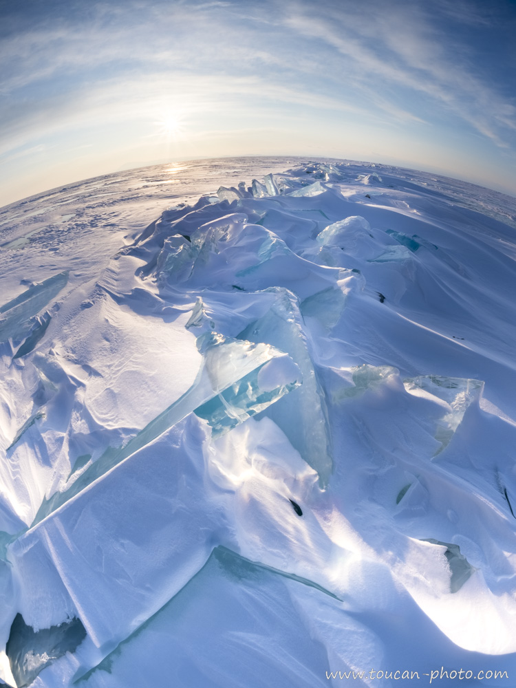
The frozen lake’s surface endures various pressures because of depth’s currents, temperature changes, pressure that it is exerted and that it receives from liquid water, etc. The frozen surface ends up cracking and the resulting plates overlap each other creating the so-called “Toros” entanglements.
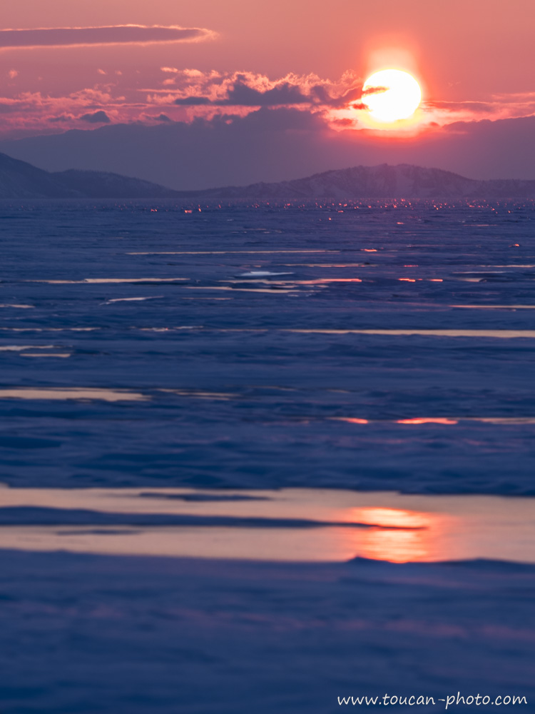
Driven by the rays of the setting sun, the surface of the frozen lake sparkles with a thousand splinters.
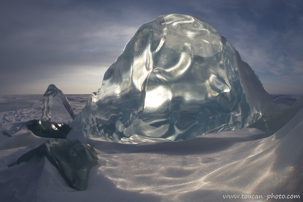
Ice fragments trapped within the frozen surface thickness.
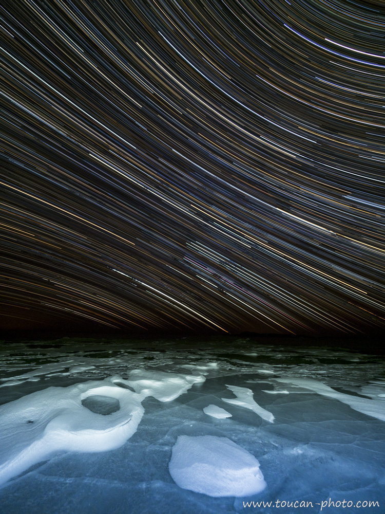
Night view on the frozen lake’s surface. A long exposure photograph captures the star’s movements.
Snow swepts by the wind.
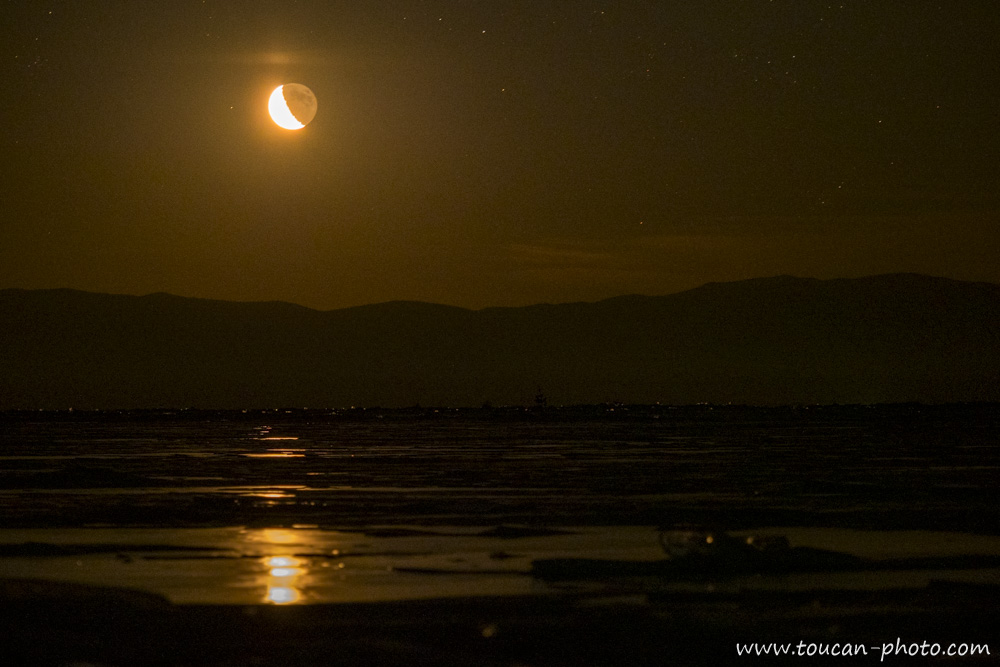
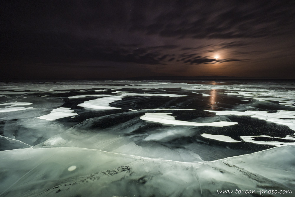
The moon also reflects on Baïkal Lake. This photo was taken at night during the moon rising.
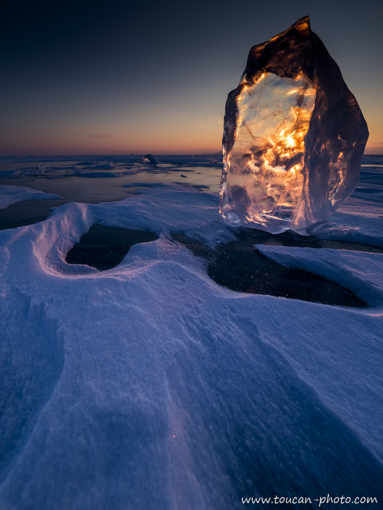
This ice block, crossed by the sun rays, turns itself into a fire block.
This ice just cracked there, creating a flaw as well as new “Toros”. In the background you can see the “Bear Mountain”, located on the East bank of the lake.
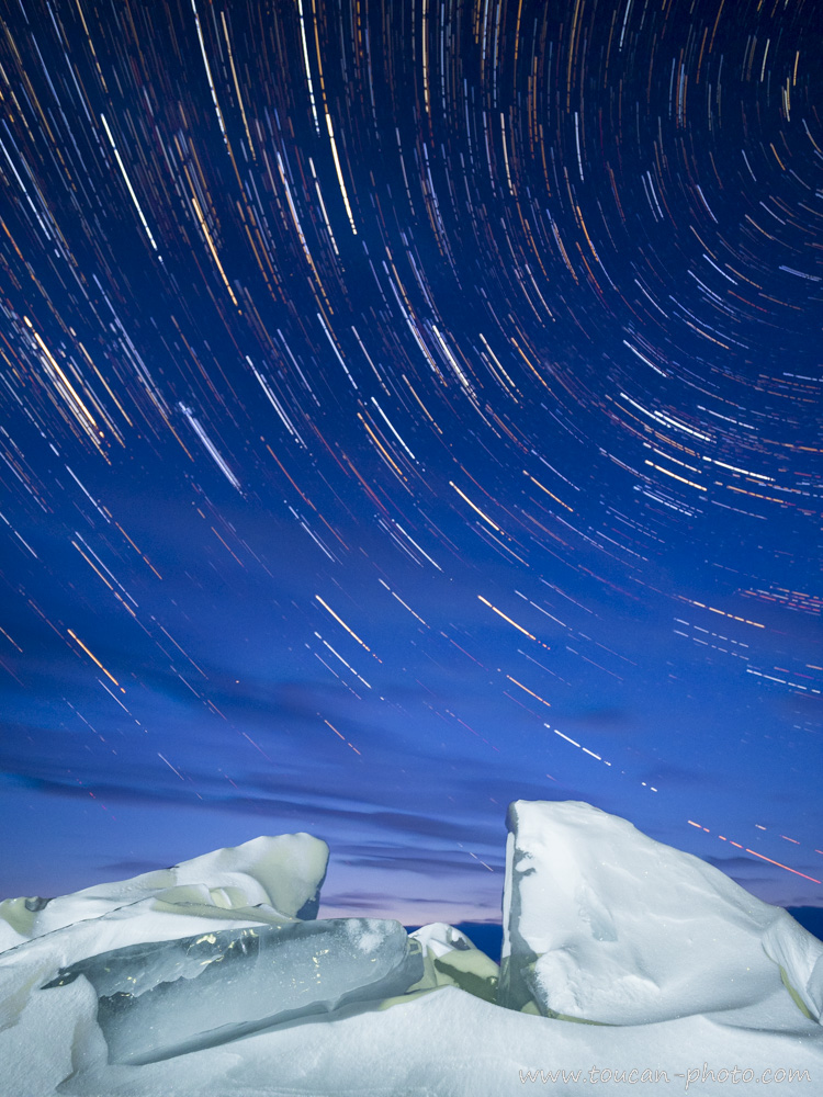
Another long exposure of the star-full sky, with a “Toros” covered with snow in the firstground.
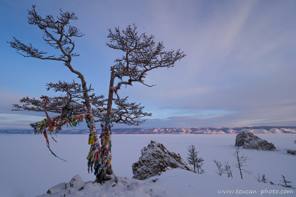
The first living souls to settle in Baïkal Lake area were Buryats, from Mongolia. They had chamanic beliefs. Buryats first considered Baïkal Lake as a sacred sea. The chamanic ribbons tied the this tree, which overlook the lake, are so many prayers and attentions addressed by the Buryats to their ancestors.
Fragment of eroded ice.
The moon reflecting on the dark ice.
Sunsets are proof that endings can sometimes be beautiful too. – Beau Taplin
One of the Baïkal Lake’s tributaries is the Selenge River. This river is partially fed by the Eg River, which itself originates from Khövsgöl Lake, located in Mongolia. An article about it is available here.
— Continue the journey —
— Complementary Resources —
Palau: Snorkeling in the Jellyfish Lake
The Palau archipelago, located in the Western Pacific east of the Philippines, consists of more than 250 islands. Most are uninhabited, covered in primary tropical rainforest and mangroves. While this description already promises adventure, the existence of a lake populated by millions of jellyfish on one of these islands makes the region truly extraordinary.
Ethiopia: The Erta Ale volcano and its lava lake
Erta Ale is an Ethiopian volcano located in the Afar region, in the northeast of the country, within the East African Rift Valley. Standing 613 meters high with a base diameter of 30 kilometers, its broad, low-profile shape classifies it as a “shield volcano.”
At the summit of this highly active volcano lies a caldera containing two pit craters. The South Pit, 200 meters in diameter, is currently the most impressive as it houses a permanent lava lake where molten rock reaches temperatures of 1,200 degrees Celsius. The lake’s level fluctuates constantly; in January 2017, it rose high enough to overflow. By April 2017, the level had dropped, offering observers a spectacular and cyclical phenomenon of emptying and refilling, which can be seen in the videos at the end of this article.
Continue reading“Ethiopia: The Erta Ale volcano and its lava lake”
Brazil: The Boto, pink dolphin of Amazonia
23 to 7 million years ago, during the Miocene era, Amazonia was partially covered by seawater. Cetaceans were living in this area. When seawater has been definitely out of Amazonia ground, a species would have adapted to continue living in rivers, drawing the Amazonian landscape. This species became the Boto, known also as the biggest pink dolphin of Amazonia.
Continue reading“Brazil: The Boto, pink dolphin of Amazonia”
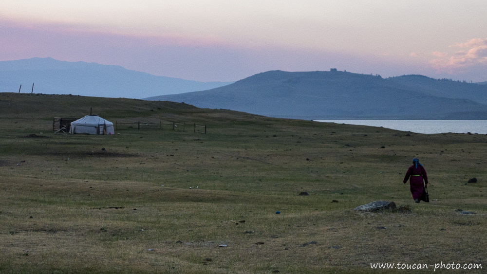
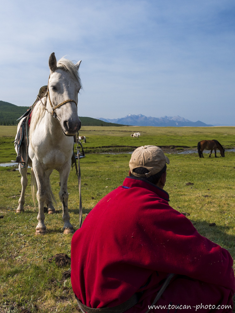
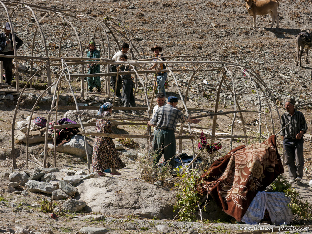
Mongolia: The Khövsgöl lake
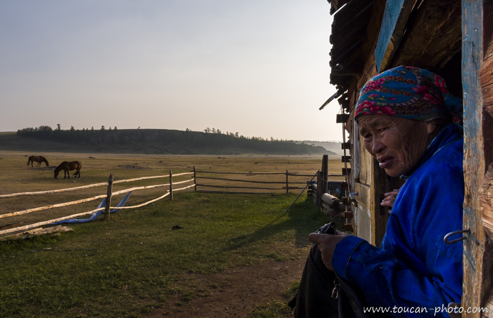
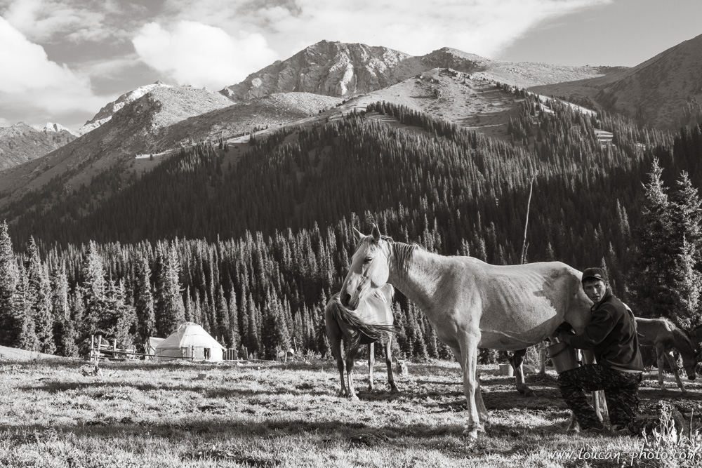
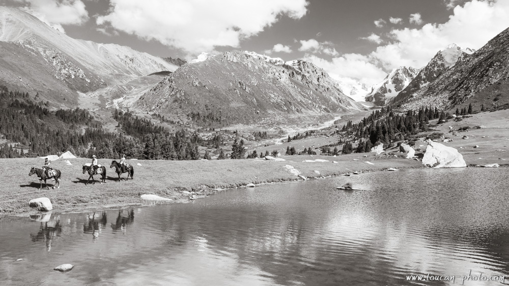
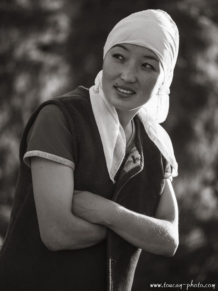
Called the « Blue Pearl » because of its water purity, the Khövsgöl lake (in mongolian : ᠺᠥᠪᠰᠦᠭᠦᠯ) is a sacred place for the local people, which they call « Mother ». The below pictures were taken at summer time, during a several weeks horse ride on the lakeside. More than a view on the lake, these photos show also the local inhabitants met during this trip.
Location of the Khövsgöl lake
The Khövsgöl lake is located in the north of the country, near the Russian border, in the eponymous province : The « aïmag de Khövsgöl » (in cyrillic mongolian : Хөвсгөл аймаг). The population density in this province is only 1,2 inhab./km2 (the average in Mongolia is about 1,7 inhab./km2)
The Khövsgöl lake has a lenght of 136km, a width of 36km and its deepest point is at 262meters. Which makes it the second-most widest and the deepest lake in Mongolia. This lake holds almost 70% of Mongolia’s fresh water and its volum of 480 km² makes it the 19th biggest lake in the world.
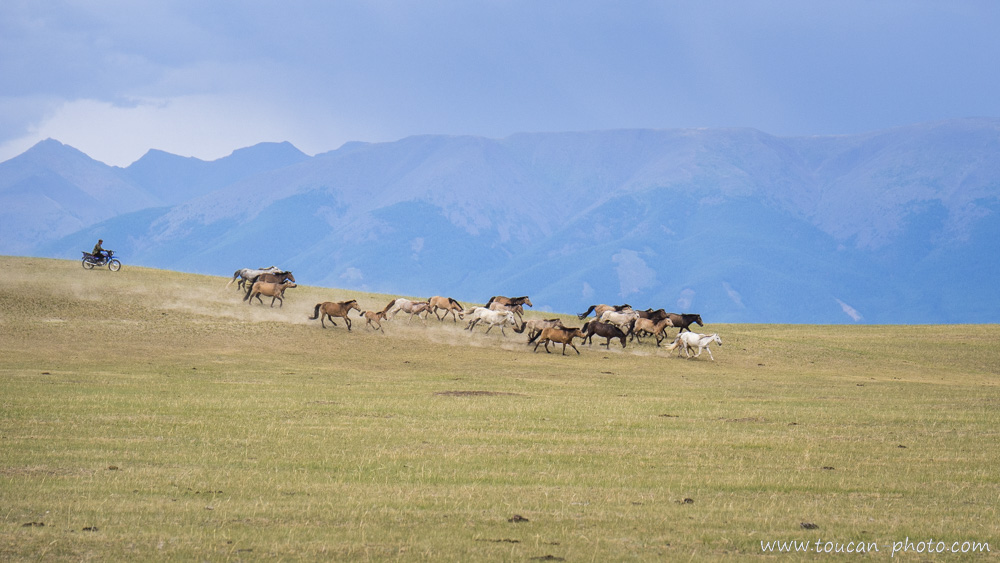
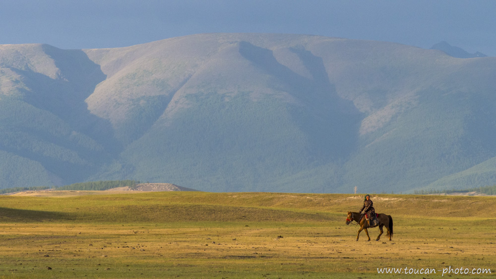
A Darkhad rider (a mongolian ethnic group living in the area) bringing together a herd of horses. As him, today, more and more horse riders prefer to use motorbikes for some tasks as to follow the herd.
A sunset view on Delgerkhaan, the mountain range located on the west side of the Khövsgöl nuur
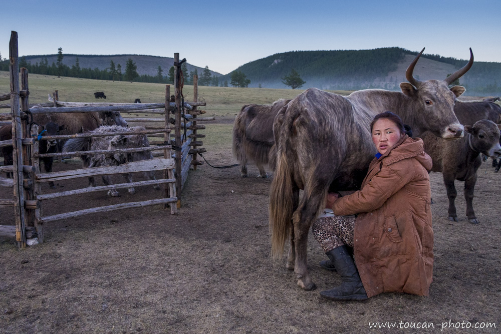
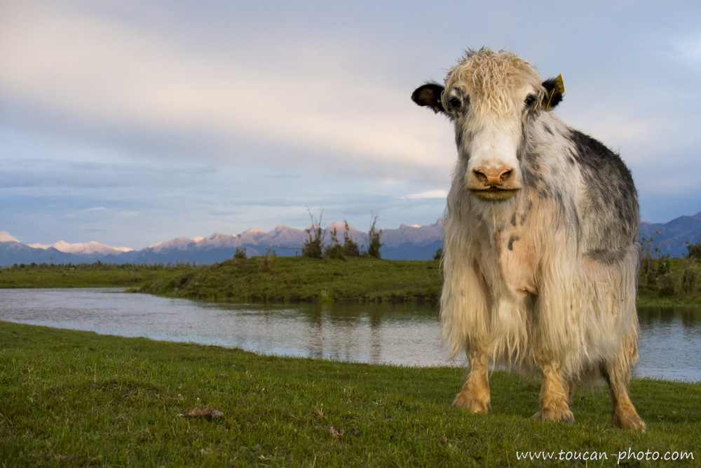
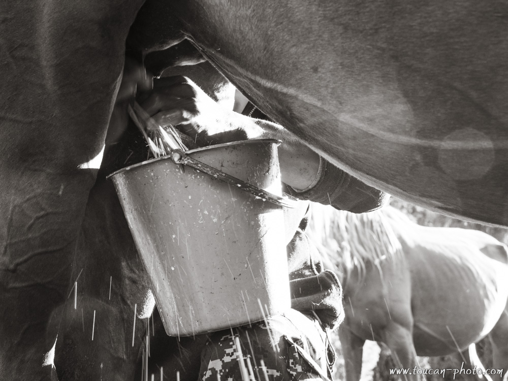
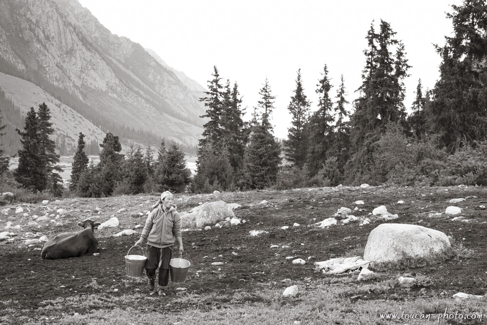
At evening, a sheperdess does the second milking of the day. Each family breed cows, sheeps, goats and sometimes yaks. The agriculture is not widespread in Mongolia, only 0,6% of lands are used for agriculture (To compare, it is more than 33% in France (2015).
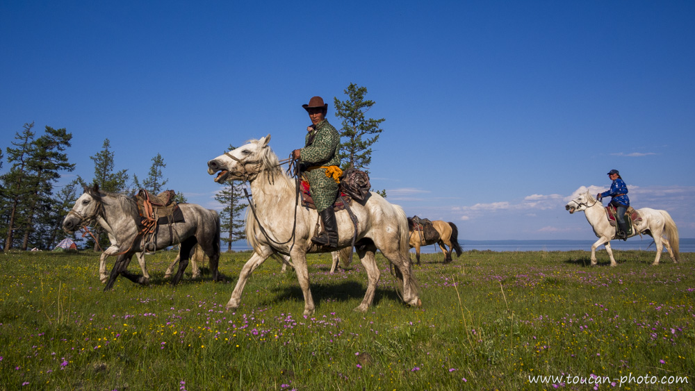
Horse riders on lake side
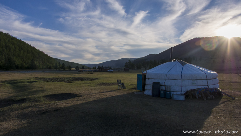
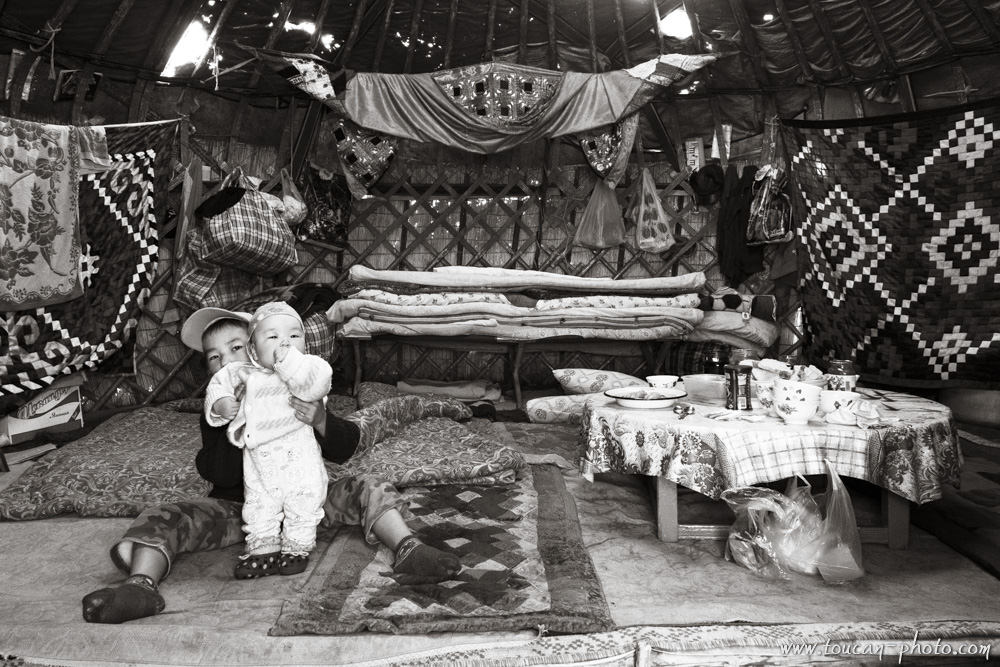
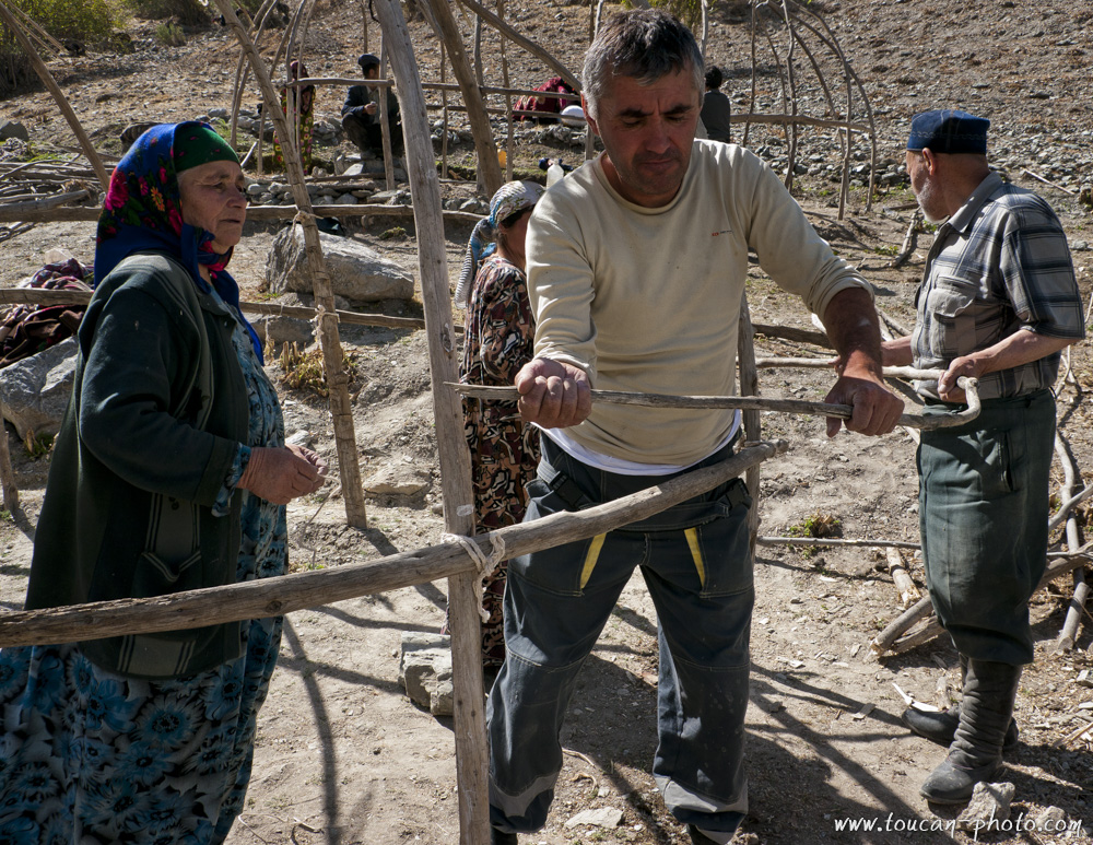
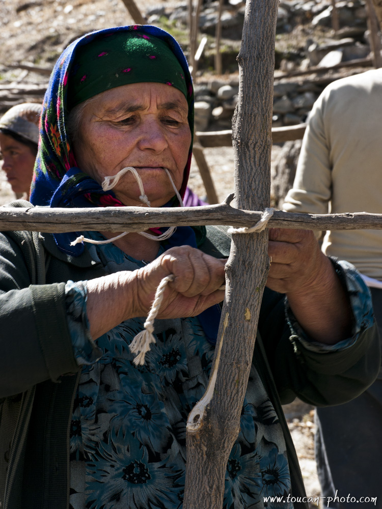
The “Ger”, means “Familly” in Mongolian, it is the traditional mongolian housing. The foreigners wrongly call it a “Yourte”, which is in fact the Russian translation. A Ger provide a ground surface of 15 to 30 meters square to its inhabitants. Two Mongolians can set up this house in around 45 minutes and disassemble it in 30 minutes. The structure is made of wood and is covered by felt. Its isolating properties, allow the house to stay fresh in summer and keep a familly warm during winter with the help of a wood, despite the extremely low temperatures.
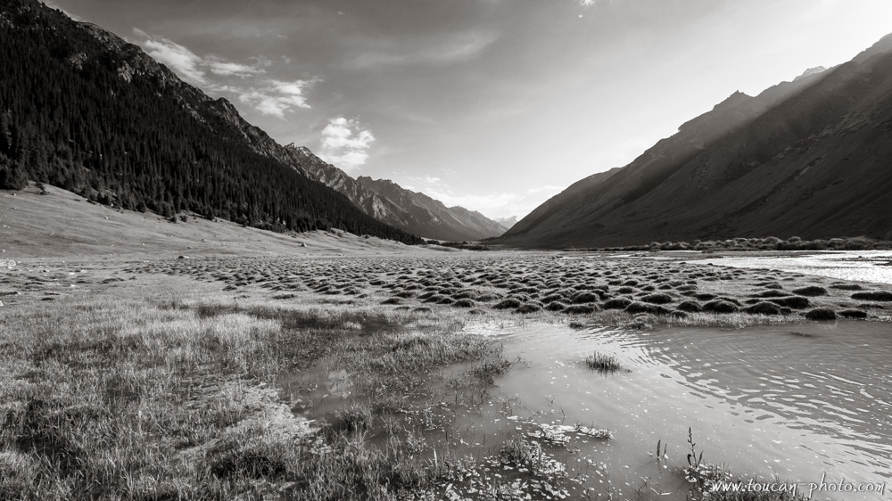
The Khövsgöl bank at sunset. The Khövsgöl lake is a cousin of the Baïkal lake, which is world-famous and located in Siberia, 195 km to the north. Both lakes were made by the same tectonic shift. The Khövsgöl lake would be from 2 to 5 millions years old.
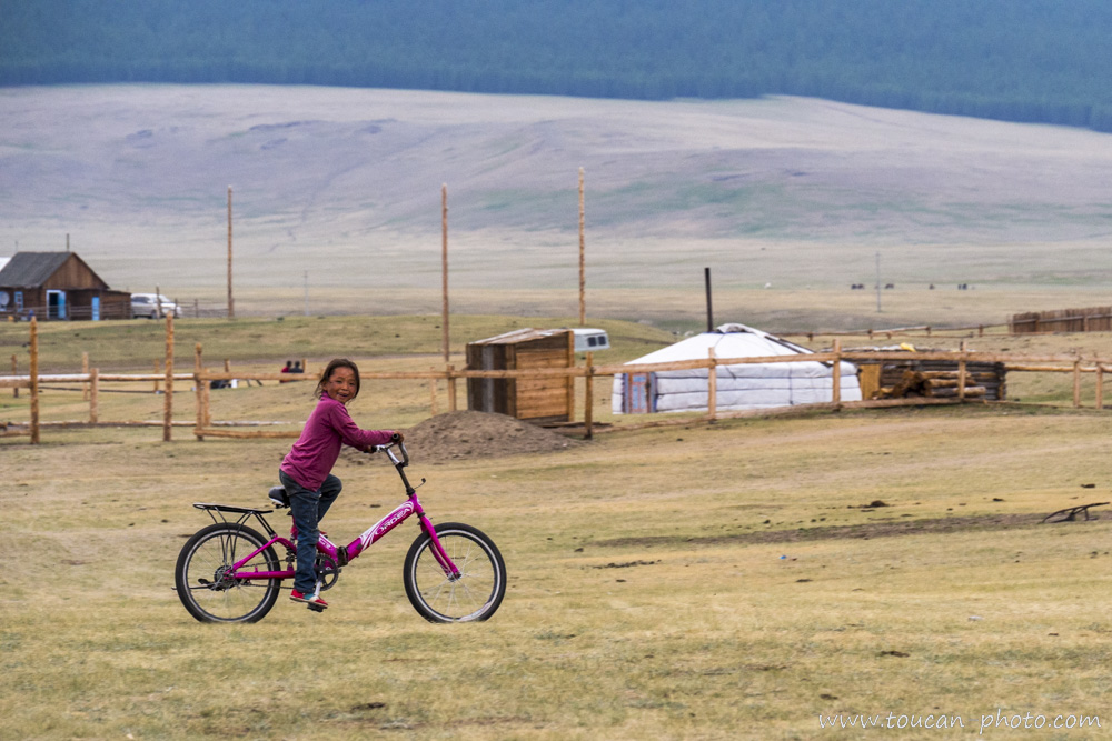
Bicycling in the steppe
This region is sometimes victime of drought, so the lake Hovsol that provide fresh water to the three main ethnic groups of the region (thee Darkhads, the Bouriates and the Tsaatanes) is considered are sacred by local inhabitants.
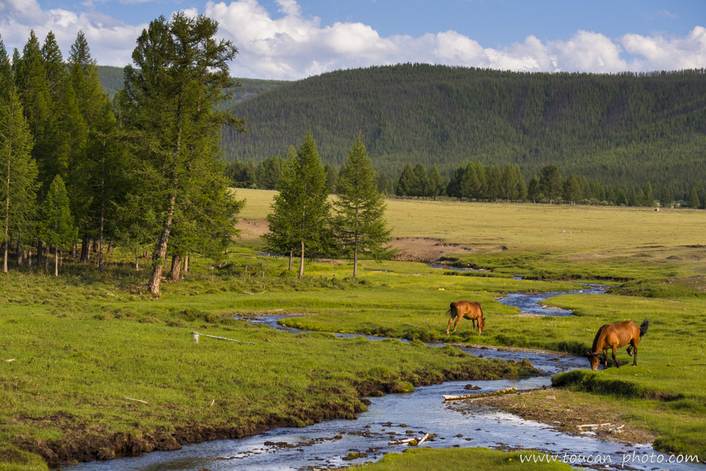
This small stream emerging from the Taïga will merge with one of the 96 riviers which will flow into the Khövsgöl lake. Thus, even if a hundred of rivers flow into the Khövsgöl lake only one goes out, it is the Eg river. It will travel 1000km before it flows into the Baikal lake, in Russia. The Taïga, that you can see in the background, is the biggest forest in the world (10% of the emerged lands of the world). This forest is mostly located out of Mongolia, but its edge is at the extrem north of the country near the Khövsgöl lake.
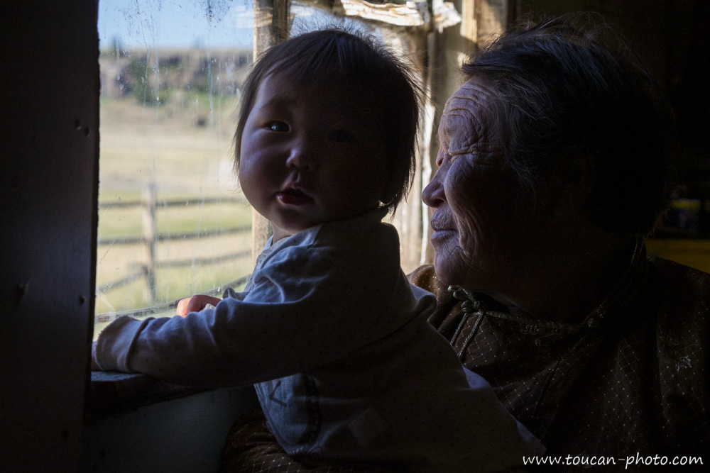
Kushi and her grandma
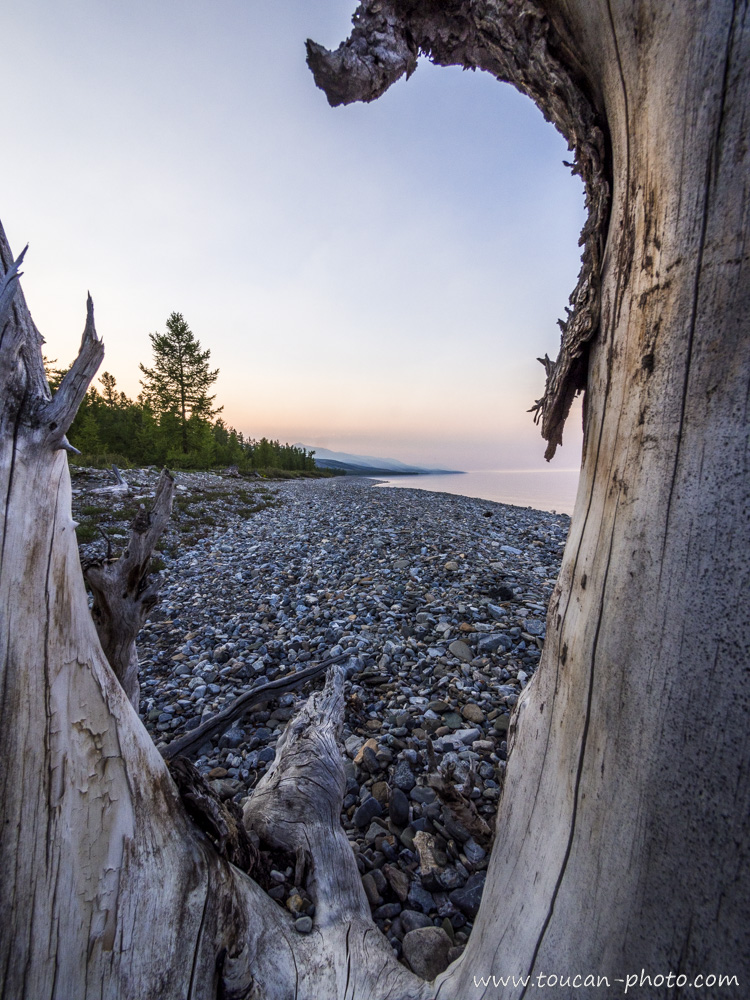
Deadwood on Khövsgöl lake side
The Darkhad valley (Mongolian: Дархадын хотгор). This mountain range along the west coast of Khövsgöl lake is itself surrounded by the Darkhad valley. It is covered by steppes, which will feed the herds.
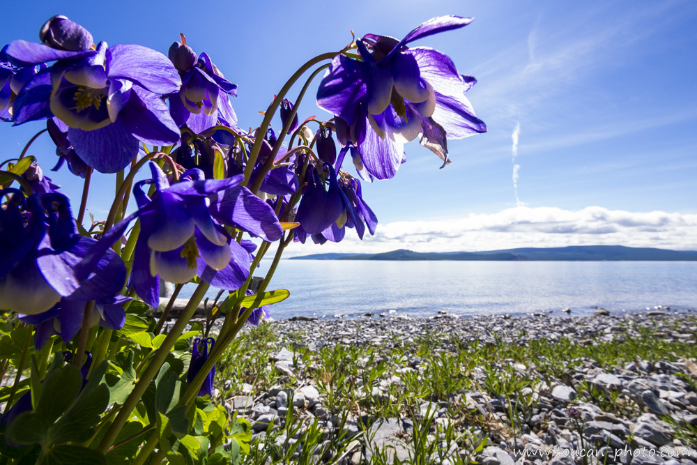
Flower on the lake side. On the second plan, we can see the east lake side. Contrary to the west side that is mountainous, the eastside has a flat landform.
This horse is watching the horse rider, which is watching another horse, the Toucan’s mount.

Chuluun (means “Stone”, “Rock”) and his little sister Kushi (means “happy life”). In Mongolia, the male surnames are meant to be the expected characteristics by the parents for their child, for example : Bat (Strong), Bold (Steel), Chuluun (Stone) are frequent names for men. About women, they often have flower names or a quality as a name, as Oyuun (Wisdom), Udval (Chrysanthemum, Narantsetseg (Sunflower), …
Due to the climate disruption of these last years, it is more and more difficult for the breeders to ensure the survival of their herds. The “dzud“ are becoming more and more frequent. A “dzud“ is a climate phenomenon defined by an extremely rough winter. The temperatures can drop to -40°C or -50°C for months. Furthermore, if the raining falls are too heavy, the snowpack will be too thick to let the herds be able to reach the food. If this rough winter is followed by a scorching summer, the animals that cannot recover their stock of fat, die by thousands. During winter 2009/2010, a severe “Dzuz” stricked the mongolian steppes, more than 8,5 millions head of cattles died, which is around 20% of mongolian herds. The winter 2015/2016 was again very rough for animals. 858,100 cattles had already perished, on the 7th April 2016.
Philippines: The Marine Park of Tubbataha
Located in the Philippines’ Sulu Sea, the Tubbataha Reef became a protected marine park on August 11th, 1988. This 968 km² sanctuary was added to the UNESCO World Heritage list in December 1993. In the Sama language, Tubbataha means “a long reef exposed at low tide,” referring to its two large atolls, each featuring a tiny islet at its center.
Ethiopia: The Simien Mountains
The Simien Mountains, located in the northern Ethiopian Highlands, have been a UNESCO World Heritage Site since 1978. Due to their high altitude, these plateaus enjoy a cooler and wetter climate than the surrounding lowlands. This environment supports the local population, mostly small-scale farmers, who are even able to cultivate coffee beans in this unique landscape.
The massif is a vital sanctuary for several endemic species. The most iconic inhabitants are the Gelada baboons and the Ethiopian Wolf. The latter is one of the world’s rarest canids, with only about 500 individuals remaining in the wild.
Indonesia: Diving the Raja Ampat Islands
Raja Ampat, or “The Four Kings,” is an Indonesian archipelago comprising four main islands and approximately 1,500 smaller islets. Located at the meeting point of the Pacific and Indian Oceans, this region serves as a vital crossroads for marine species from both basins, fueling extraordinary biodiversity.
Peru: A hat history
To each their own hat, and for each headgear, a unique meaning. In Peru, and more broadly across the Andean highlands, choosing a hat is far from a simple fashion statement.
Indeed, every piece of headgear, in addition to its practical and decorative purposes, carries vital information about its wearer. A hat can reveal the social or marital status of the person beneath it, while ethnic identity remains instantly recognizable through specific shapes, colors, and materials.
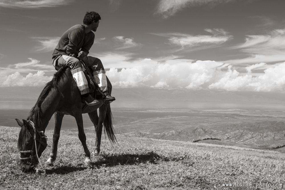
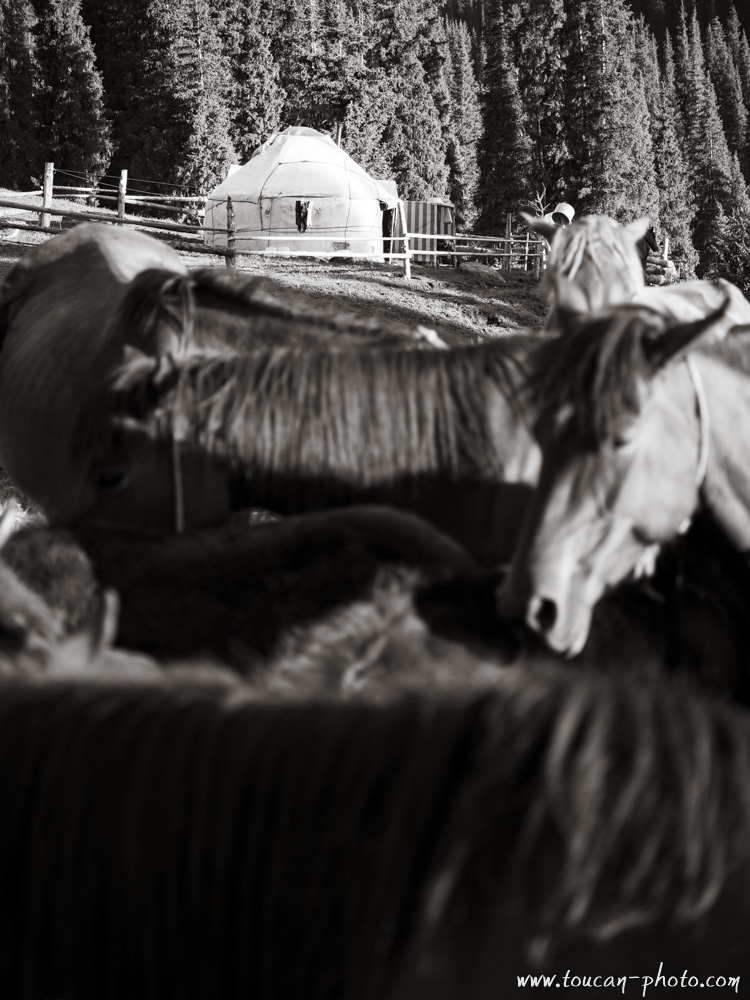
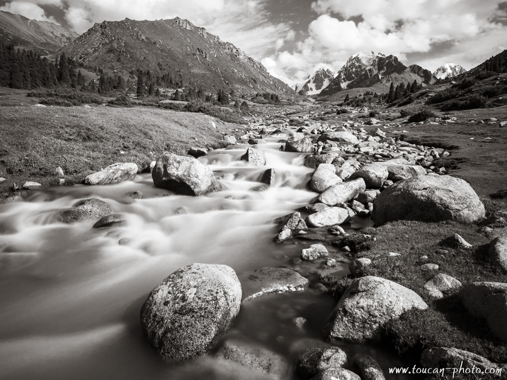
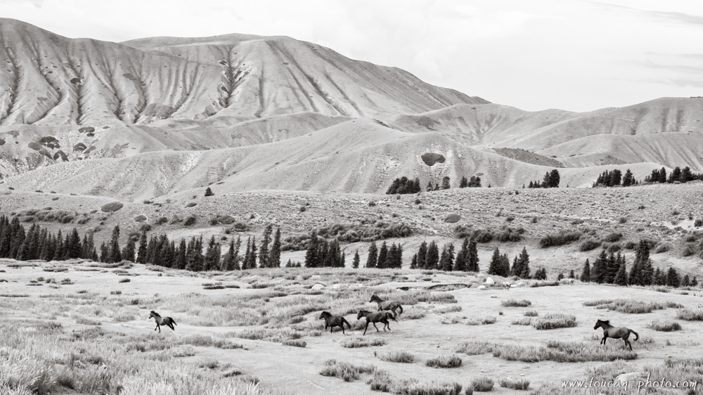
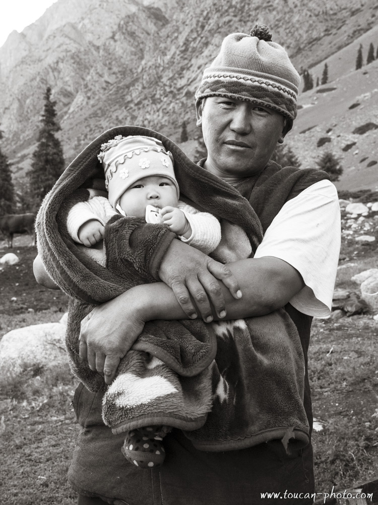
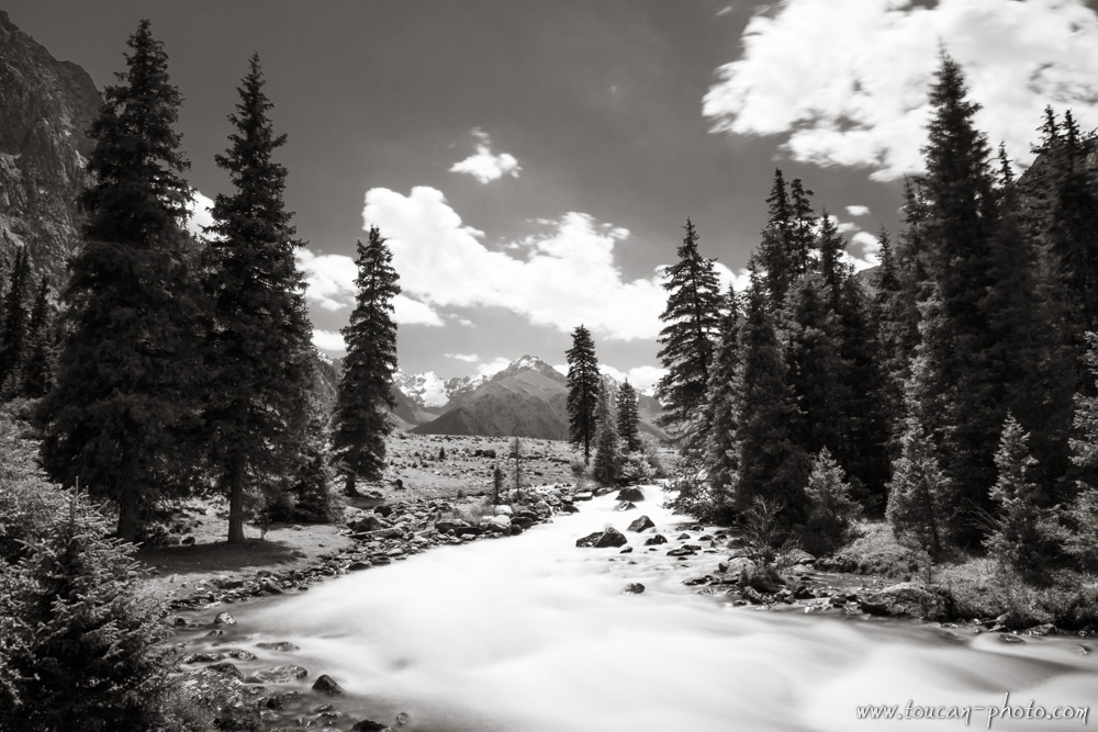
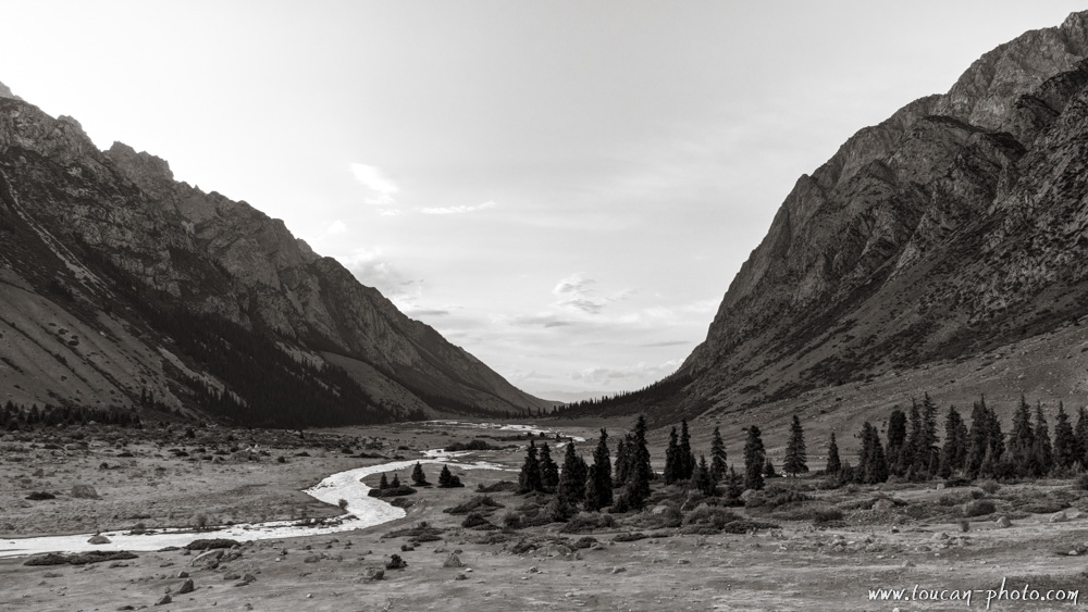
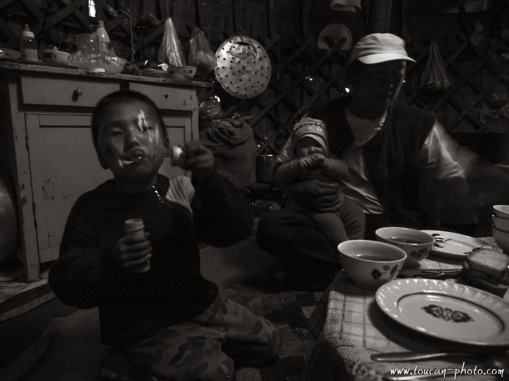
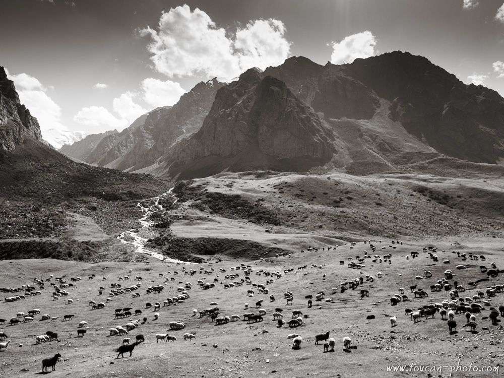
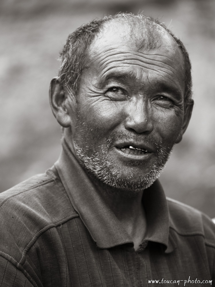
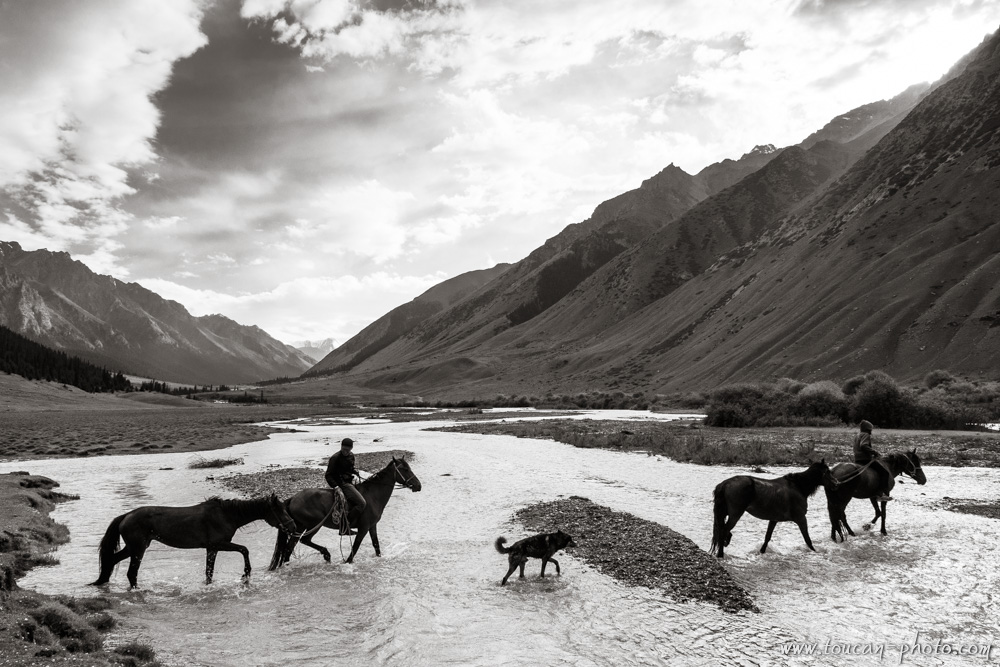
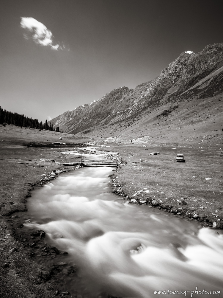
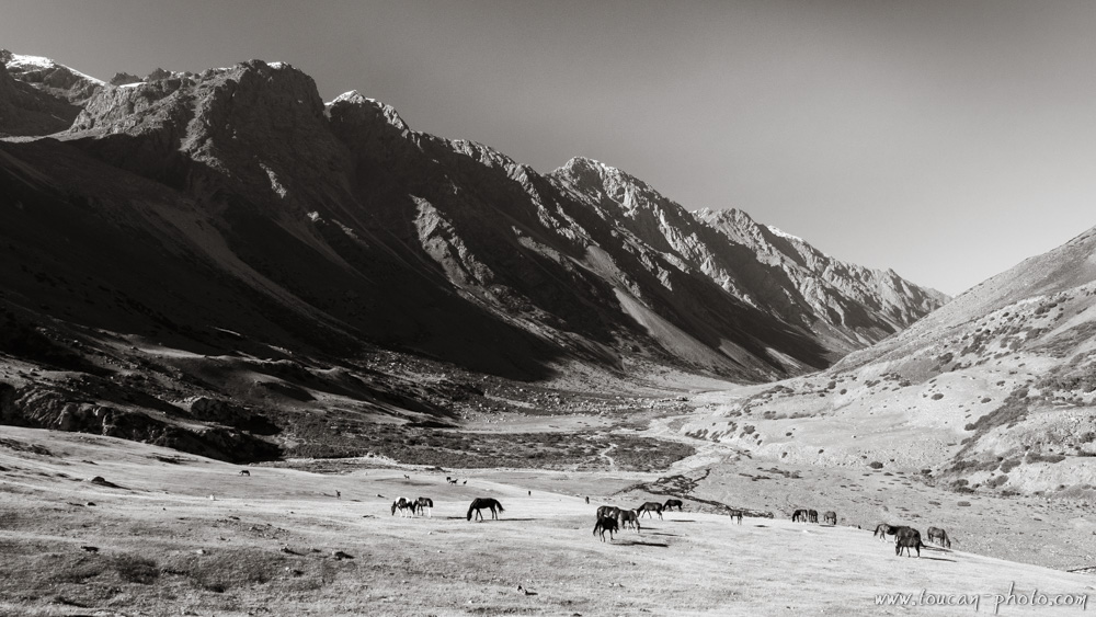
Kyrgyzstan: Nomad ride
The Kyrgyz proverb “He who has no horse has no feet” speaks volumes about the lifestyle of these mountain shepherds. A former crossroads for Silk Road caravans, Kyrgyzstan remains home to a resilient nomadic culture that moves with the rhythm of the seasons.
Accompanied by their herds, Kyrgyz horsemen ride through vast Central Asian steppes and rugged mountains in search of the best high-altitude pastures. Here is a selection of snapshots captured during a journey through the land of the “Celestial Horses.”
— Continue the journey —
Egypt: Diving the Red Sea
Here is a selection of images captured during dives in the Egyptian Red Sea. This region is world-renowned for its crystal-clear waters and the exceptional biodiversity of its underwater ecosystems.
This series includes photographs of local wildlife, such as Hawksbill turtles and vibrant coral reefs, but also explores the haunting beauty of the many wrecks littering the seabed. These underwater monuments offer a unique glimpse into history, now being slowly reclaimed by marine life.
Peru: The Nazca geoglyphs
Today it is particularly hot. The air is dry and it hasn’t rained for months, yet you are crossing the vast desert. Your goal is the mountain on the far side. There lives Kon, the servant god who carries messages from the Earth to the Heavens. In exchange for the offering you bring, he might deliver your plea: a desperate request for the celestial gods to bring rain once more to your village’s crops.
To find your way to the mountain, you follow strange paths etched into the ground. These paths have never been seen in their entirety by human eyes. To do so, one would need to fly like a condor—but that gift, like these drawings, is reserved for celestial birds and the gods.
Yemen: Socotra Island
Socotra is a Yemeni island covering an area of approximately 3,579 km². Located over 250 km from the nearest coast, its geographic isolation has allowed flora and fauna to evolve far from external influences. Consequently, more than a third of the plants found on Socotra grow nowhere else on Earth.
Burkina Faso: The Senufo Dozo dry funeral ceremony
Today, the Masks are emerging. They parade and dance to accompany a Dozo hunter toward his afterlife. The crops were bountiful, and the Senufo spirits will surely grant the hunter a warm welcome…
The Senufo People
The Senufo people, with approximately 2.7 million members, represent one of the largest ethnic groups in West Africa. Their territory spans the borders of Burkina Faso, Mali, and Côte d’Ivoire.
In the Bambara language, the word Senufo means “dialect of the farmers,” referring to a traditionally peaceful and agricultural society. The Senufo are renowned for their diligence and pride in their craft. A proverb that best characterizes them is: “I do not quarrel with anyone; it is with the land that I fight.” Migrating over a thousand years ago to escape persecution from the north and east, they settled permanently in these lands due to the exceptional agricultural quality of the soil.
Continue reading“Burkina Faso: The Senufo Dozo dry funeral ceremony”
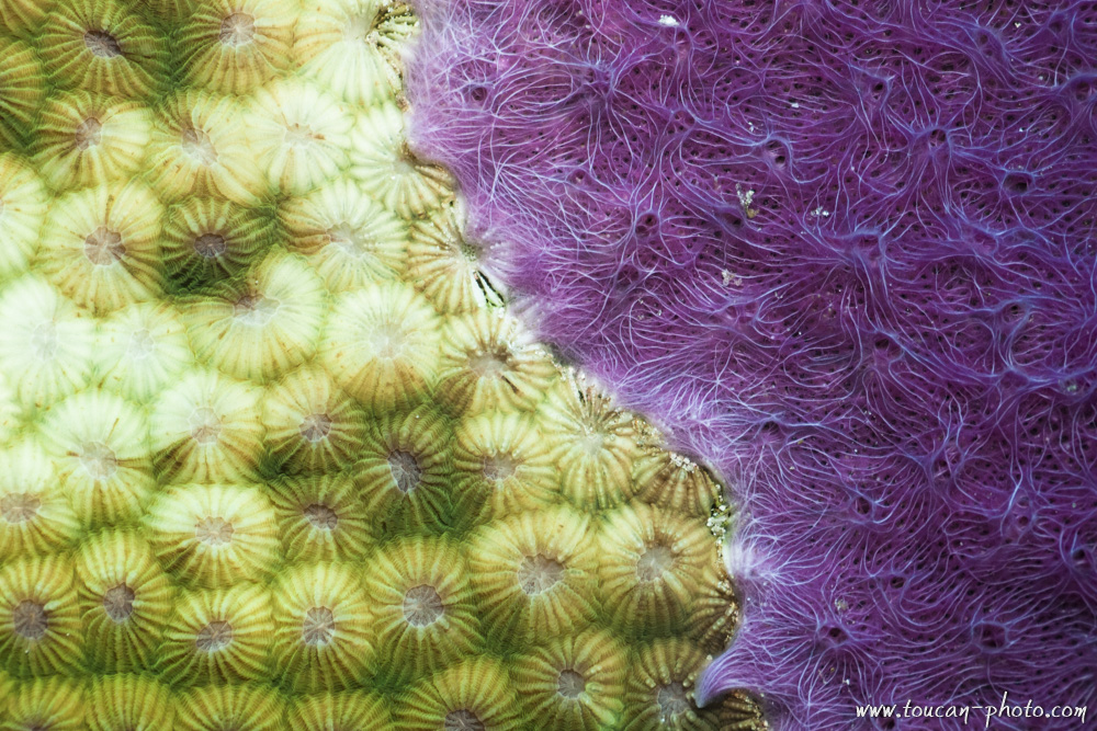
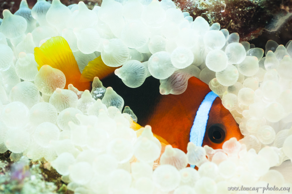
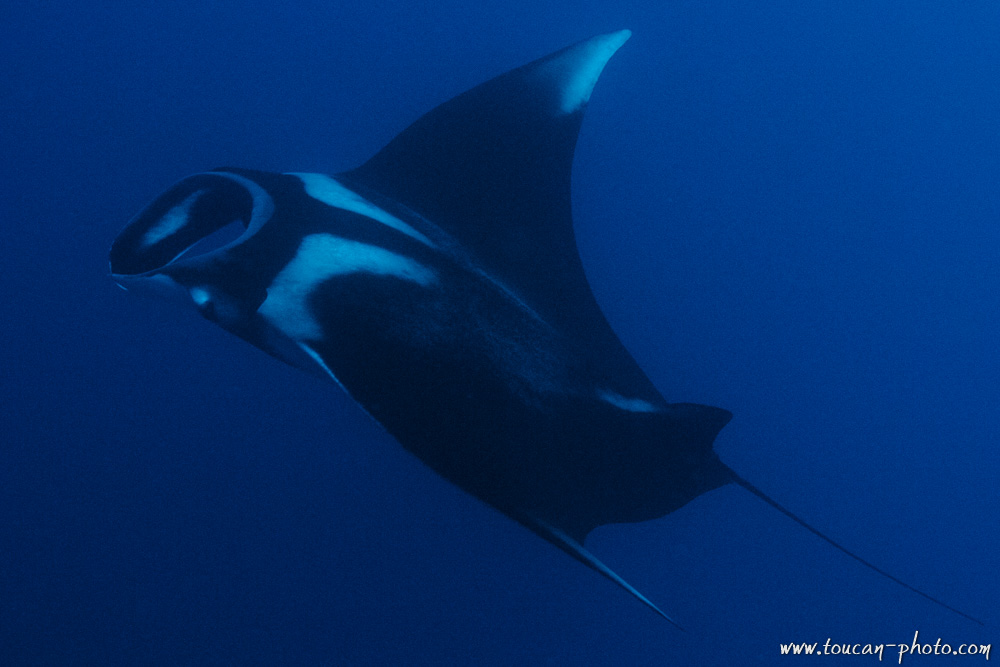
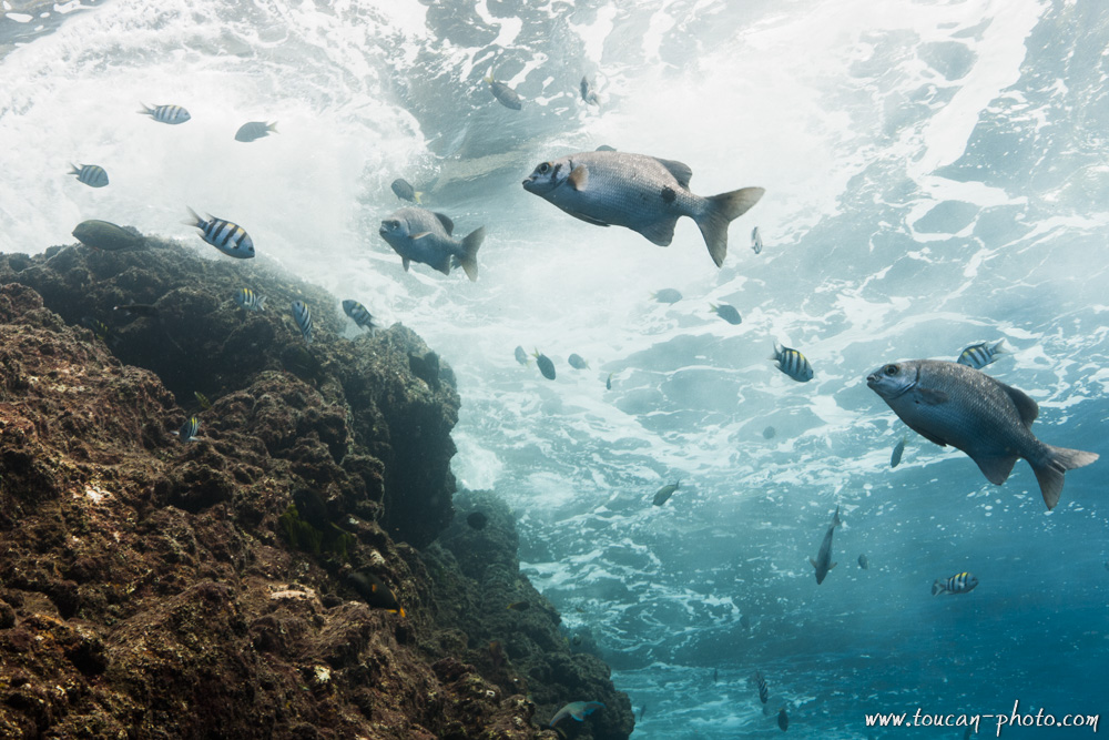
Indonesia: Diving Komodo
All of the images presented here were captured in Indonesia, specifically within the marine area of Komodo National Park. This park is an ideal destination for those wishing to dive and discover the incredible diversity of a coral reef. Numerous species of nudibranchs live alongside strange crustaceans, such as anemone shrimps or carrier crabs, while gigantic manta rays share the spotlight with the world’s smallest syngnathid, the pygmy seahorse.
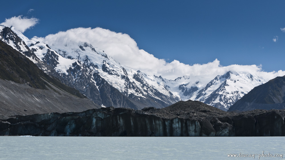
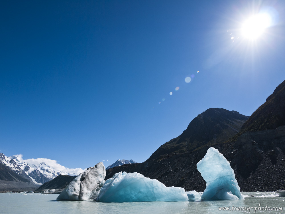
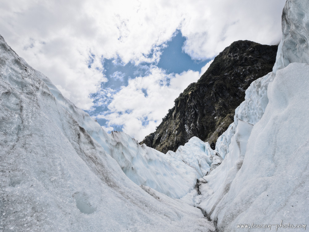
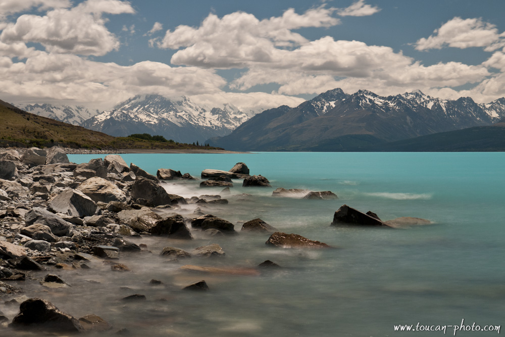
New Zealand: Tasman Glacier and Pukaki lake
Tasman Glacier, the largest of New Zealand, offers to its visitors a beautiful sight. Ice blocks collaps from its southern face, and remain afloat in a dark gray lake. While walking around the lake, these icebergs give us an image of a polar excursion.
The visit will continue up to the Pukaki lake, an attractive place of this glacier valley due to the turquoise color of the water.
The Tasman glacier Location
The glacier:
Tasman glacier lies at the Aoraki/Mount cook base. It’s a 20 kilometers long glacier, and the thickness is up to 600 metres. This scope make it the biggest glacier in New Zealand. 20,000 years ago, Tasman glacier encompassed other glaciers, like Hooker, Murchison, Muelle, and formed an ice tongue of over 115 kilometers long. It is this ice tongue that dug the contours of the valley, allowing Pukaki lake and Tasman lake to appear gradually as the glacier surface decreased.
The Tasman glacier topology (Interactive Map)
The front of the Tasman glacier, and the Tasman lake at the base
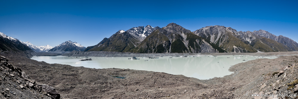
A sight of Tasman lake. The glacier is on the left
An Iceberg factory:
Tasman Lake is located at the glacier base. The glacier fragments fall into the lake, and take the appearance of large icebergs. Because the temperature of the lake water does not exceed two degrees Celsius, the icebergs melt slowly. Only 10% of the iceberg is visible, the rest is under water surface.
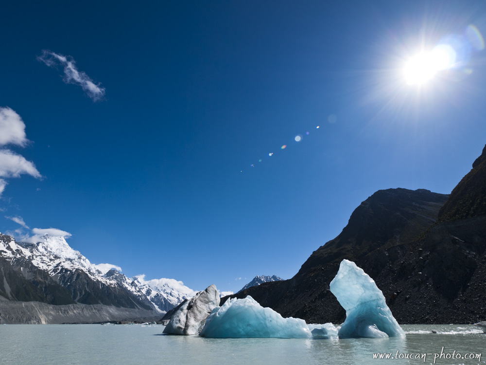
Drifting icebergs
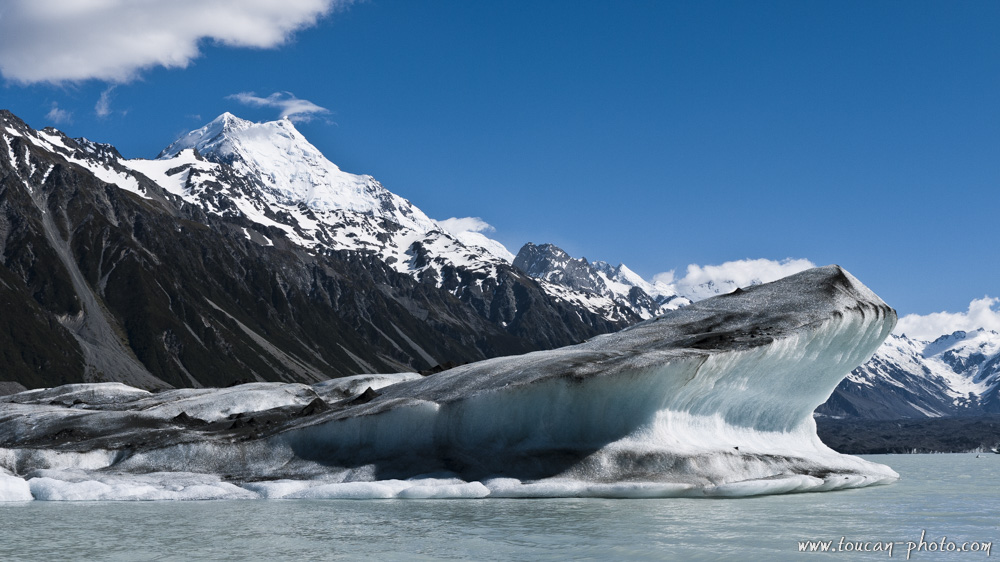
An iceberg, on the background the Aoraki/Mont Cook
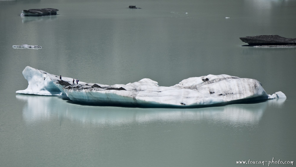
A walk that looks like a polar expedition
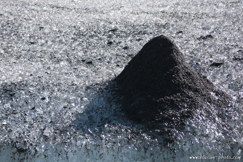
Color changes: white to gray:
Tasman Glacier, when sliding the mountain, is loading the black rock chunks snatched in the mountains. These black particles accumulate in the ice and will stay on board of the glaciers when they are floating in the lake. During the melting of the iceberg, the particles concentration increases, and changes the ice coloration. Thus, a newborn iceberg will appear white, while an older iceberg would have a dull gray color. At the end of melting, the particles of rock are giving a milky gray to the Tasman lake.
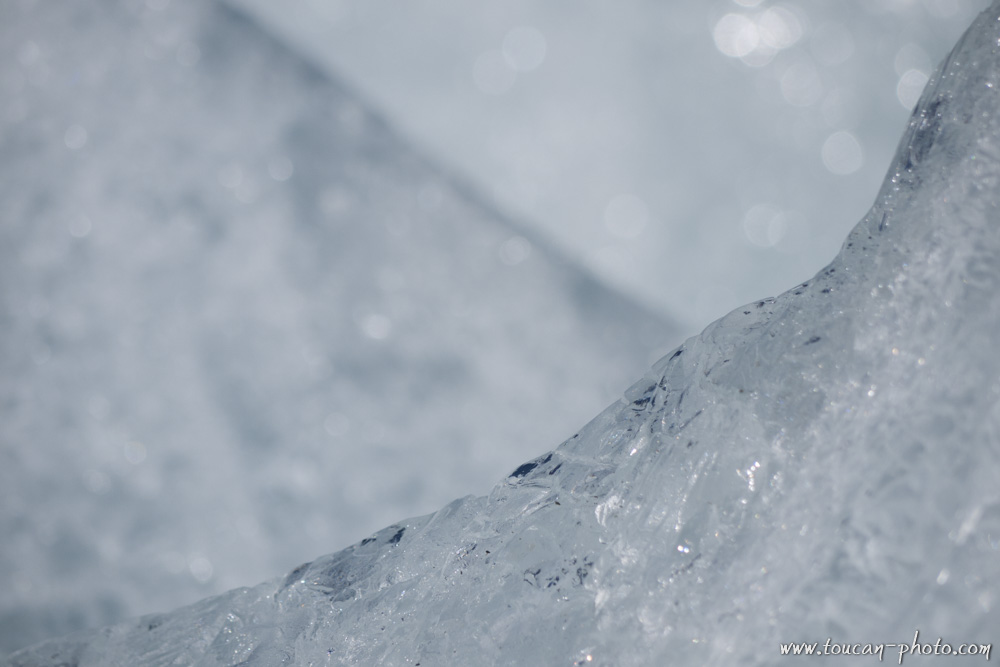
An apparently pure ice when melting…
… can form strange particle clusters.
Color changes: gray to blue:
A river rises in Lake Tasman. This river carries particles of rock from the lake, which also give to the river the gray color. As the rock particles have a higher density than water, they sink to the bottom of the Tasman River before the water flows into Lake Pukaki. The water ice, when it arrives in the Pukaki Lake, is free from all impurity, and colors the lake water in an incredible turquoise blue.
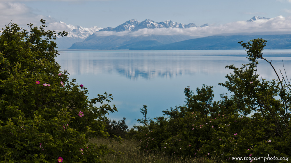
The Pukaki lake early morning
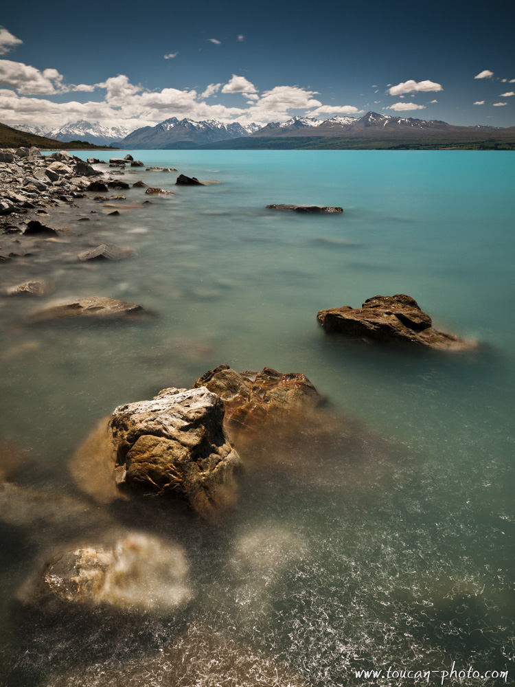
Pukaki lake and turquoise water
— Continue the journey —
See more pictures from New Zealand
Kauris: the legendary trees of New-Zealand
— Complementary Resources —
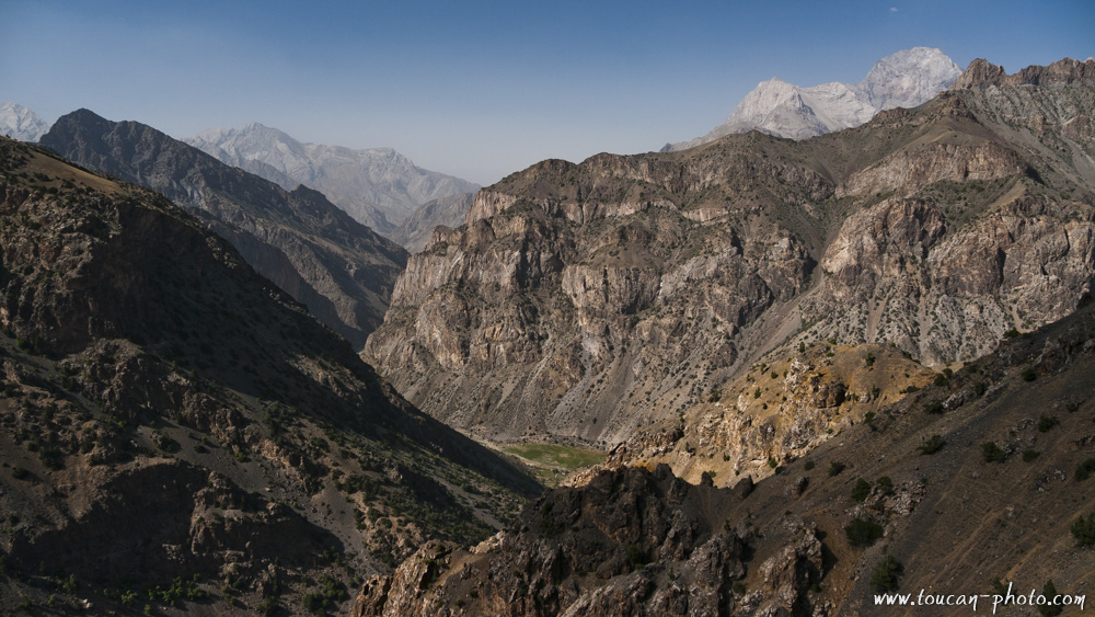
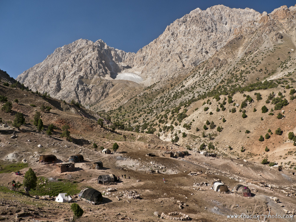
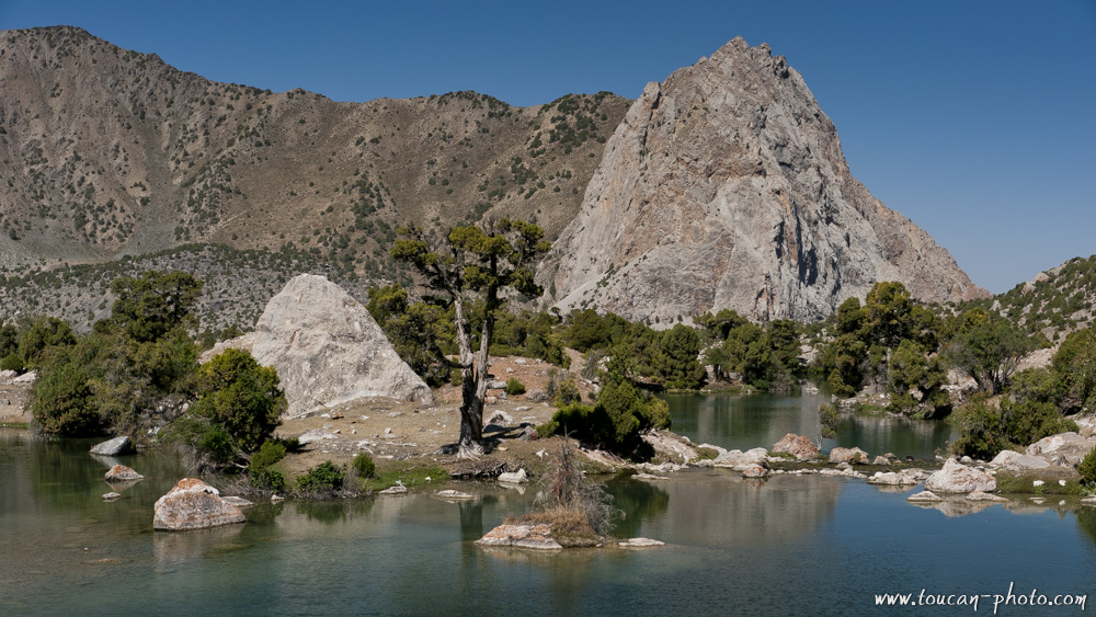
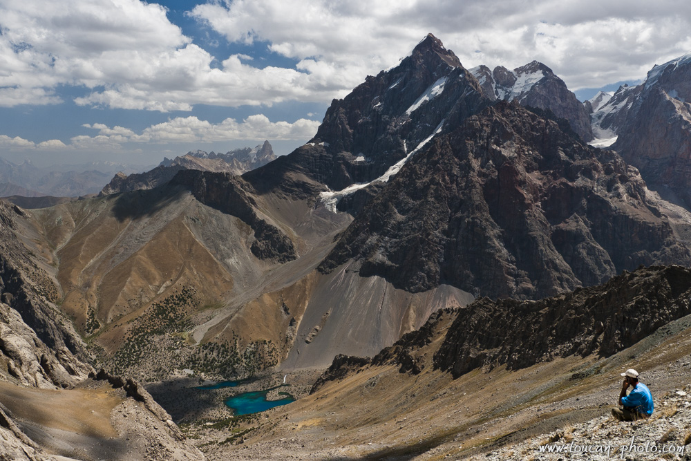
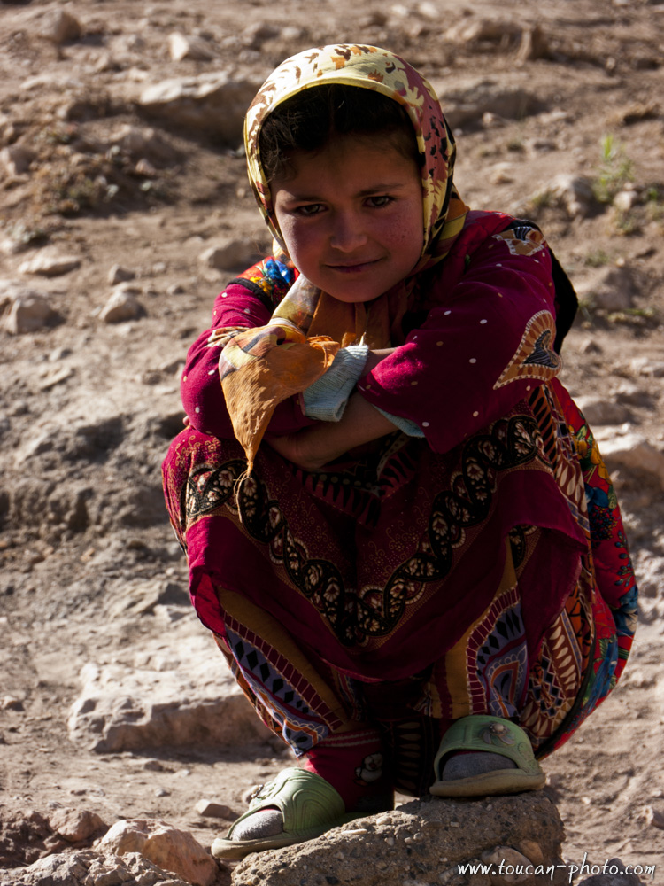
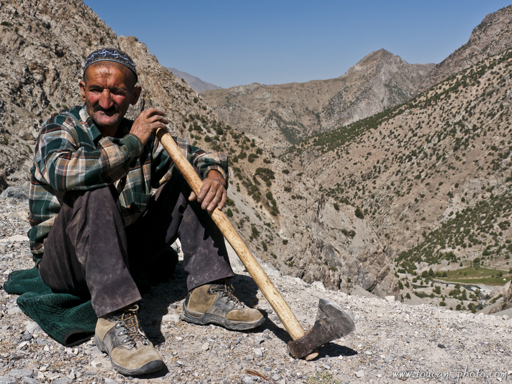
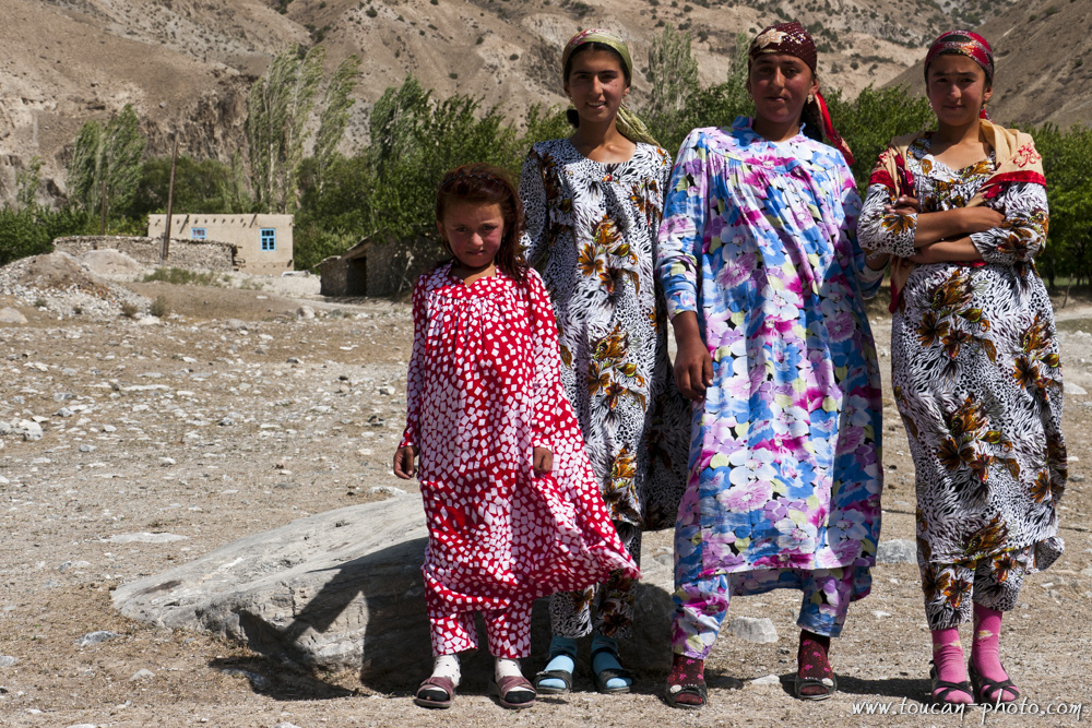
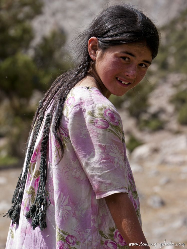
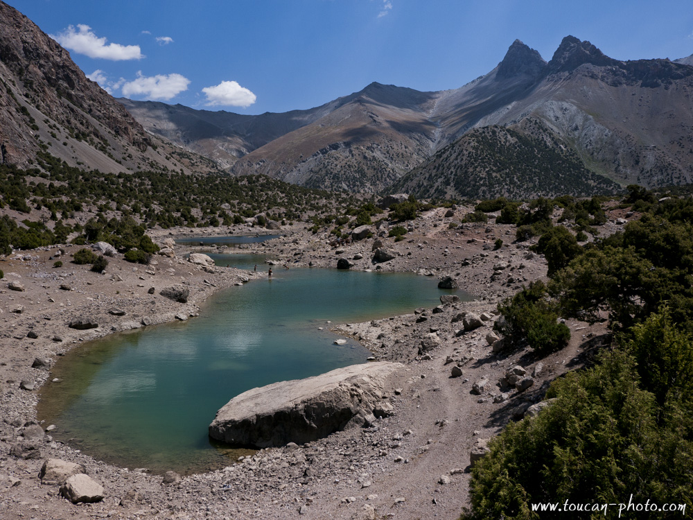
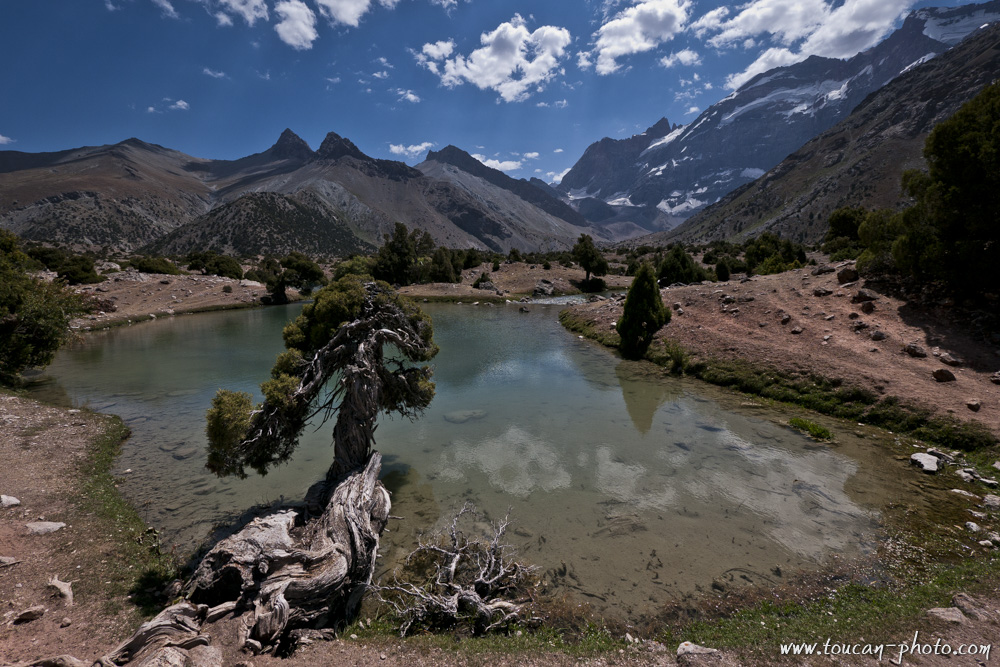
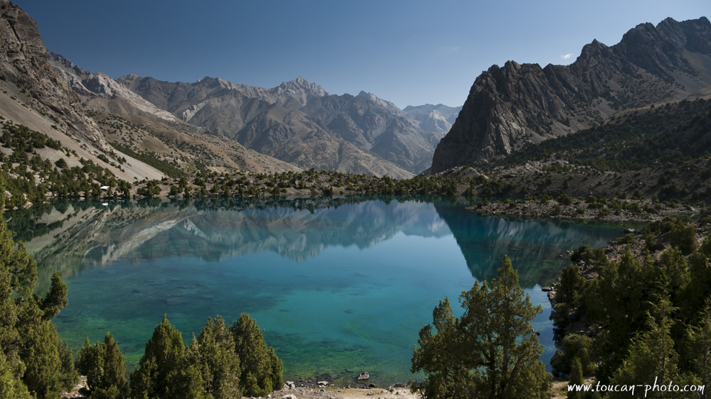
Tajikistan: Hiking the Fansky mountains
Spending time in Tajikistan means “gaining altitude”! The country’s land is 93% covered by mountains, with more than half of the territory situated at least 3,000 meters above sea level. The highest point is the Ismail Samani peak, reaching an impressive 7,495 meters.
The two main massifs are the Pamir, famous since the days of the Silk Road, and the Alay Mountains, which run along the northern part of Tajikistan and the southern part of Kyrgyzstan.
Hiking through the Alay Mountains, valley after valley and pass after pass, allows you to meet the Tajik shepherds who live there. These nomads move with the seasons alongside their herds. Their traditional dwellings are called “Kappa”—wooden tents covered with animal skins. There are also permanent villages where stone and cob houses are huddled together for protection against the harsh winters.
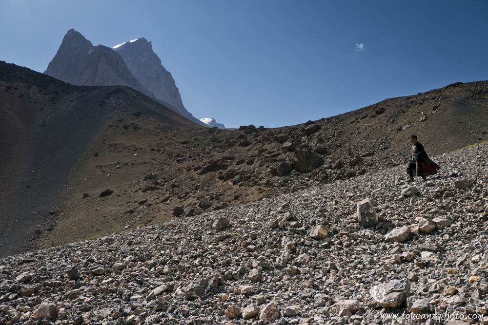
Through these photographs, I invite you to discover the mountainous landscapes of Tajikistan, its turquoise glacial lakes, and the people who call these heights home. These images were captured in the Fansky Mountains, part of the Alay range.
Location of the Fansky Mountains in Tajikistan
Mountain panorama
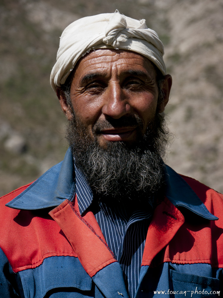
Tajik pride
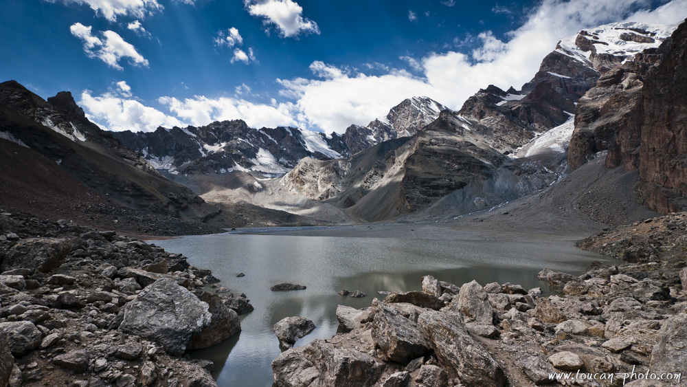
Glacial lake of Moutny (3500m), and Chimtarga (5489m)
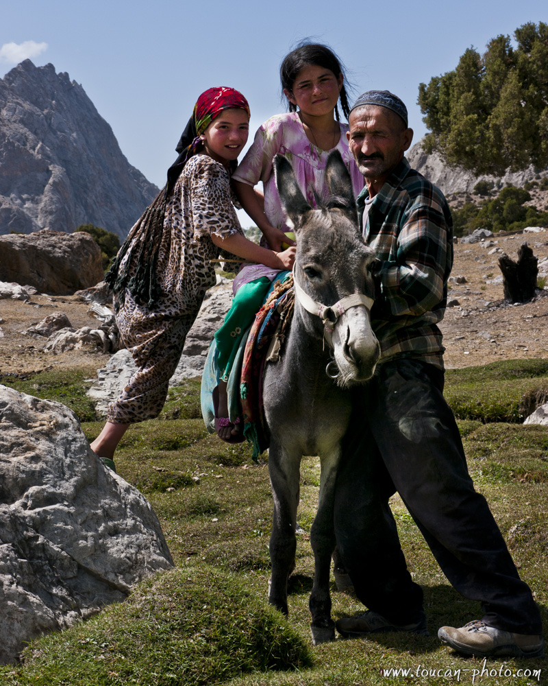
Sahid and his daughters
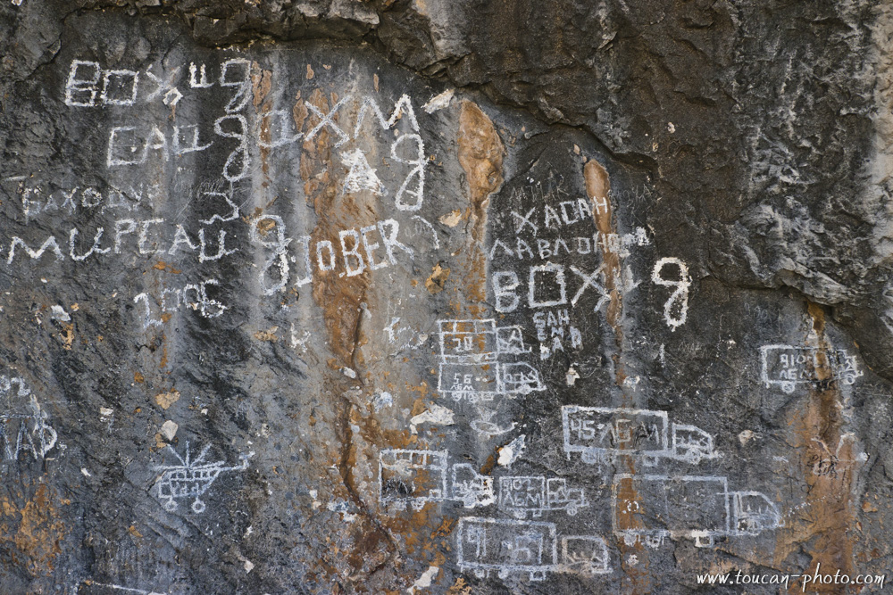
Graffiti
Nomadic village of Vole ethnic group, Sarmat valley
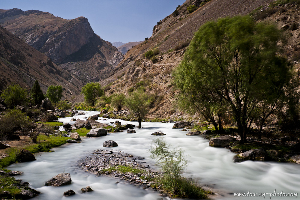
Reude river
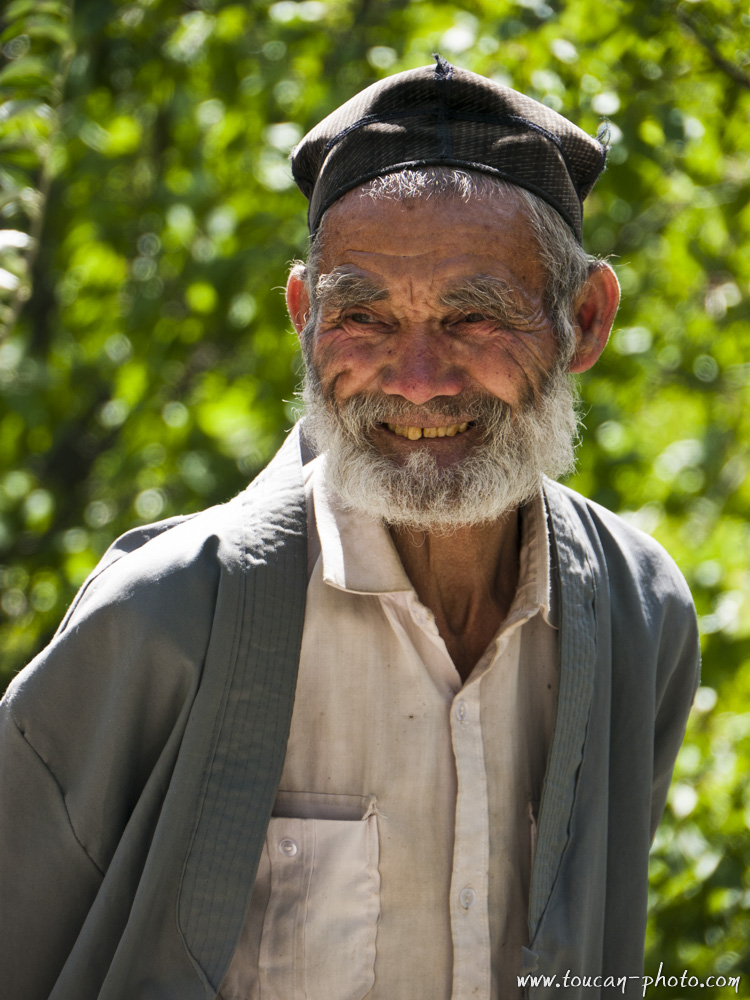
Tajik smile

Tajik curiosity
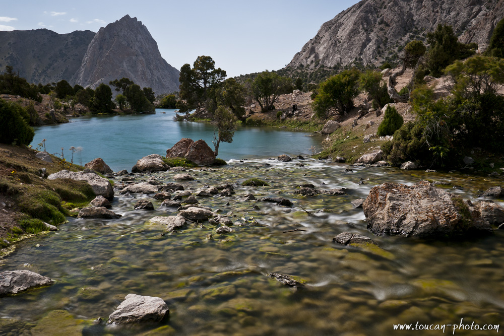
Culicalon lake (2880m)
Mountain of war
Sight of view to Chabdara (5049m) from Aloudine mountain pass (3840m)
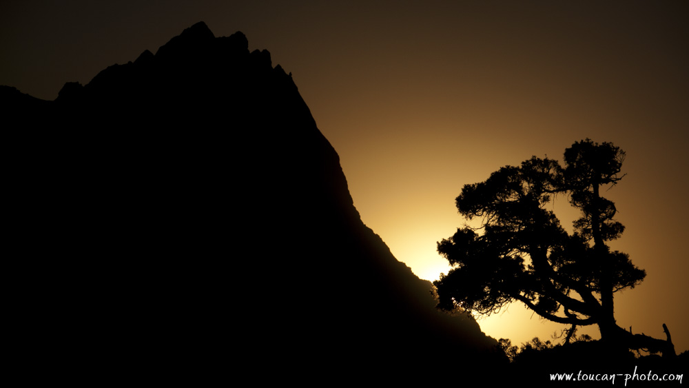
Sunset on the war mountain
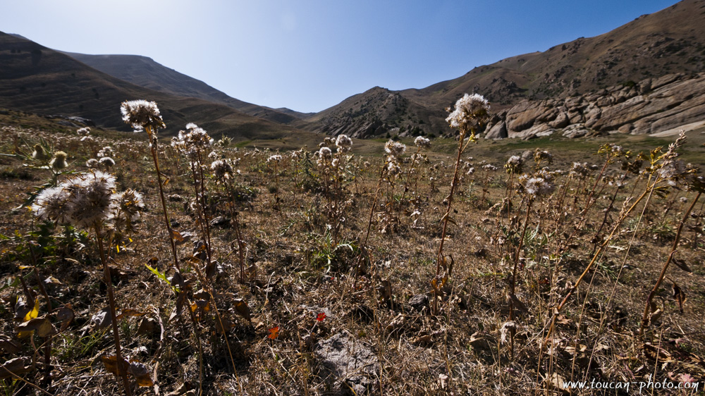
Dried grass and pasture
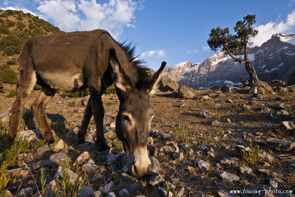
A donkey, in front of Chimtarga (5489m)
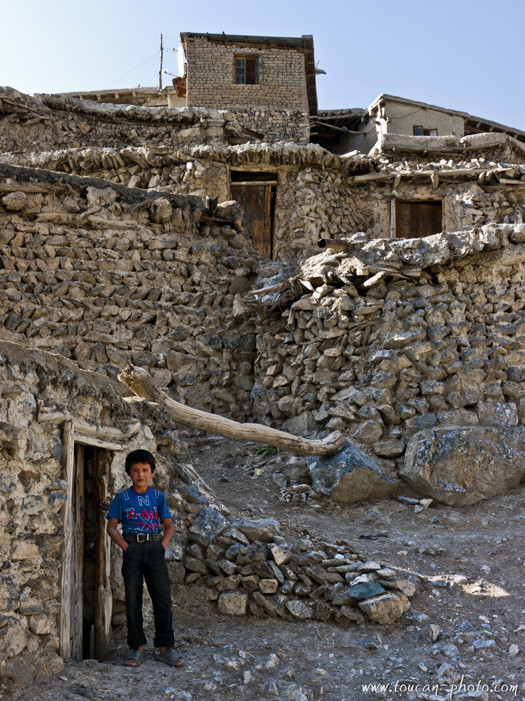
A mountain huddled houses village
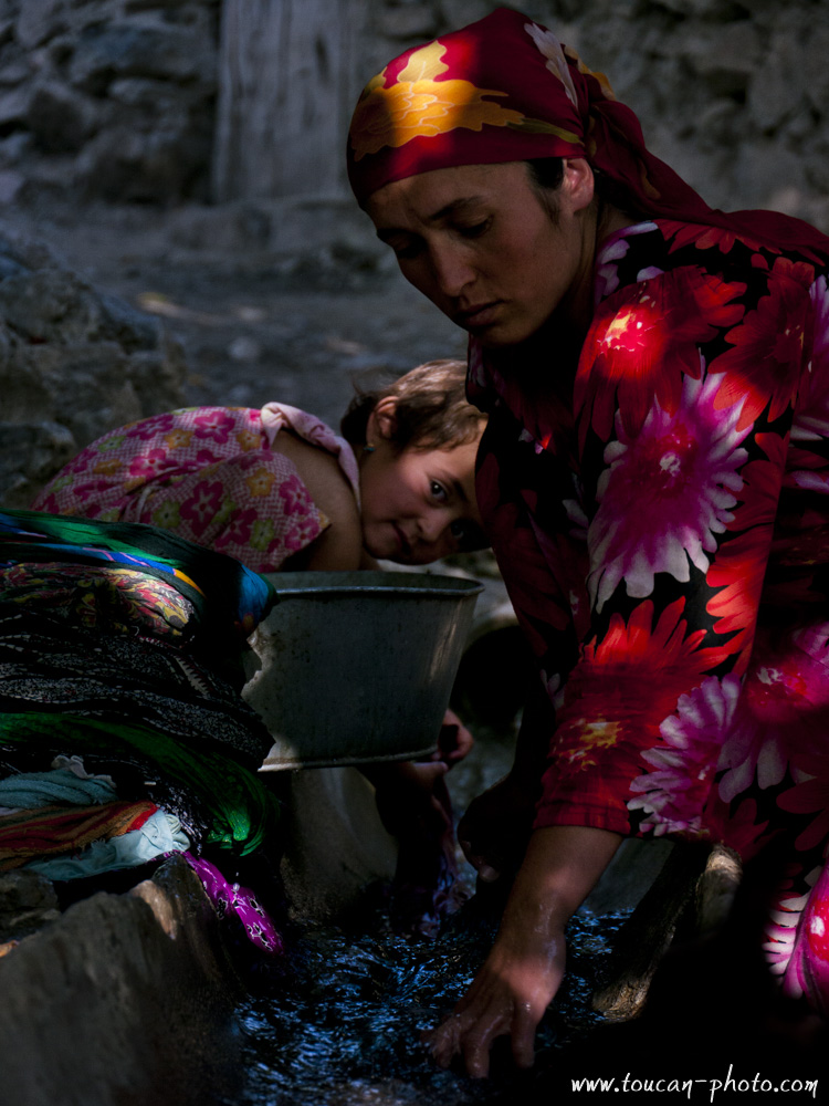
Mother and daughter
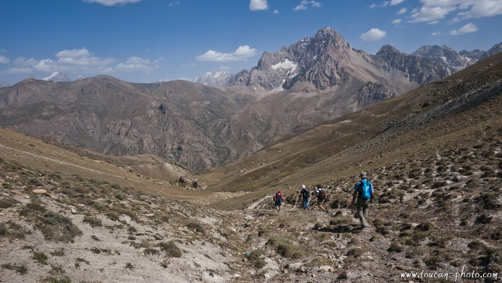
Hikers in the mountain
A donkey caravan moving in
Few hours are enough to erect a kappa
Kappa assembly
Specific actions during the assembly of a Kappa
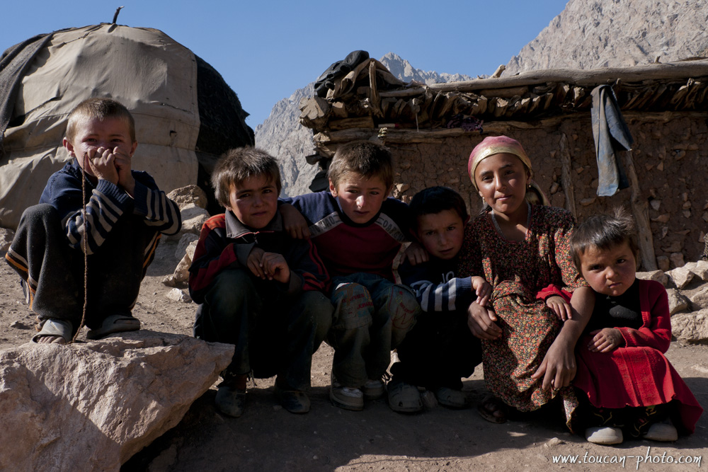
Kids of Vole ethnic group
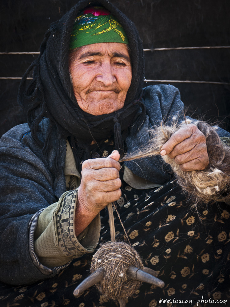
A spinner at work
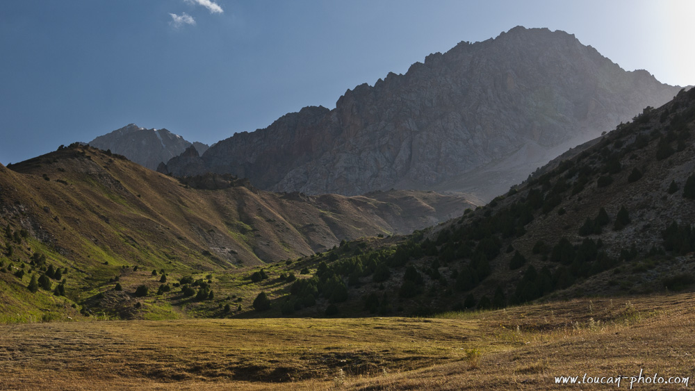
Pasture valley
Herdsman walk the mountain
Young girl
Sahid
Inhabitants in the valley Archi Maidan
Zamira
Culicalon lakes system
Culicalon lake (2880m)
Aloudine lake (3700m)
Australia: The Pinnacles Desert
Under your feet, a warm and golden sand…
The surrounding dunes are pierced with thousands limestone arrows . Some measuring almost four meters high, which give the whole place a strange atmosphere, almost surreal.
You are in the Australian Pinnacles Desert …
Continue reading“Australia: The Pinnacles Desert”
Malaysia: Rafflesia, the world’s biggest flower
Rafflesia is a kind of parasitic flower which lives under tropical climate of the Southeast Asia. This genus has 28 species and can measure up to 1 meter in diameter (Rafflesia Arnoldii) and weights up to 10 kg. Even the smaller species, Rafflesia Baletei, has 12 cm diameter flowers. So, Rafflesias, is the world’s largest flower. The species introduced in this article, the Rafflesia Kerri, has a diameter of 50-90 cm.
Continue reading“Malaysia: Rafflesia, the world’s biggest flower”
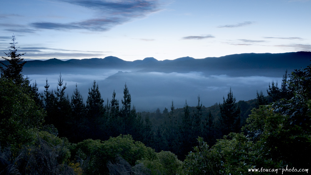
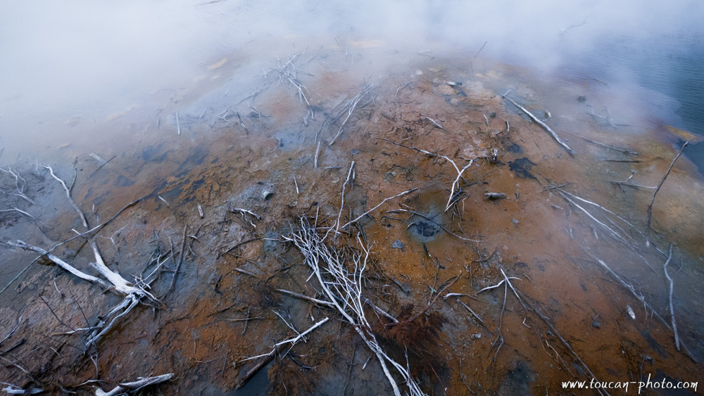
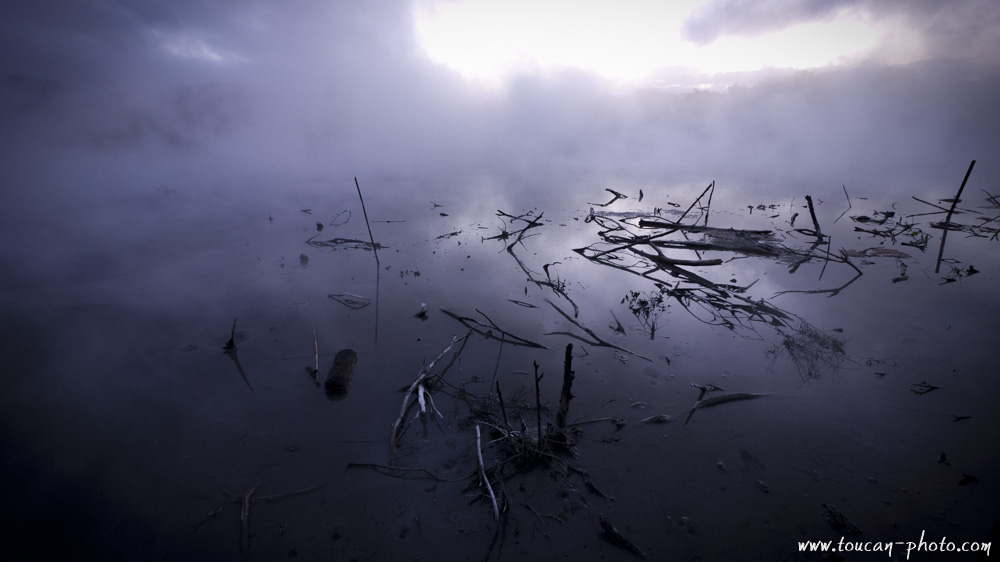
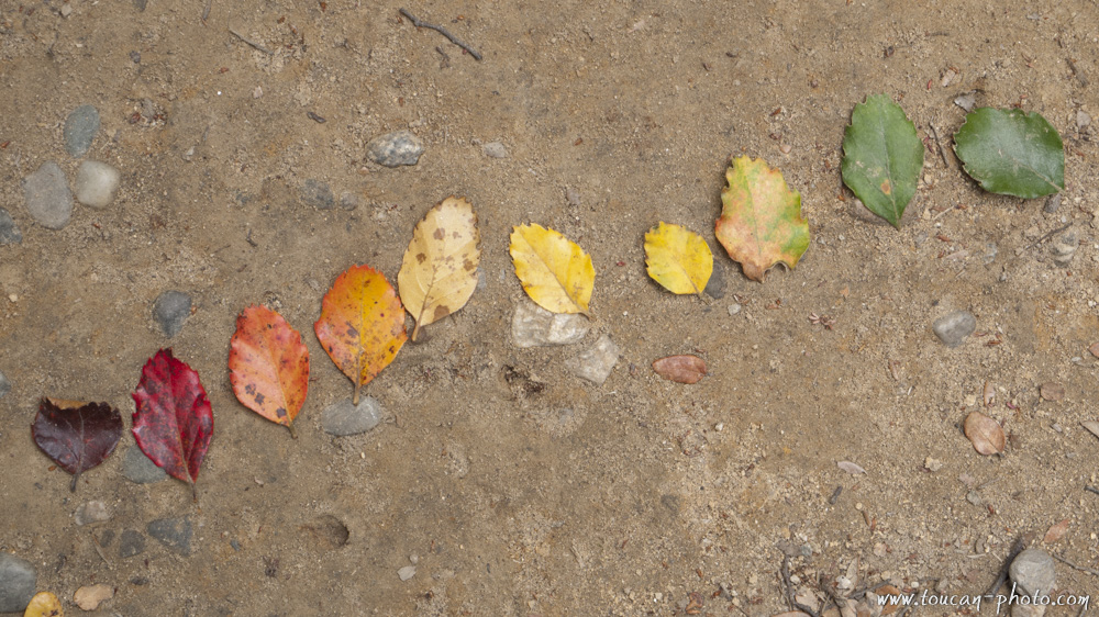
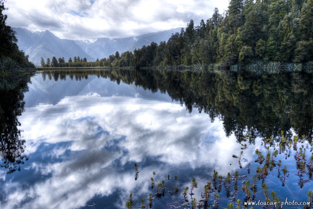
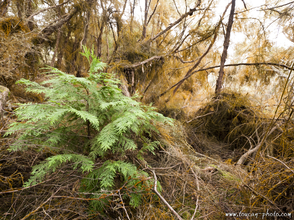
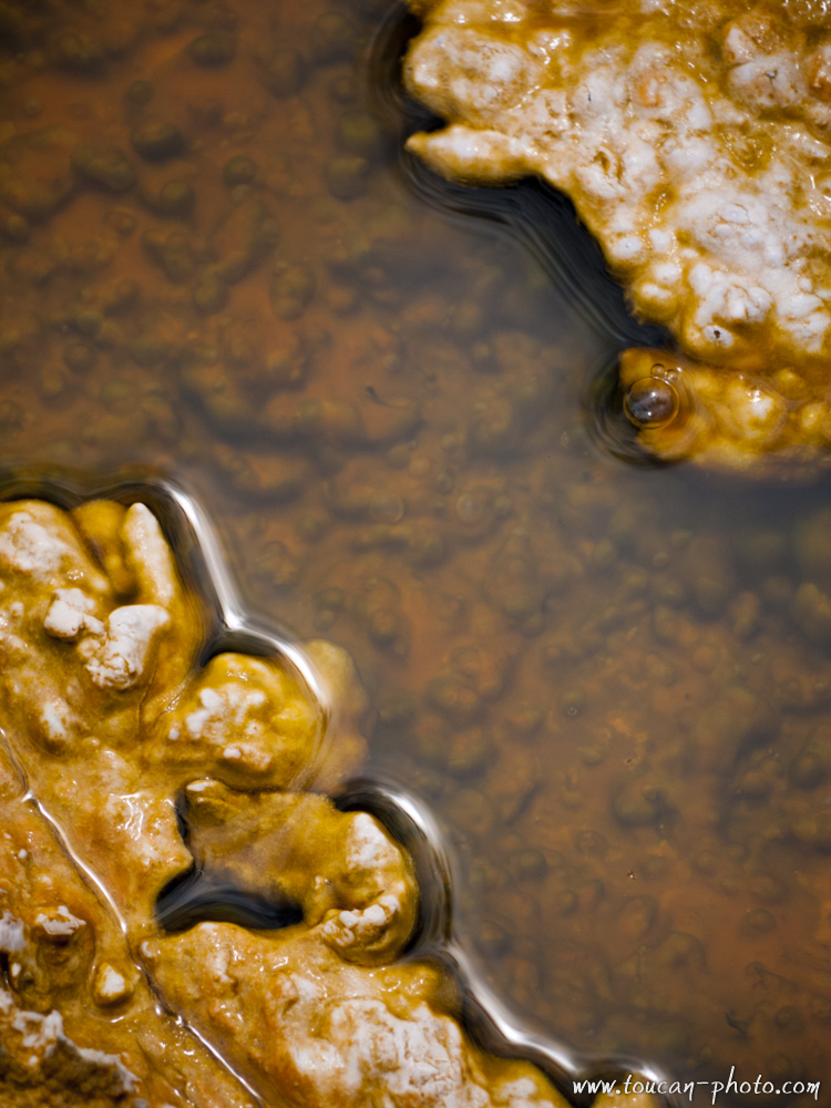
New Zealand: Color palette
New Zealand offers to its visitors varied and colorful landscapes. The pure white glaciers rubs turquoise blue or emerald green mountain lakes. An intense geothermal activity that reveals from soil gray mud pools, or sulfured water springs they brings small particles that colors the ground to yellow…
The pictures in this series, issued from a grandiose landscape or a small detail of a curious source, are, therefore, also rich in color.
Hauru falls
Riwaka valley night view
Oxidized vegetation in Rotorua
Desolation around Rotorua

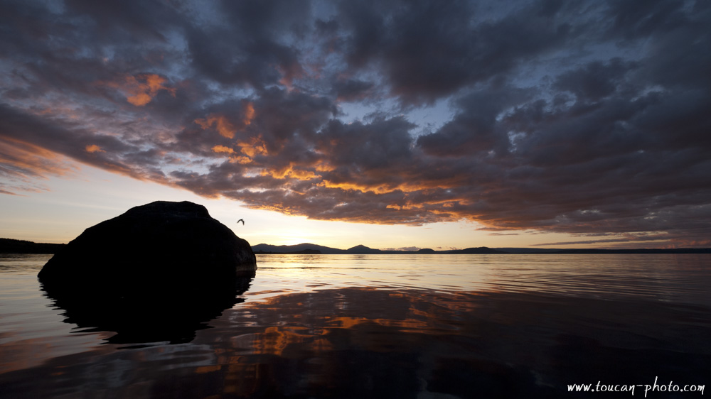
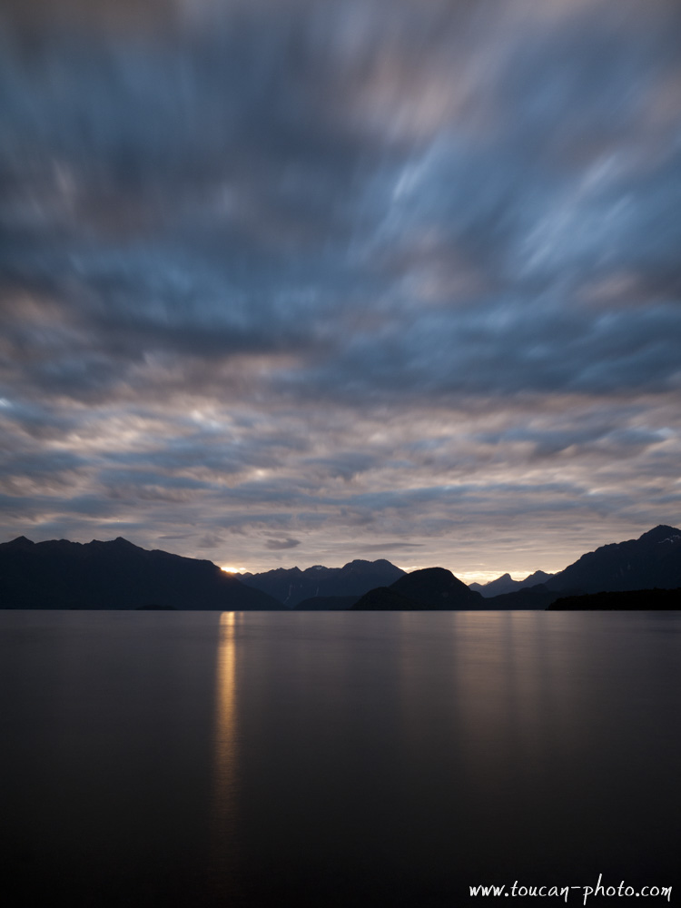
Sunset on Lake Taupo
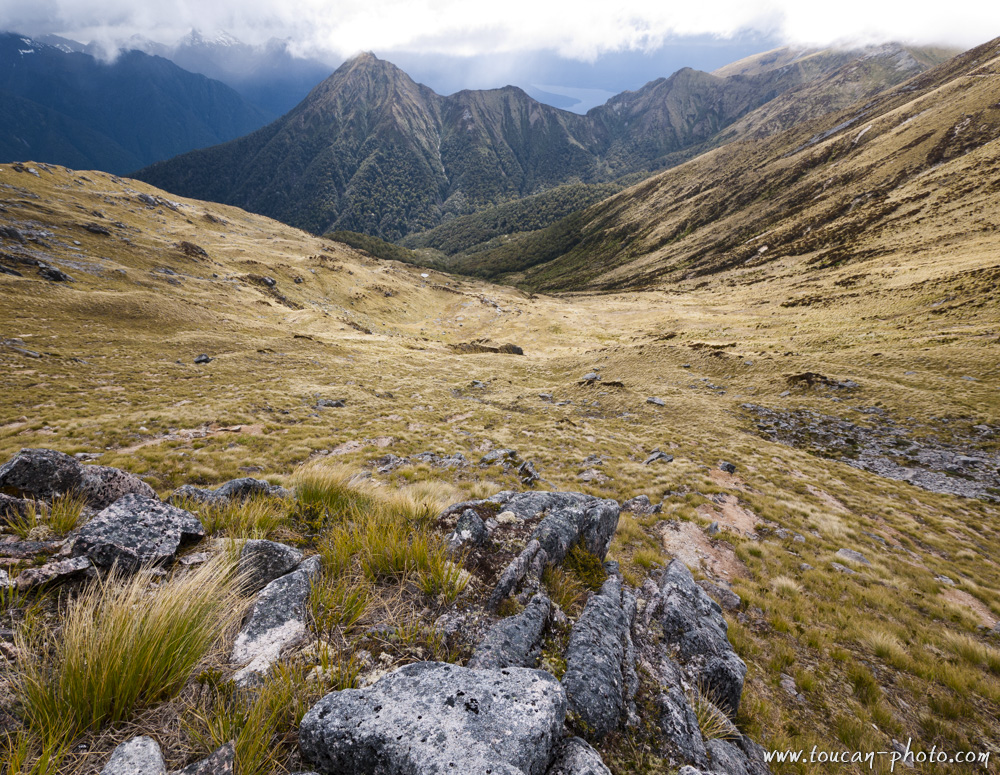
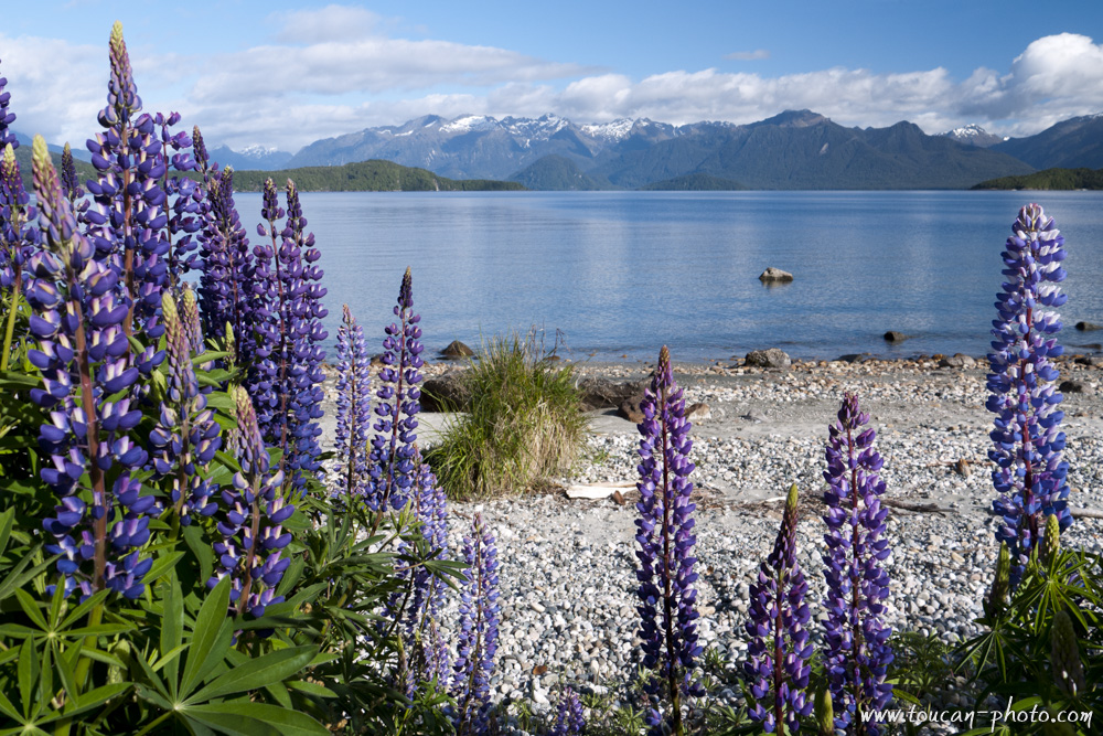
The Kepler Track in the Fiordland National Park
Vegetal rainbow
Fern spared by the sulfur vapors
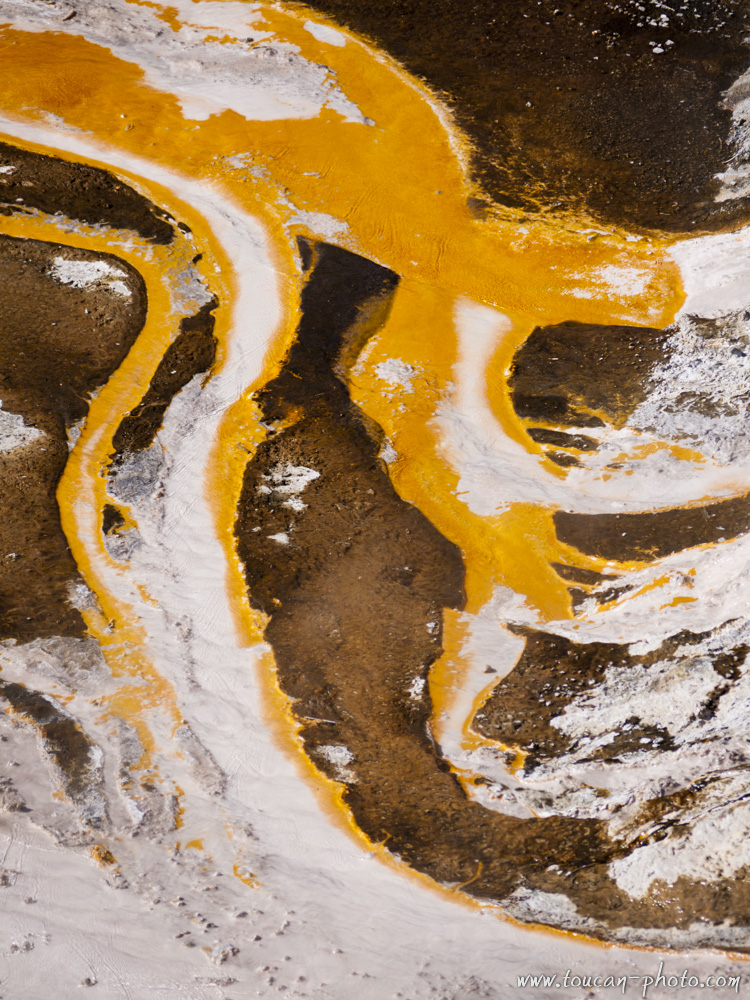
Colored flow in the Orakei Korako
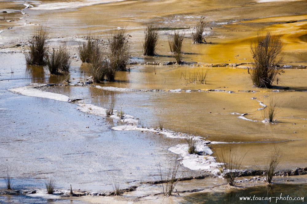
Plants and colored ground
Detail of colored deposits
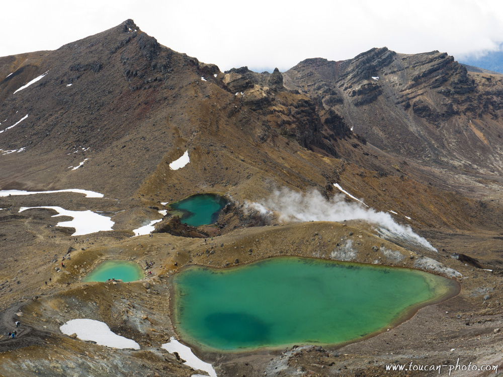
Emerald lakes on the Tongariro volcano
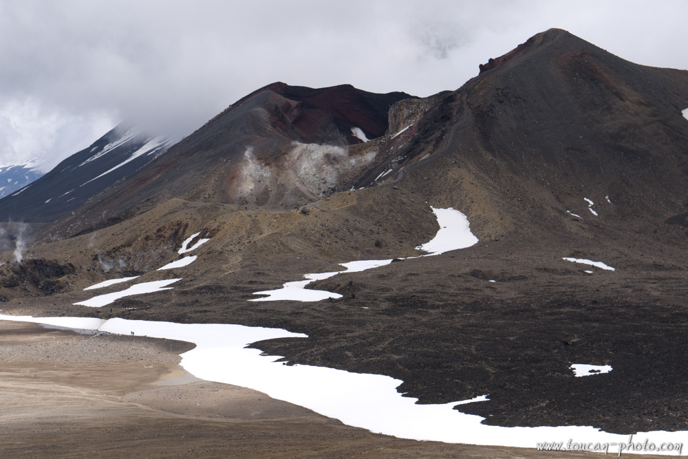
Red crater of the Tongariro
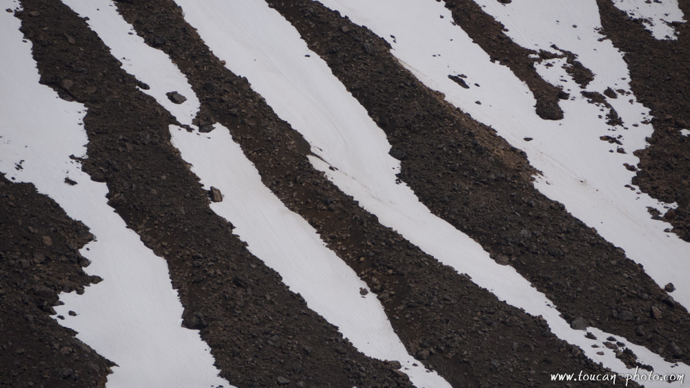
Snow zebra on Mount Tongariro
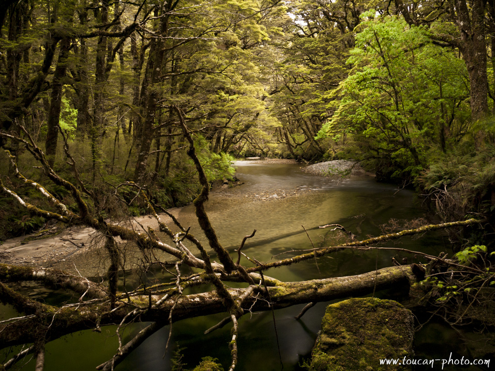
Forest atmosphere in the Fiordlands
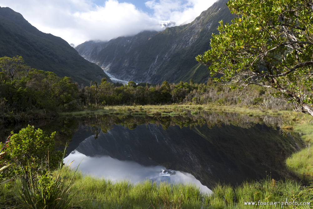
Franz Josef Glacier reflection in Peter’s pool
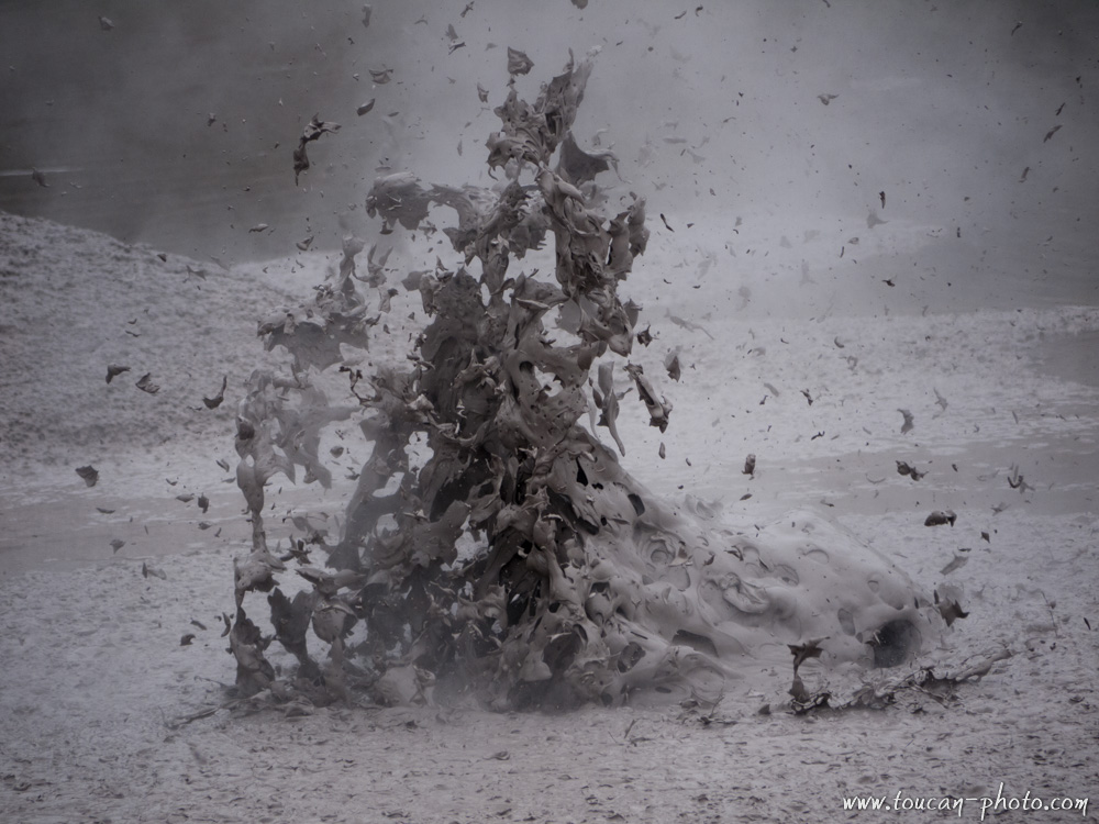
Mud explosion
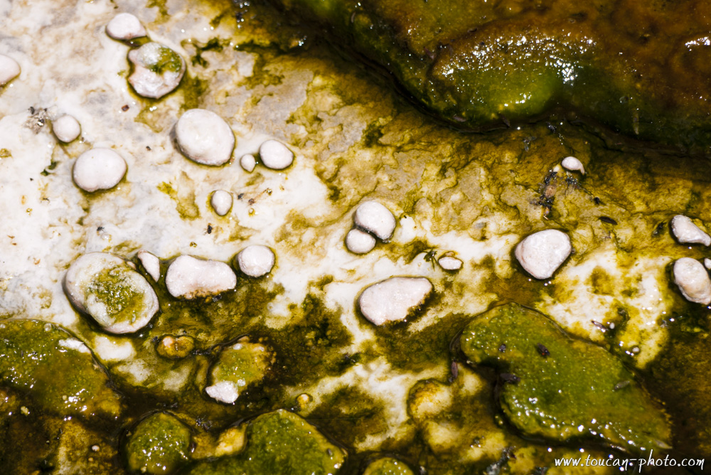
Colored detail
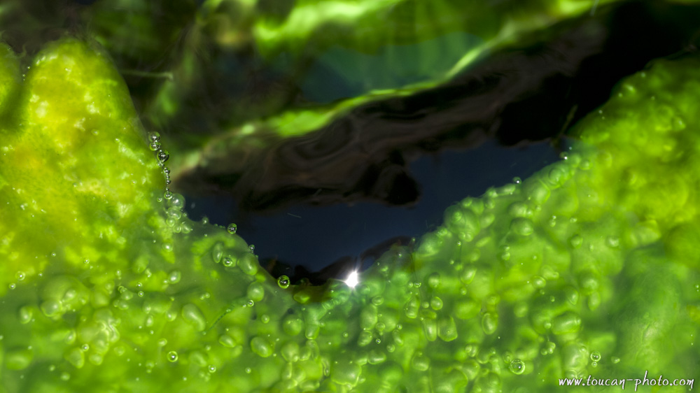
Green algae
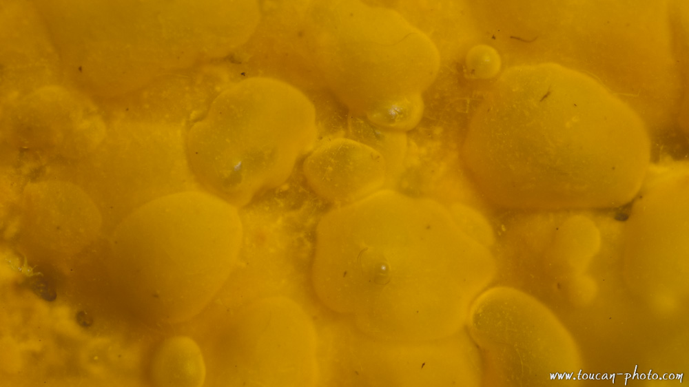
Yellow detail
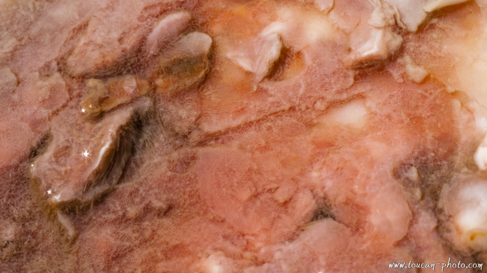
Pink detail
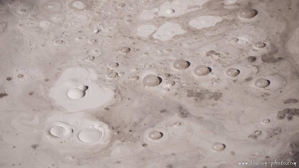
Boiling gray mud
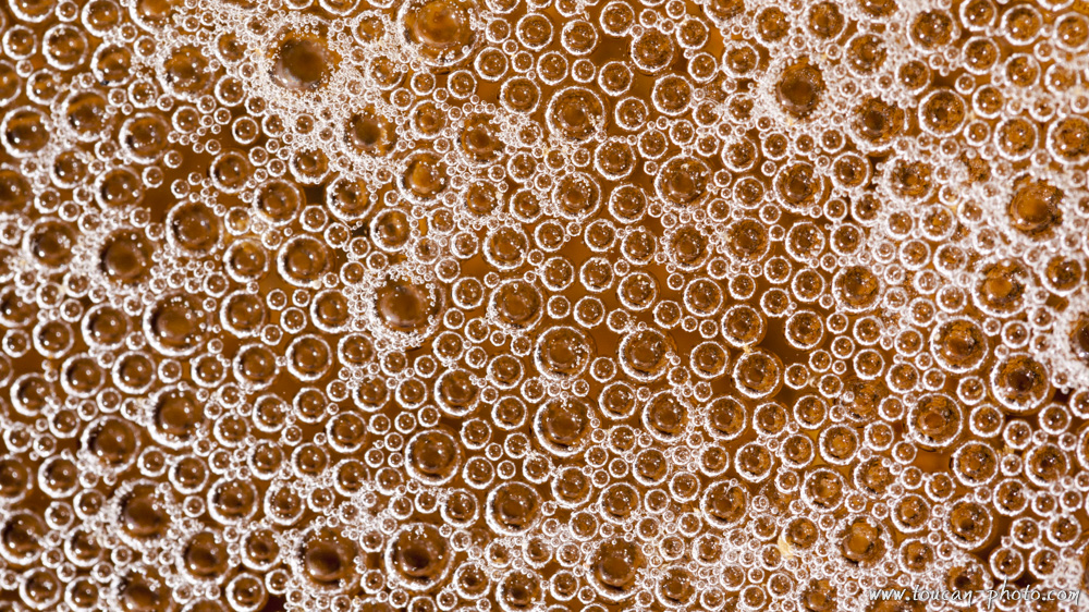
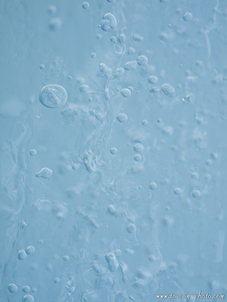
Small bubbles in a stream
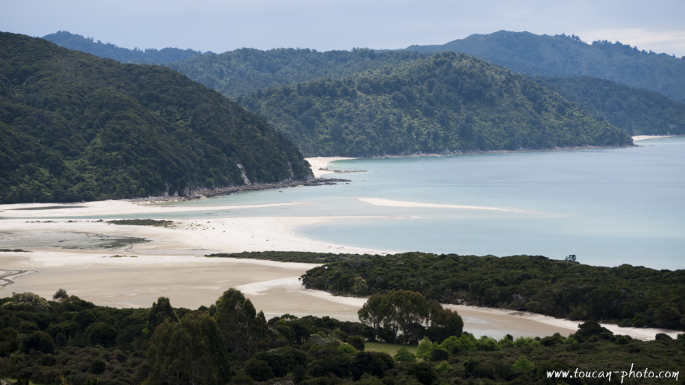
Abel Tasman Park
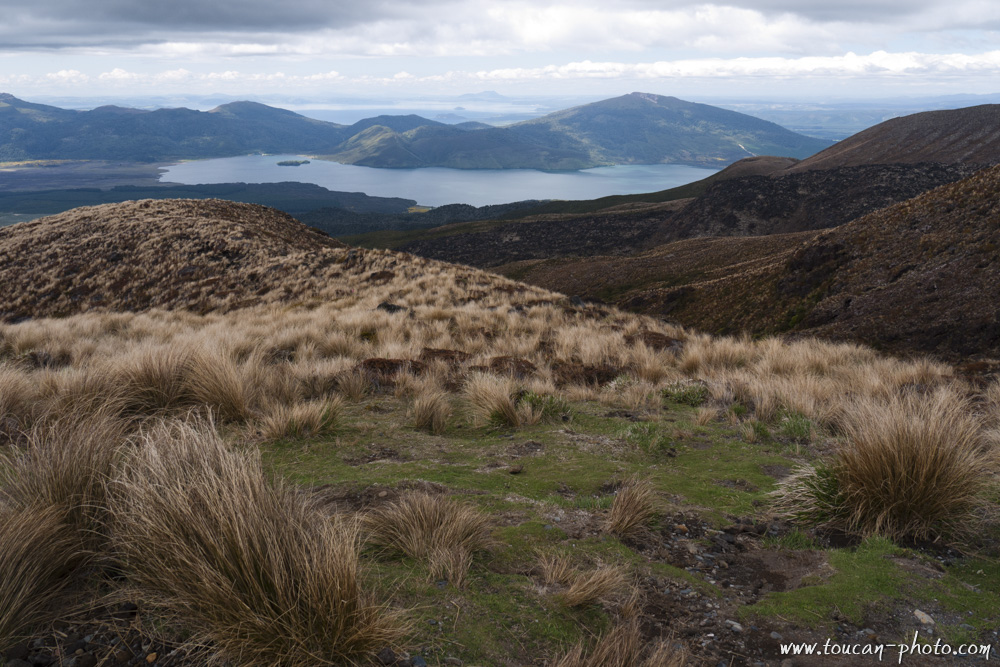
Tongariro National Park
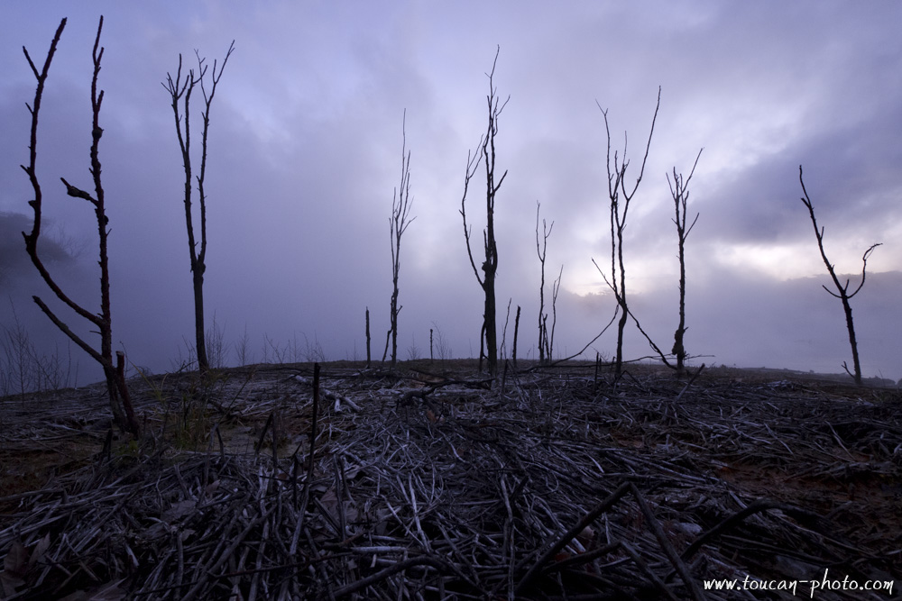
Dying branches
Lake Taupo
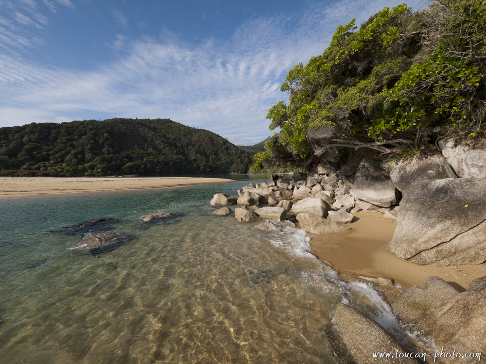
Beach of Abel Tasman Park
Mountains in the Kahurangi National Park
Meybille Bay
Franz Josef Glacier and its reflection
Icebergs in Tasman Lake
Bubbles in the ice
Inside Franz Josef Glacier
Lake Manapouri
Fiordland National Park
Rainbow between the rocks
Atmosphere in a forest of Fiordland National Park
Lake Te Anau
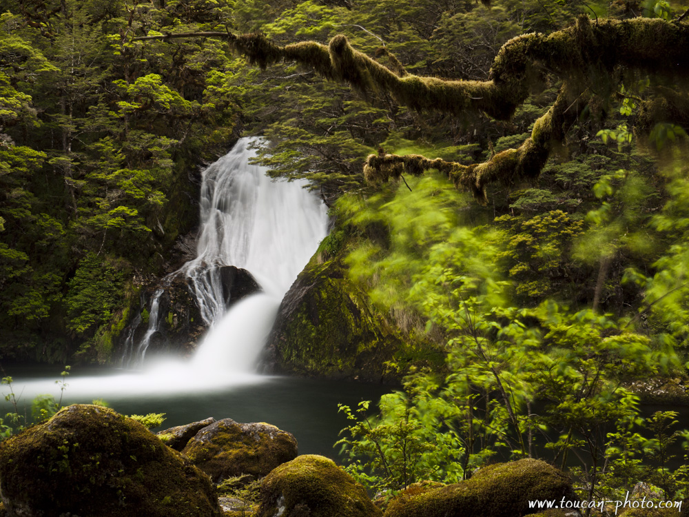
Waterfall in the Fiordland National Park
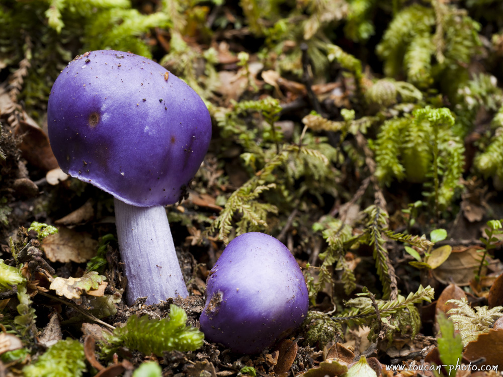
Violet mushroom
Lake Manapouri
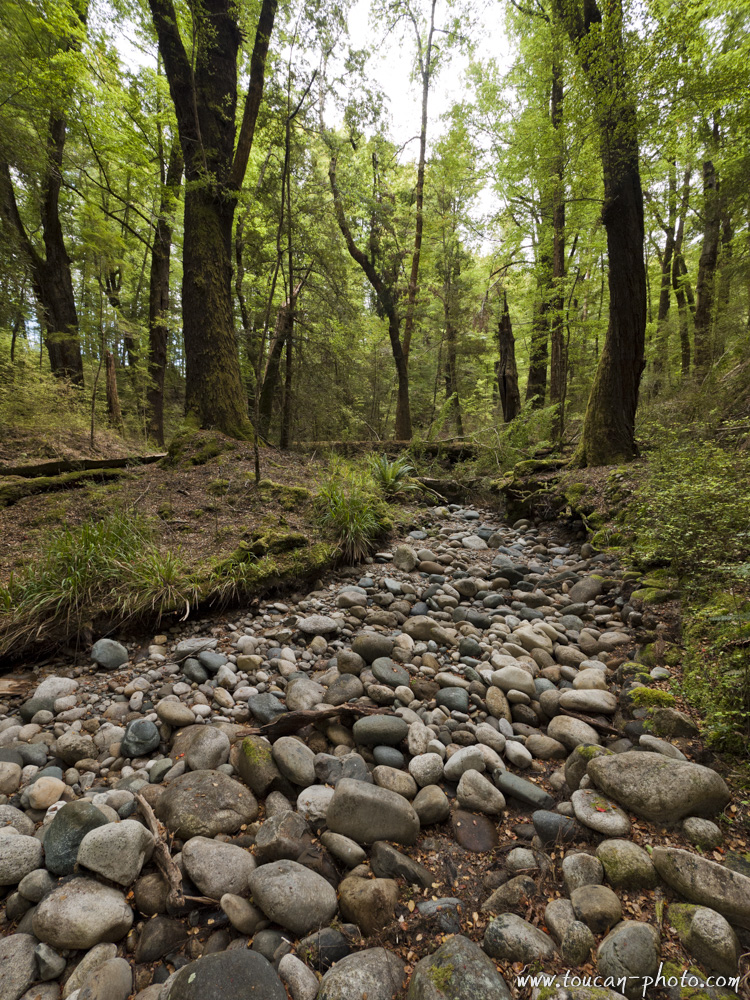
Pebble river
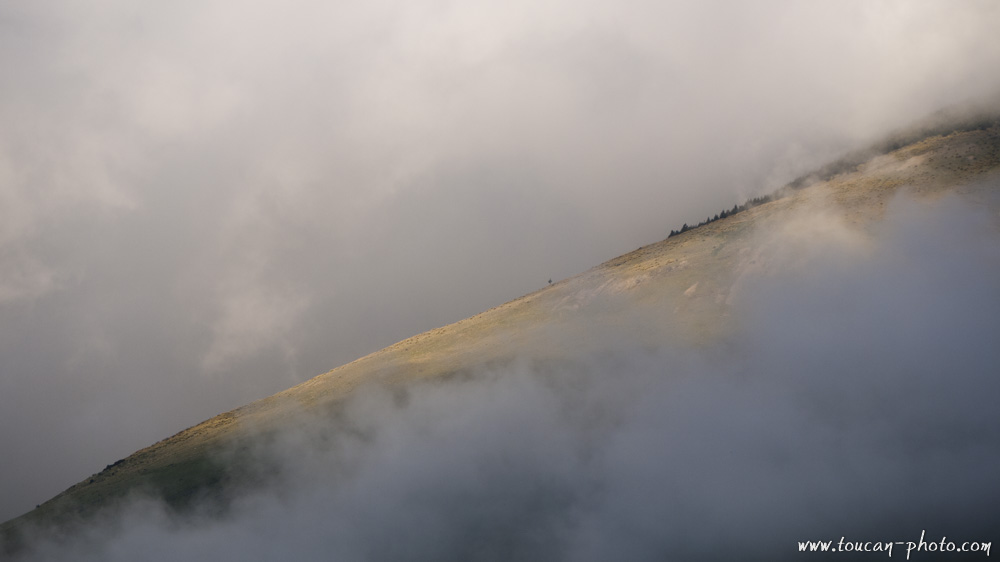
Hill piercing the clouds
Lake Pukaki
— Continue the journey —
Tasman Glacier and Pukaki lake
See more pictures from New Zealand
Kauris: the legendary trees of New-Zealand
— Complementary Resources —
Cambodia: Norry, the bamboo train
The bamboo train, called “Norry” in Khmer, is an original form of rail transport that can be seen on the railway that crosses through Cambodia. A norry consists of a bamboo tray about 2.5 x 4 meters assembled with two axles similar to heavy weights and powered by a small engine. He runs on the Cambodian railway.
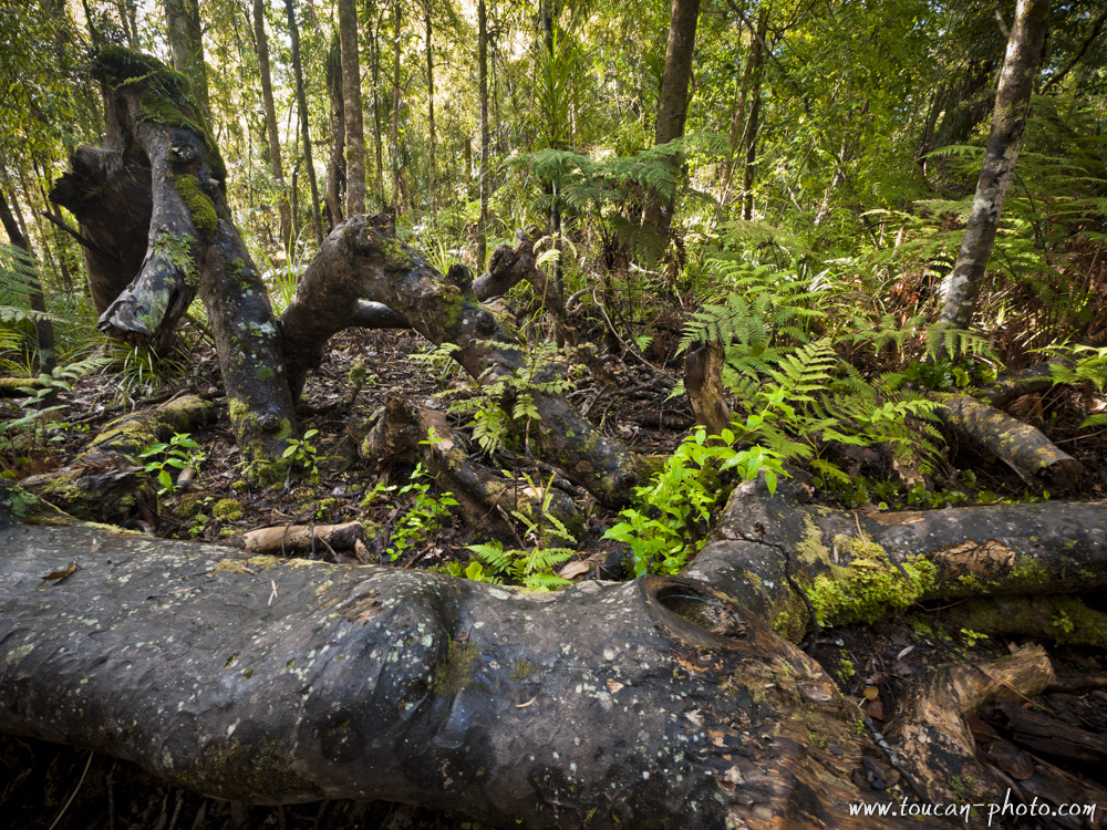
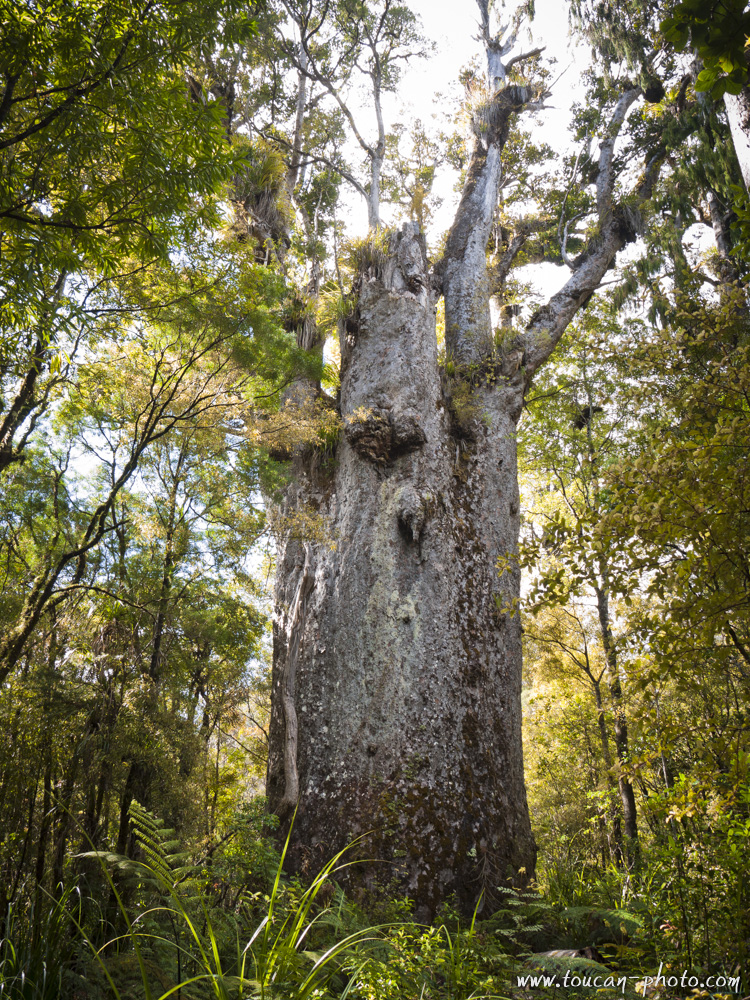
New Zealand: Kauris, Legendary trees
The Kauri (Agathis australis), also called Kaori, is an endemic tree from the family of the conifer that can be found in the northern part of New-Zealand. Kauris exist in New-Zealand for ages. Some fossils had been discovered and have been estimated to 220 millions of years old.
The Waipoua forest location, New Zealand
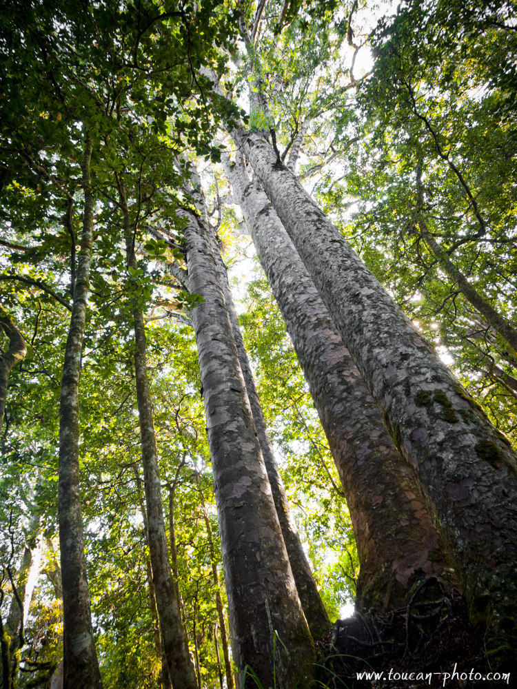
In the past, very thick forests of Kauris covered the northland. We estimate that before 1800, the Kauris forests used to occupy more than 12,000 square kilometers. However, after the overexploitation of the forest by the western population after their landing on this archipelago, only 4% of the initial number of these legendary trees has been spared. The survivors are now mostly located in the Waipoua forest.
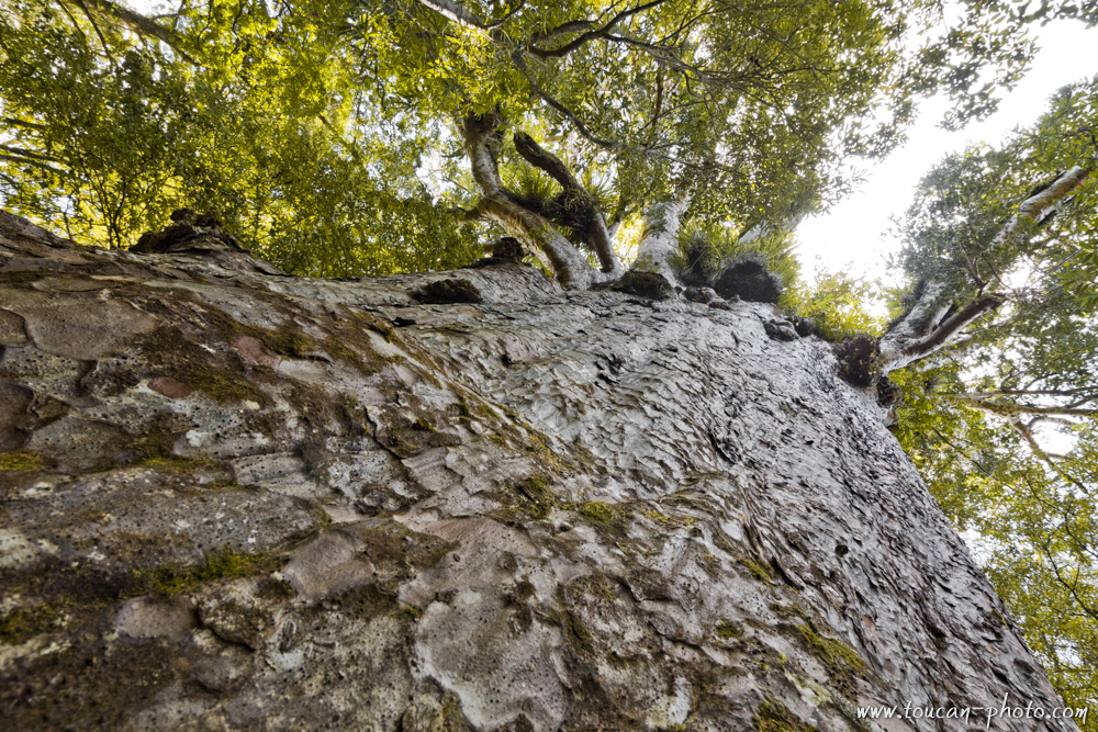
The size of this tree and its straightness make it the ideal wood to build boats. Especially for the boat masts. Its sap, called « gum », was also taken and used to make varnish for the wood pieces, glue and also fire starter. Once the sap taken, the tree was dead. Despite its huge size, the Kauri is very fragile because of its very thin roots. The use of synthetic products instead of the sap helps to save the Kauri.
The few remaining Kauris can be more than 50 meters high and the trunk more than 3 meters large. These characteristics make it one of the most majestic trees on Earth. Even if it’s difficult to estimate the age of these trees, some recent studies conclude that the oldest trees are 2000 years old. Nowadays, preservation and protection plans are controlled by the DOC (Department of Conservation). The Kauris are referenced; some footpaths are marked to prevent hikers to step on weak tree roots.

Huge kauri in the Waipoua forest
Remains from dead kauris
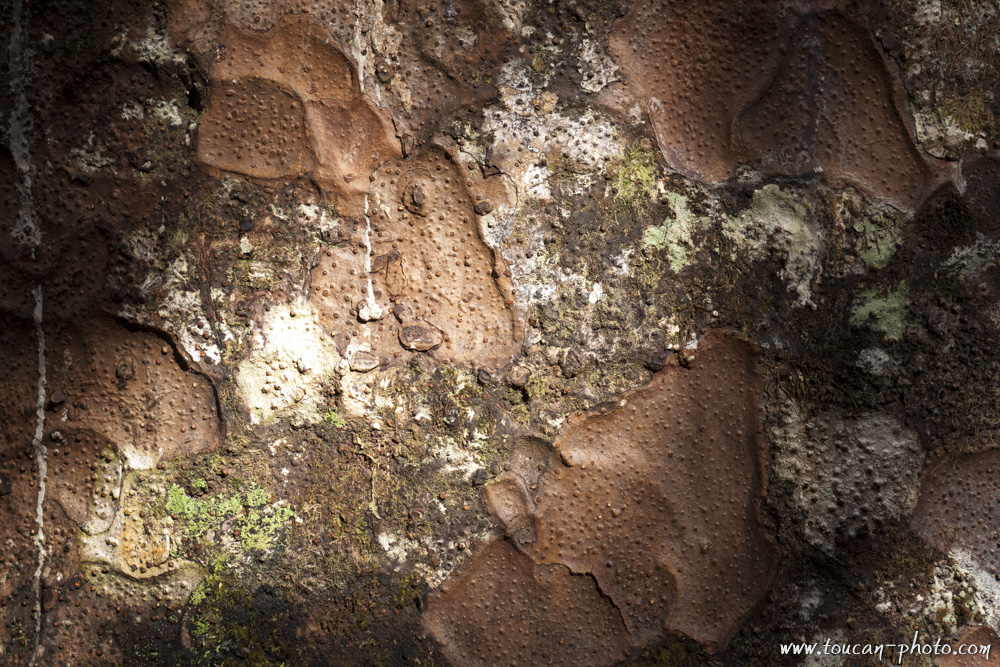
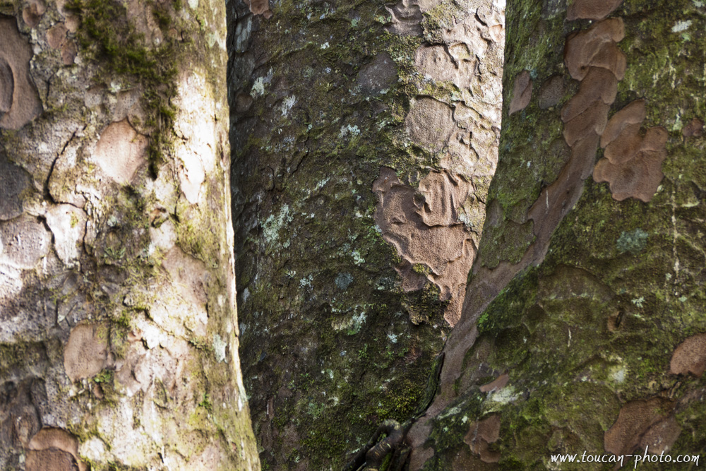
Kauri bark
Tane Mahuta, the lord of the forest:
One tree, the Tane Mahuta (“lord of the forest”), has an important place in the Maori cosmology because it is the son of Papatuanuku (the earth Mother) and of Ranginui (the Sky Father). Papatuanuku and Ranginui were living entwined, deeply in love. They were physically so close of each other that the universe was smothering.
Tane Mahuta, the fruit of their love, grew up with strength and separates his parents, the earth and the sky and allowed the surroundings to live within the light. The atmosphere has also been created by this event as well as the life as we know it today. Tane Mahuta, with its 51.2 meters height and with a circumference of 13.77 meters is really the lord of the forest. Its age is estimates to 2000 years old.
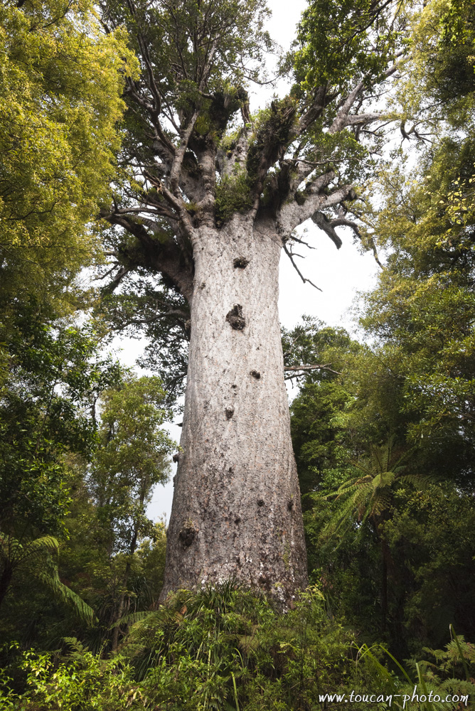
Tane Mahuta, « Lord of the forest »
Other interesting Kauris:
Among the other interesting trees, Te Matua Ngahere, is considered by some scientists as the oldest tree on earth within the humid forest category. It would be about 4000 years old. Te Matua Ngahere has a colossal trunk with a circumference of 16.41 meters and 5.2 meters large. Sometimes it happens that the Kauris trunks are splitted in several pieces. That’s the case of the “Four sisters”, a tree composed of 4 trunks growing in the Waipoua Forest.
Te Matua Ngahere, the widest trunk Kauris
Te Matua Ngahere
Four sisters, composed of 4 trunks
Four sisters
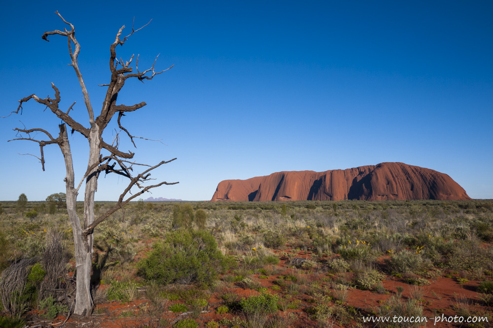
Australia: Uluru / Ayers Rock
Uluṟu is a rock formation located in the heart of Australia, Northern Territory, near Alice Springs. Uluru, and other geological curiosities around (like Mount Olga) is part of the Uluru-Kata Tjuta. The park, covering an area of 1325km² created in 1987, was classified in the same year as a UNESCO Natural Heritage Site world.
Location of the Uluṟu-Kata-Tjuta national park
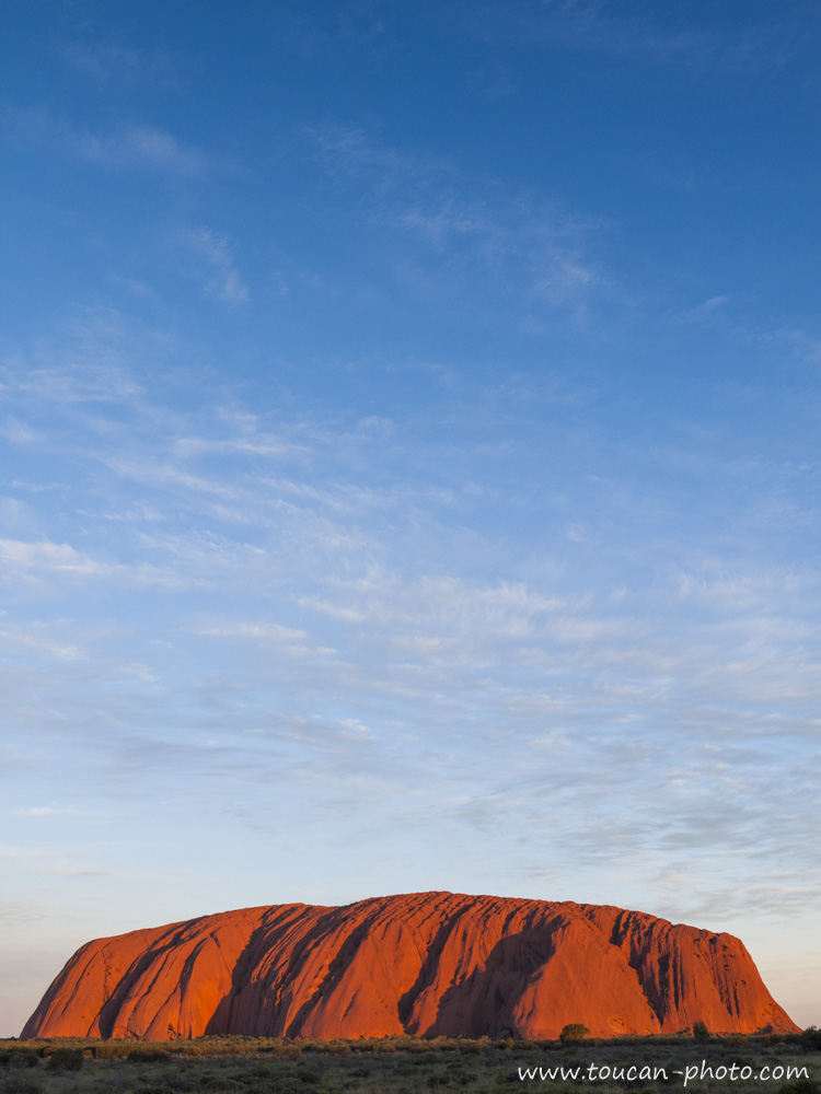
Uluṟu / Ayers Rock
Names
Uluṟu is the name given by natives (Anangu) at this sacred rock their eyes. Although this word does not have precise meaning in the Anangu culture, but It is sometimes used to define or translate the words “protection”, “long sleep”, “journey” or “freedom”… Renamed «Ayers Rock» in 1873 by William Gosse, the first explorer European to have visited the site, the building now bears the double name Uluṟu/Ayers Rock.
Uluṟu/Ayers Rock, in the heart of Uluru-Kata-Tjuta National Parc, and at the horizon line, the Mount Olga
Geology
Contrary to popular belief, Uluṟu is a monolith, but only emerged part (348 meters above ground) the rock formation that continues deep underground and it is called “mountain-island” (like an iceberg is rock) second largest “mountain-island” in the world after Mount Augustus, located also in Australia. Uluṟu is a sandstone rock formation very homogeneous, since it does nor diaclase or cleavage, it is very resistant to erosion and wear of time, since, only the outer portion subject to bad weather. It is therefore very likely that its shape is not changed for 10,000 years, when the first Anangu people settled in the region. It is also because of ferrous elements that make the Uluṟu’s sandstone that characteristic red / brown colour. The oxidative effect of these ferrous rock, change the grey colour from the inside to rusty.
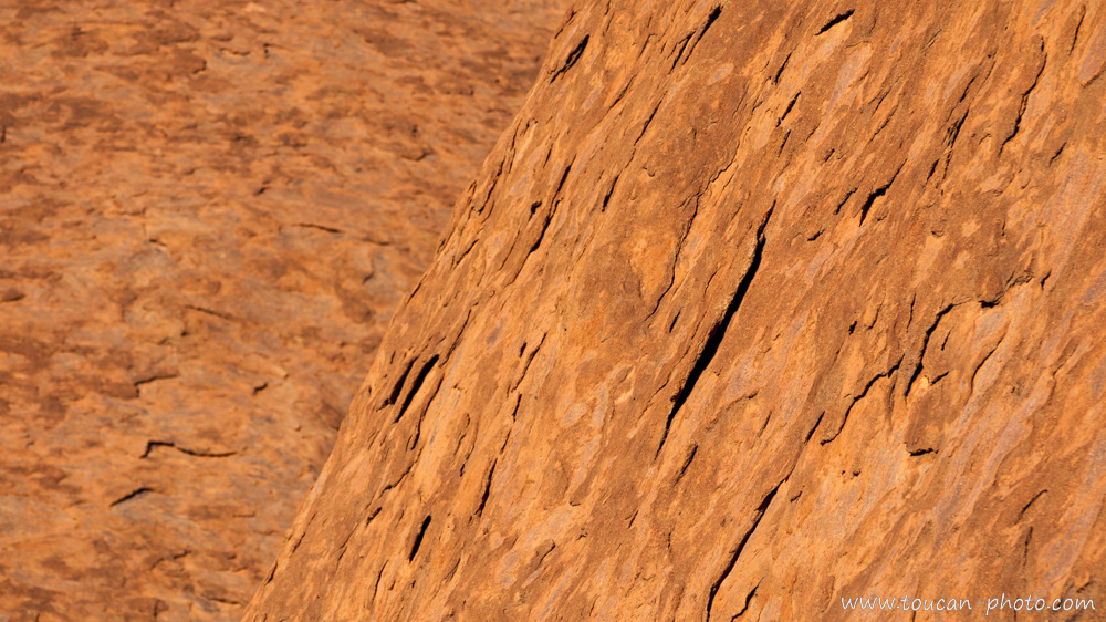
Uluṟu’s stone detail, under the oxidized crust, tiny grey rock appears
Uluṟu in the myth of the creation of the world
According to the tradition of the Australian Aborigines, the “Dreamtime” (Tjukurpa Anangu language) is the period during which the world not yet existed, but was being created by the “Great Minds”, whom appeared in the form of plants, humans or animals. That’s for example, when were created the great rivers, which are borrowed from a spirit snake footprint. Uluṟu and was erected by two children playing in the mud after rain. They would have done this hill of mud so they could slide on the side. Traces of these different slides are also still visible throughout Uluṟu. Today, the “Great Minds” would be held in Uluṟu, making this site one of the most sacred to Anangu culture*.
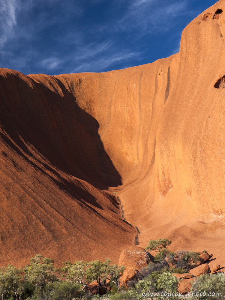
A «Slide trace» on the Uluṟu’s side
Rock Painting
History and future
Uluṟu which “belonged” to the Australian government before that, was surrendered to Anangu people in 1985, in exchange of granting a lease and operating for 99 years to the National Parks and Wildlife agency. This organization is still seeking the best way forward in site management. For example, perceived as a sacrilege in Anangu culture, the National Parks and Wildlife agency, fearing a desertion of tourists, still doesn’t prohibit to climb Uluṟu. On the other hand, the photography of some areas of Uluṟu that may affect the Aborigines was prohibited (these areas are normally reserved for an elite, but it is very difficult for the National Parks and Wildlife agency to monitor them).
*Climbing Uluṟu and photograph these prohibited areas has obviously not been done for the realization of this article
— Continue the journey —
— Complementary Resources —
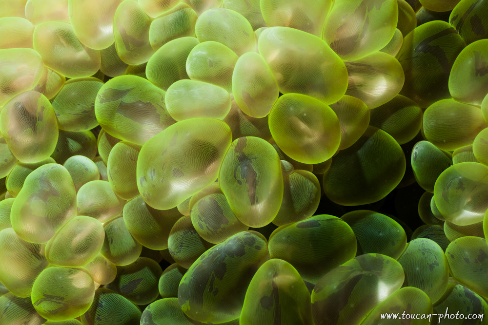
Thailand: Diving Andaman sea
The experts may certainly recognize Moray, Manta Ray, Clown fish, Parrotfish, Squid and Cuttlefish, different species of hard and soft corals, and some Shellfishes. Have a good dive!
Andaman Sea location
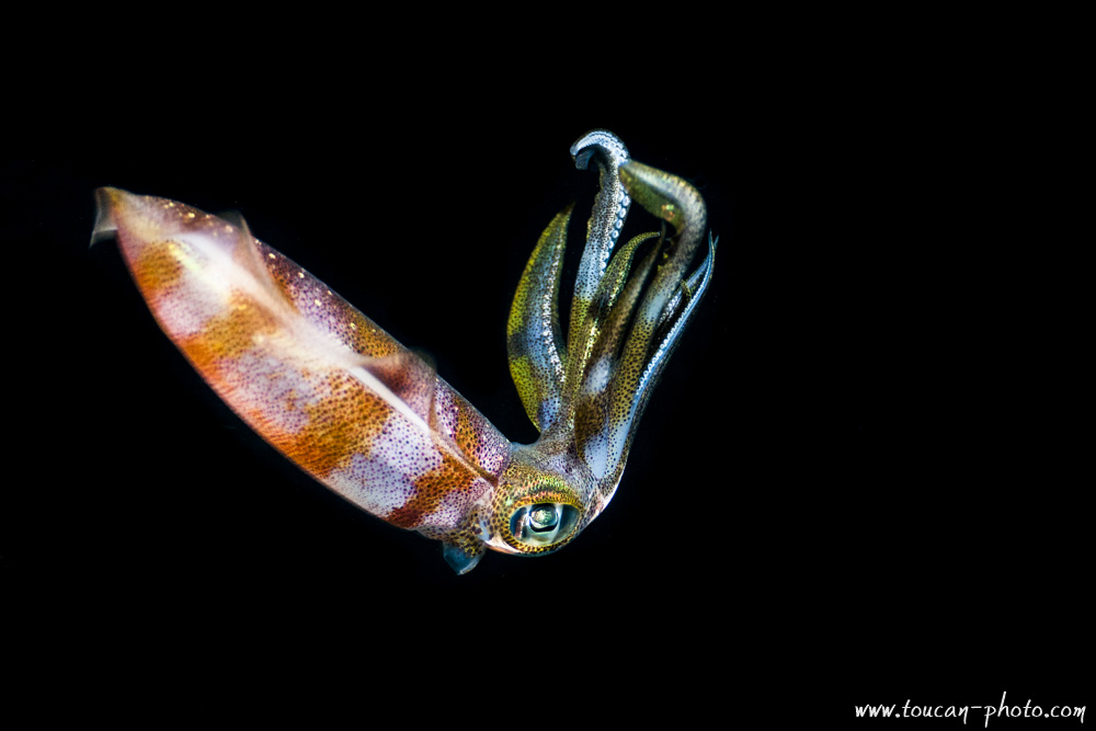
Night shot of a squid
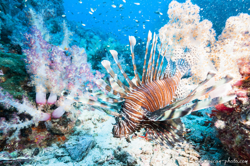
Lion Fish
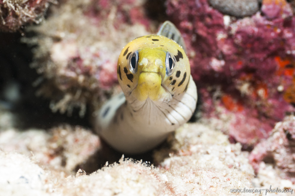
Yellow head moray
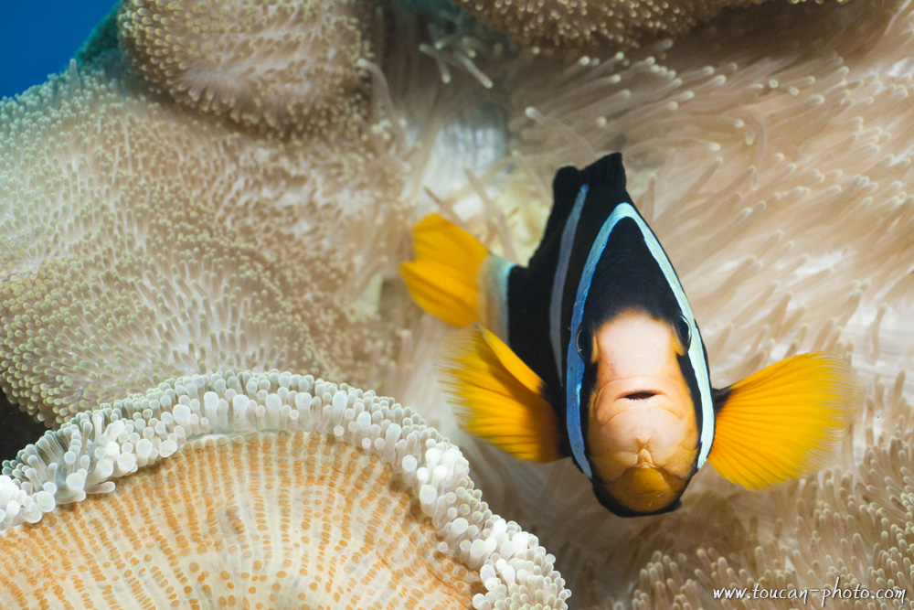
Clark’s anemone fish
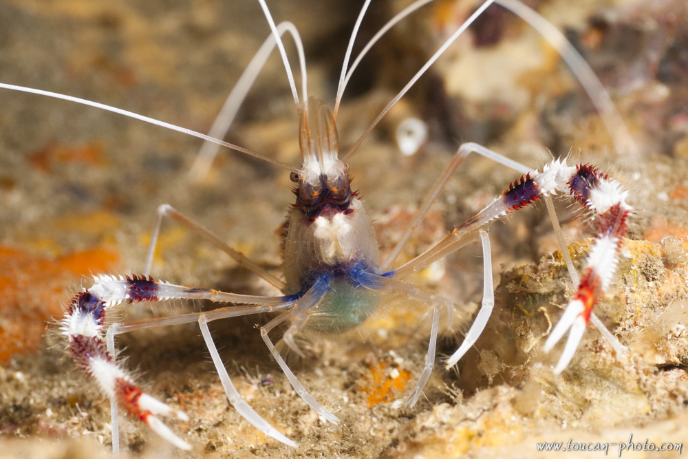
Banded cleaner shrimp (Stenopus hispidus)
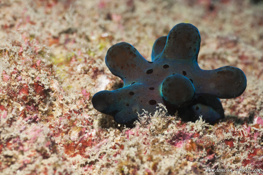
Hiby’s coriocella (Coriocella hibyae)
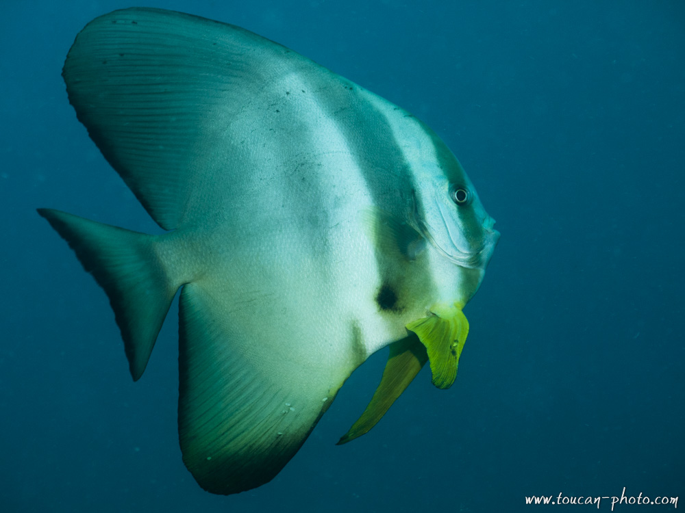
Batfish
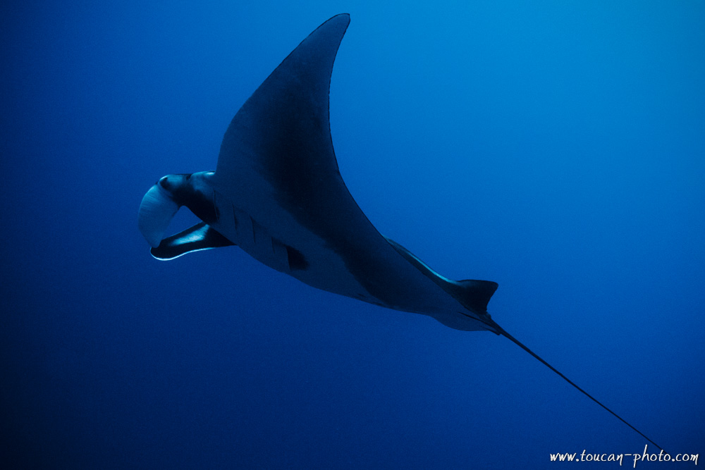
Manta ray
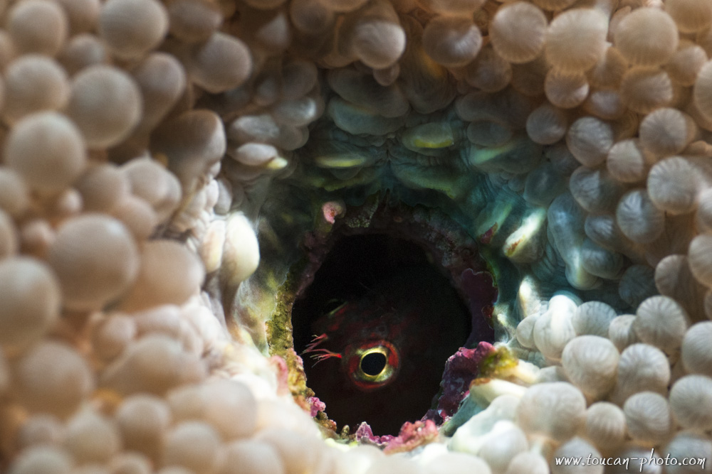
A blenny try to get hide inside a coral hole
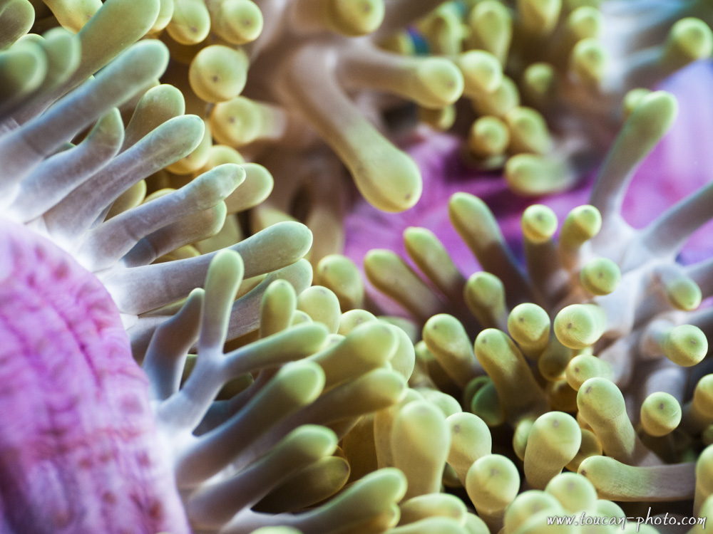
Inside the anemone
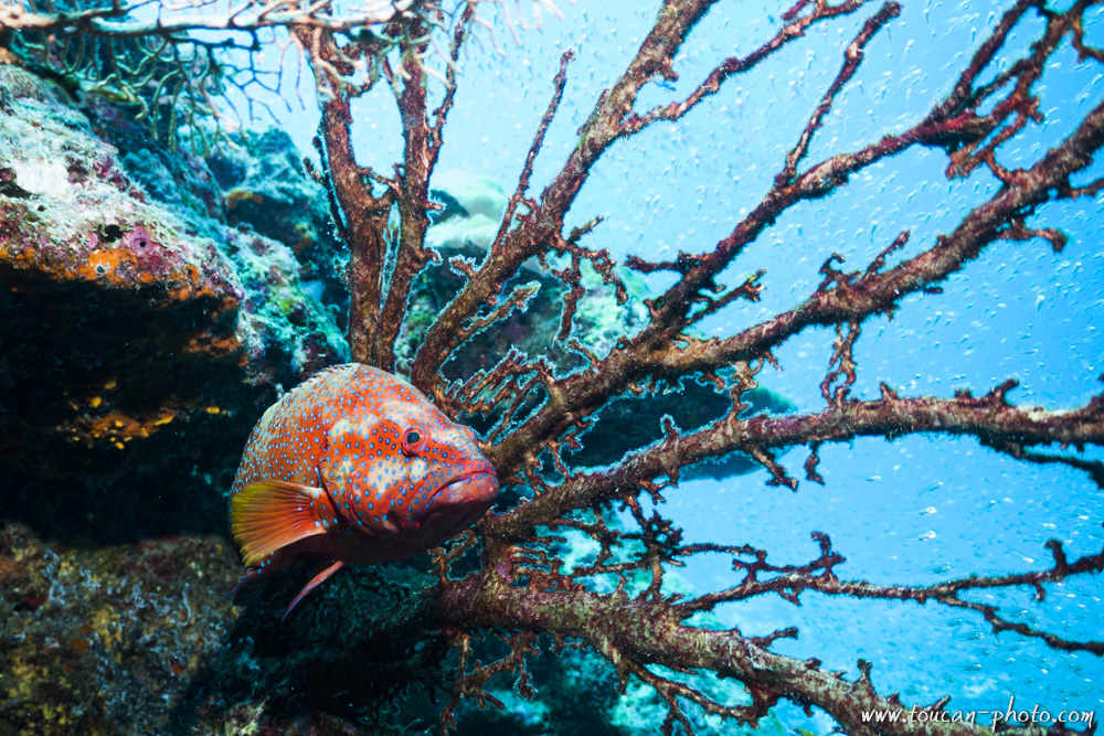
Coral hind (Cephalopholis miniata)
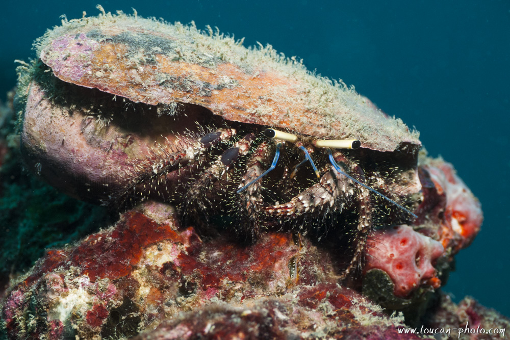
Hermit crab
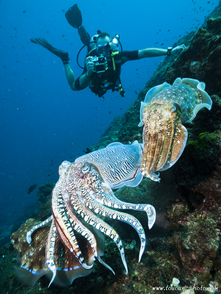
Cuttlefishes and diver
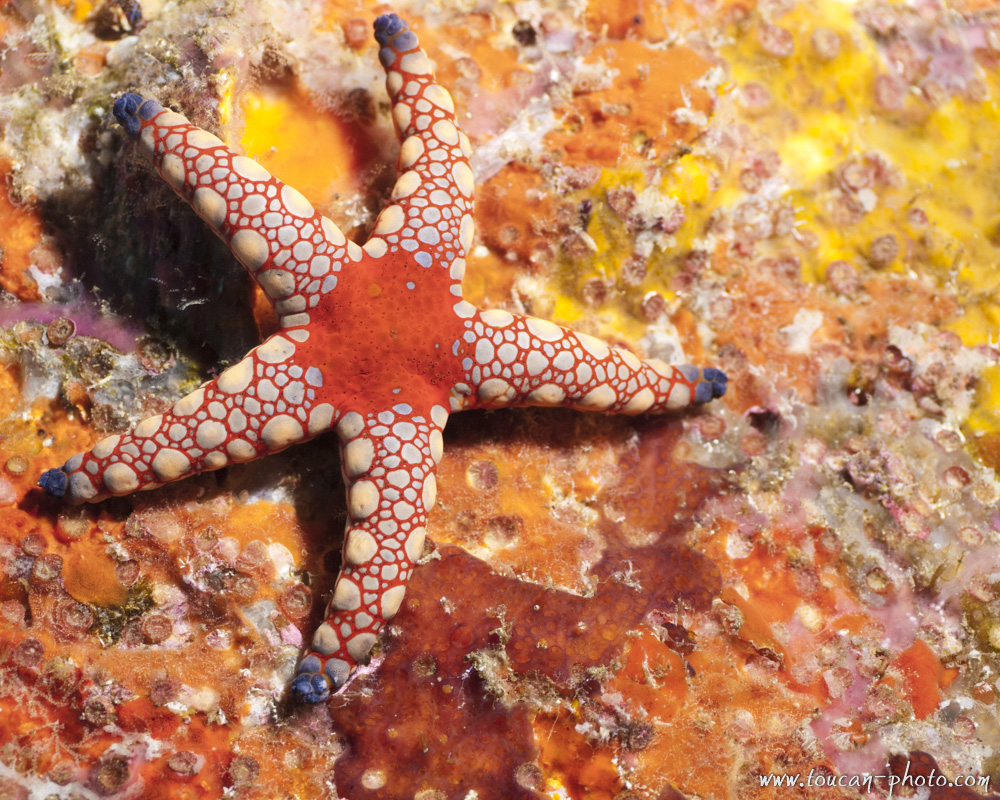
Sea star
Bubble coral
Coral
Anemone-Fish in its anemone nest
Manta Ray
Reef
Trigger-Fish
— Continue the journey —
— Complementary Resources —
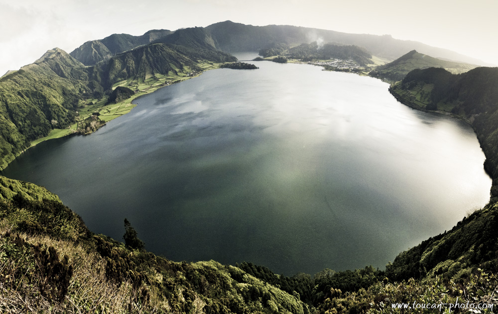
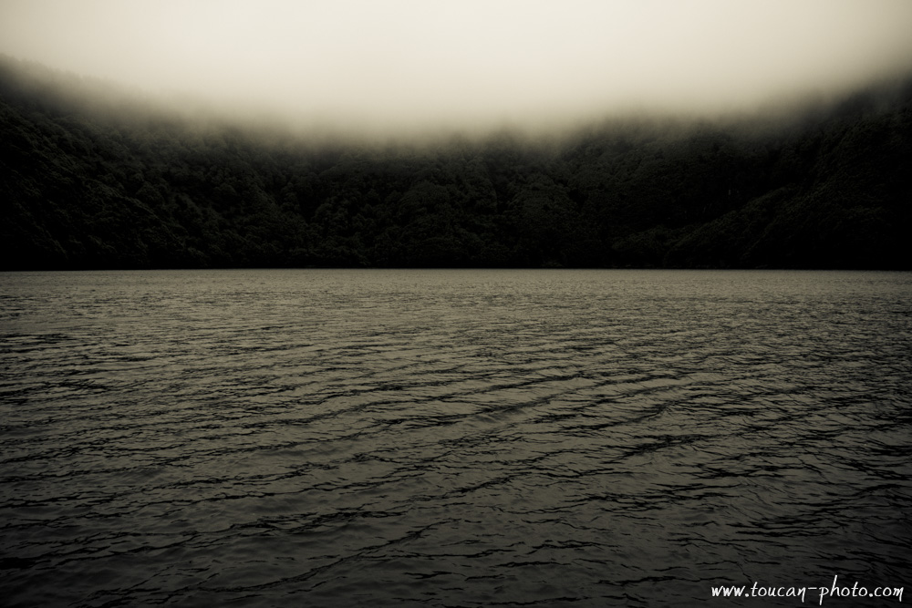
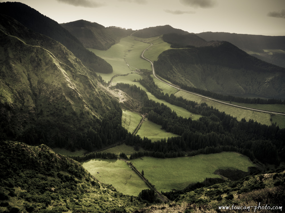
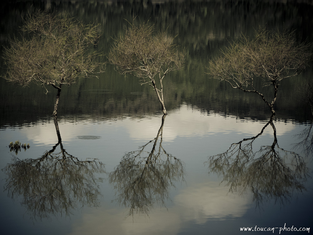
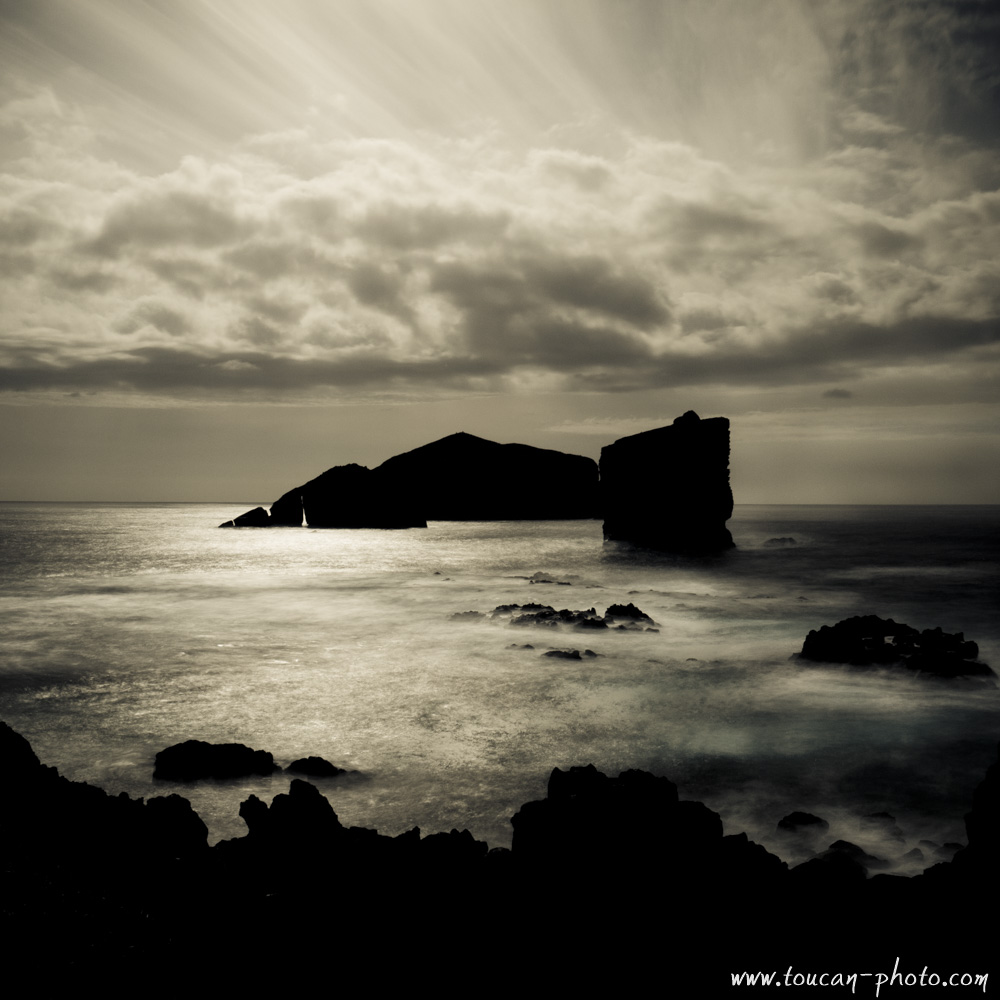
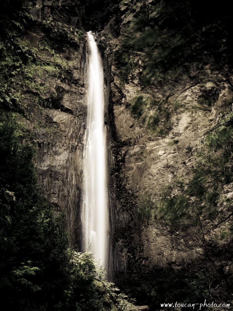
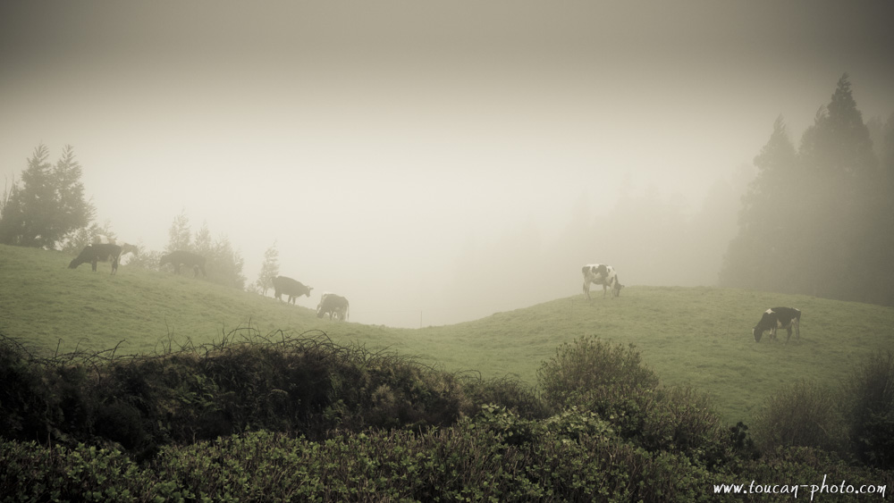
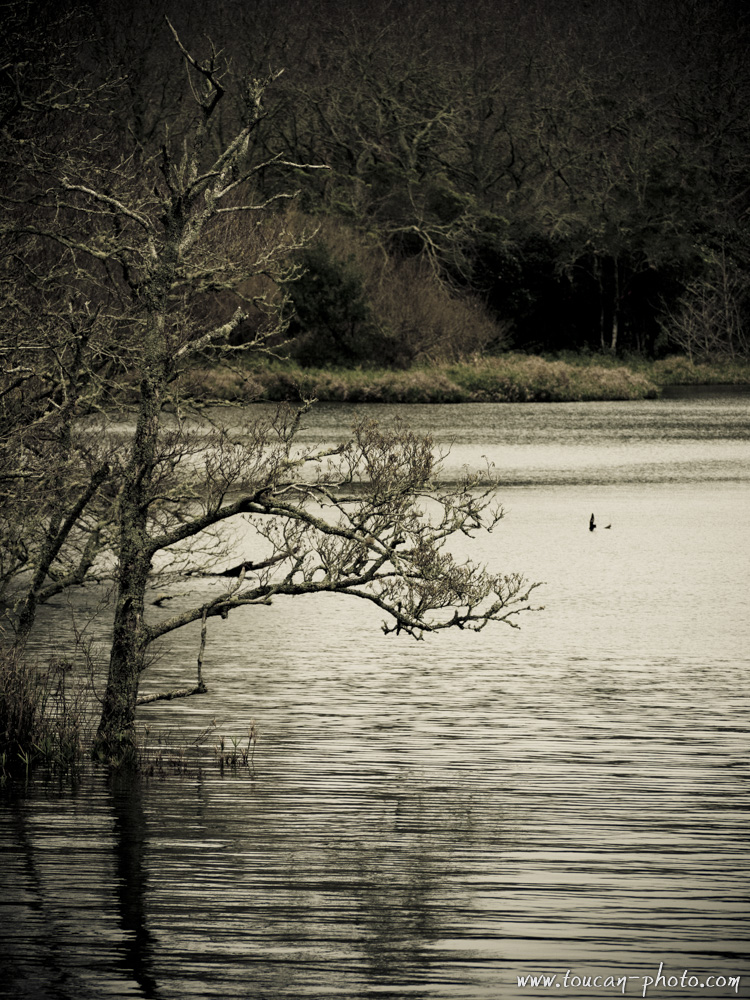
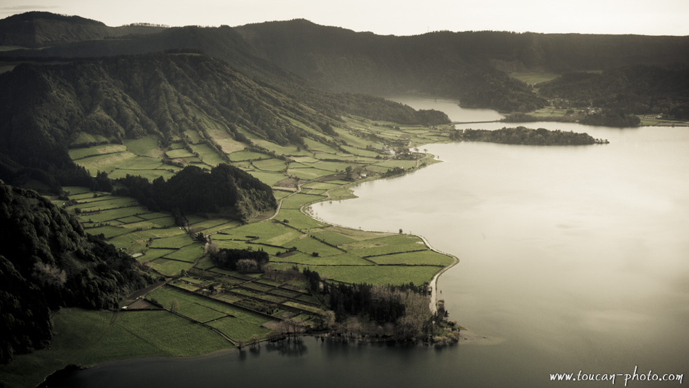
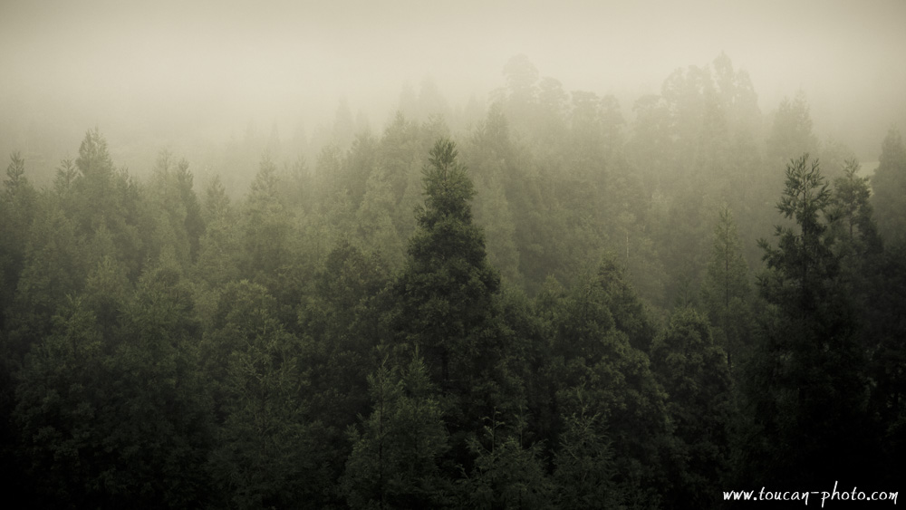
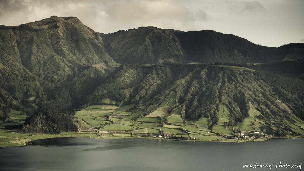
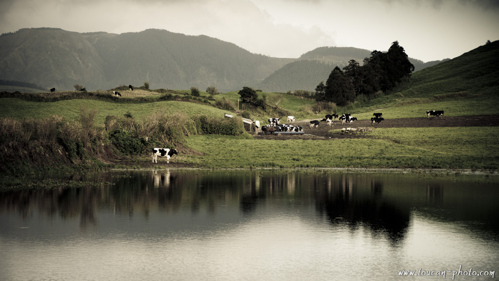
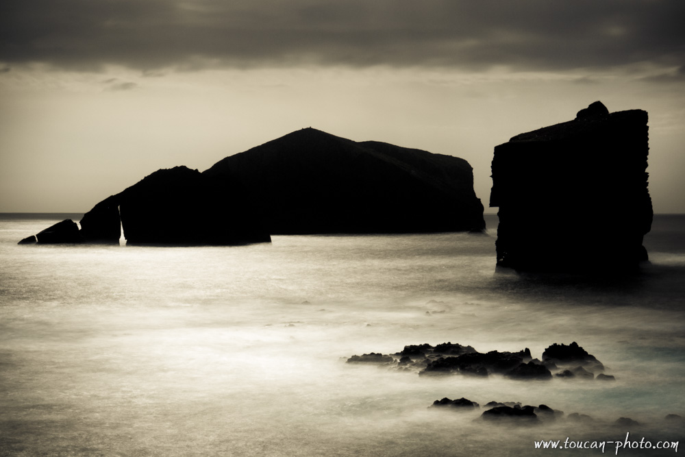
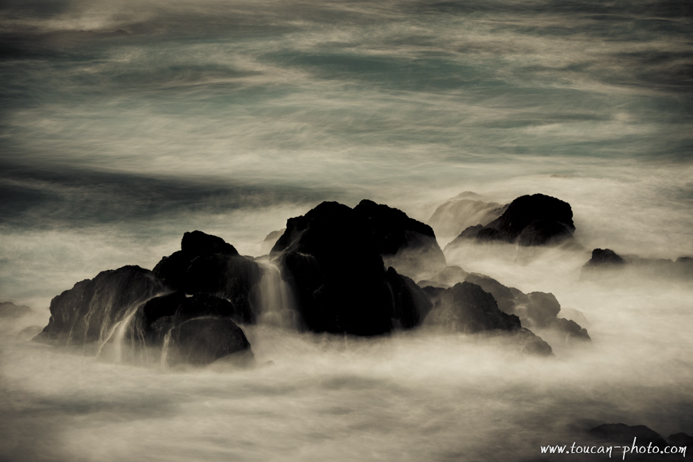
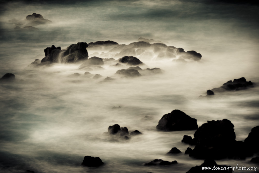
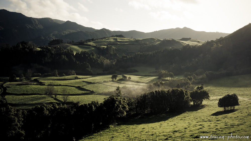
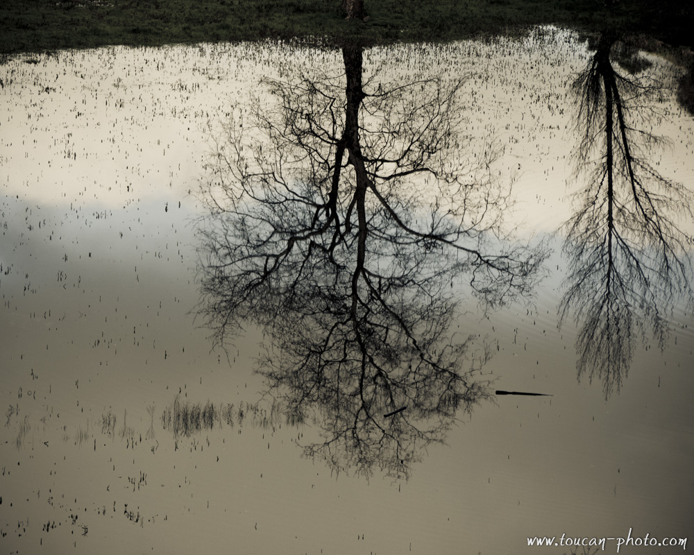
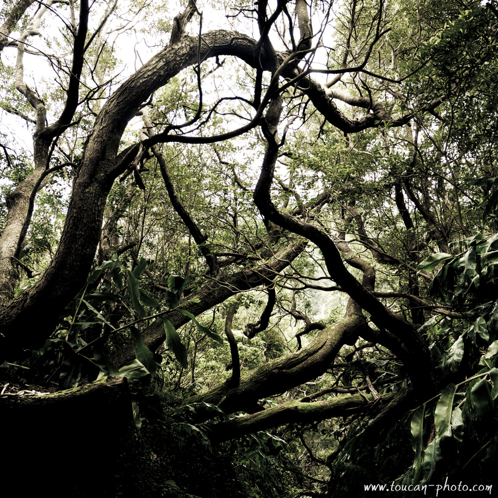
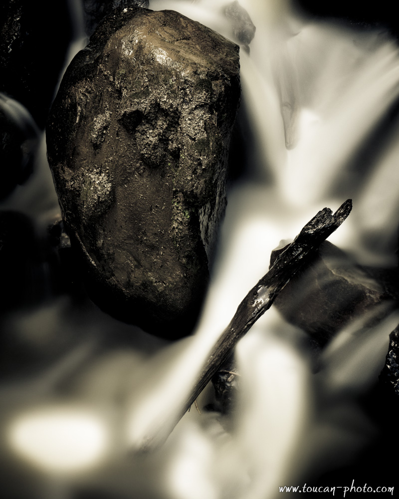
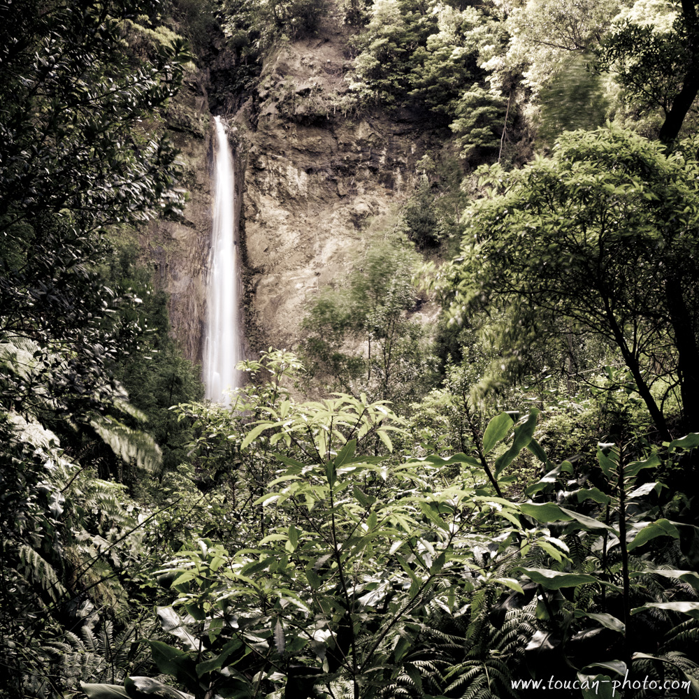
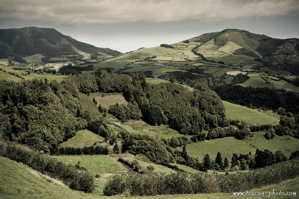
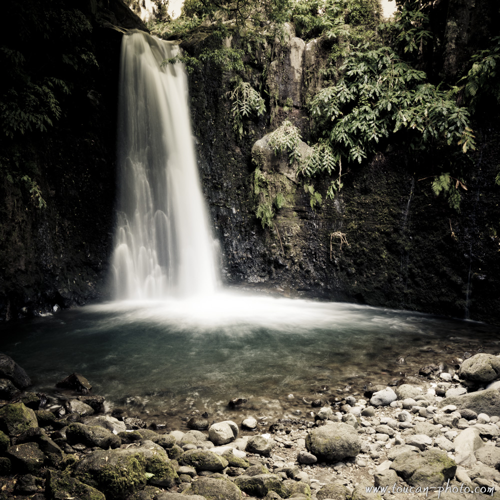
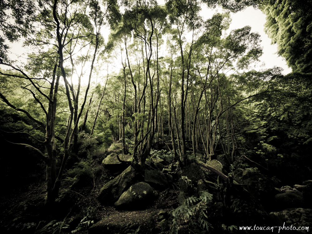
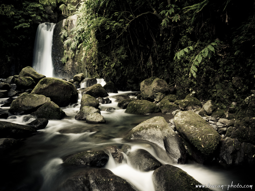
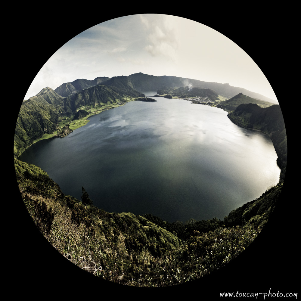
Portugal: Azores, Sao Miguel waters
Everyone has heard of the Azores … At least during a weather report. 😉 Indeed, an anticyclone is covering the Azores. It acts like a barrier and prevents precipitation to come to West Europe. However, this is synonymous of heavy rains and strong winds to the Azorean population.
It took me a few minutes after getting out of the plane to realize that water is omnipresent in the Azores. Rain, coulees, Hot springs getting out from nowhere, torrents, waterfalls … all in a small island in the middle of the Atlantic Ocean! You see for yourself on the pictures that I have created, that water is everywhere ! Take a poncho!
— Continue the journey —
— Complementary Resources —
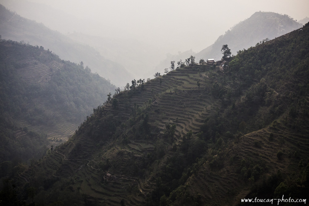
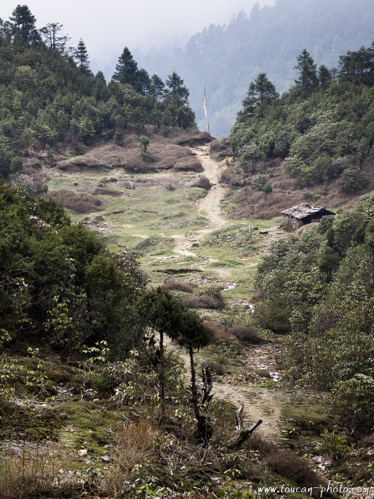
Nepal: The Langtang National Park
Langtang is a region in the Himalayas of Nepal to the north of the Kathmandu Valley and bordering Tibet. The Langtang National Park is located in the area. About 4,500 people live inside the park, and many more depend on it for timber and firewood. The majority of the residents are Tamang. The park contains a wide variety of climatic zones, from subtropical to alpine. Approximately 25% of the park is forested. Trees include the deciduous Oak and Maple, and evergreens like Pine, and various types of Rhododendron.
Overview of the Langtang National Park

Tamang village
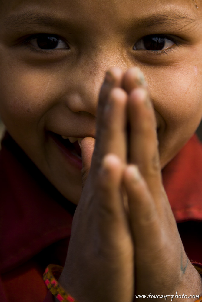
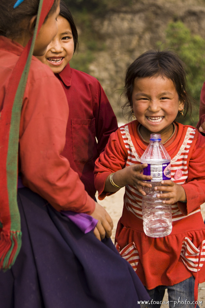
Tamang children
Buddhist Temple
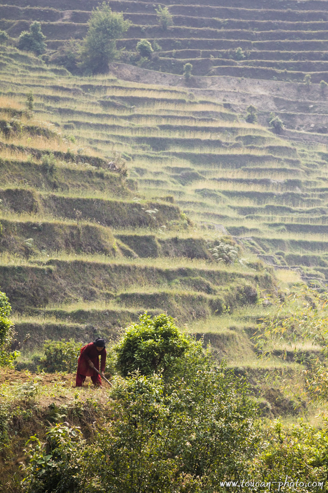
Terrace cultivation
Encounter along a path
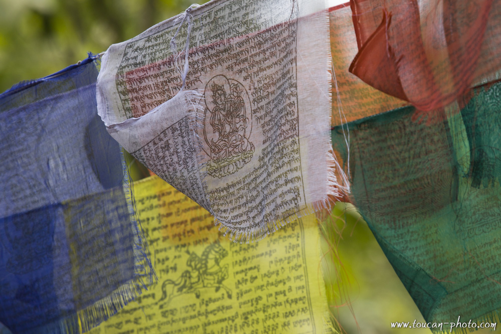
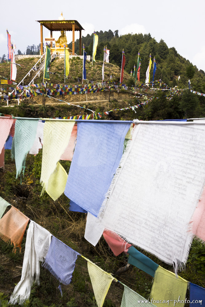
Buddhist praying flags
Langtang
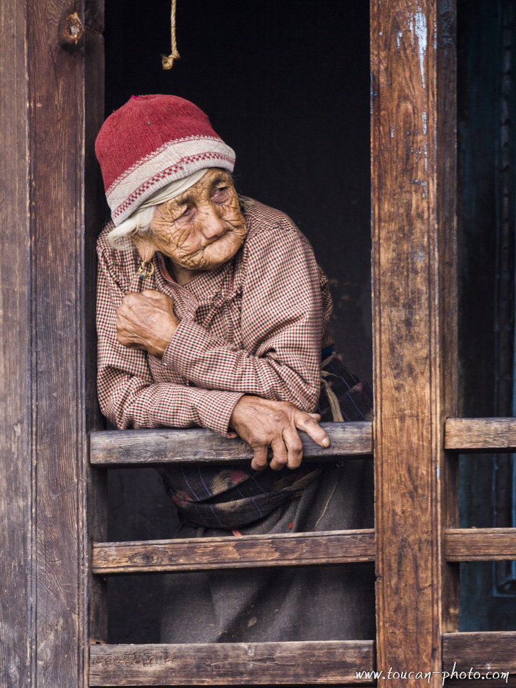
Langtang inhabitant
Langtang
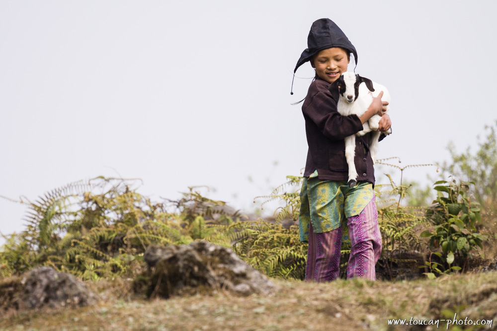
Young shepherdess
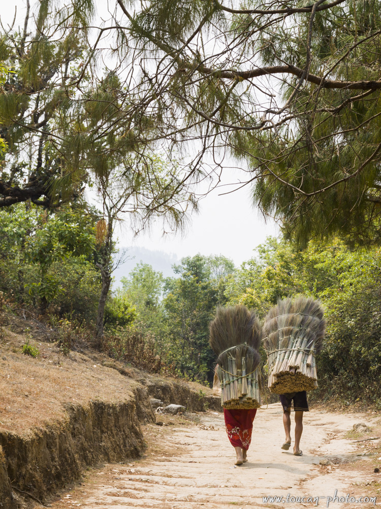
On the way to the village
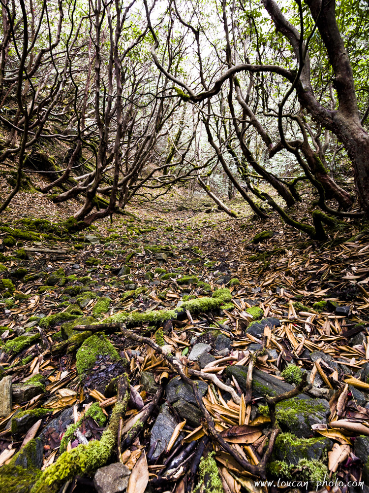
Forêt
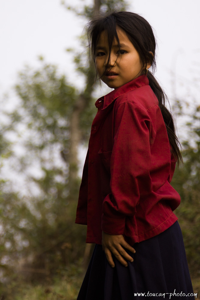
Young girl
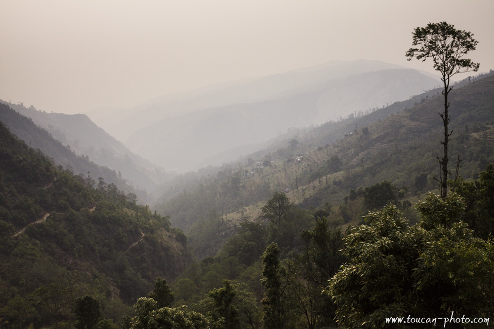
One of the National park Valley
— Continue the journey —
— Complementary Resources —
Morocco: Erg Chebbi, the Merzouga’s dunes
Erg Chebbi (Arabic: عرق الشبي) is one of Morocco’s two Saharan ergs – large seas of dunes formed by wind-blown sand. This Erg is also knowed as “The Merzougas Dunes” beccause the proximity of Merzouga village. The dunes of Erg Chebbi reach a height of up to 150 meters in places and altogether spans an area of 50 kilometers from north to south and up to 5–10 kilometers from east to west lining the Algerian border.